
Rumbling, stormy day across NSW, Qld
It's the sort of stormy day in large parts of New South Wales and Queensland this Wednesday that reminds you that spring is just around the corner.
You can see the storms moving across the central and eastern parts of the eastern states on Wednesday afternoon on the loop below, many of them tracking directly towards the east coast's largest cities Sydney and Brisbane.
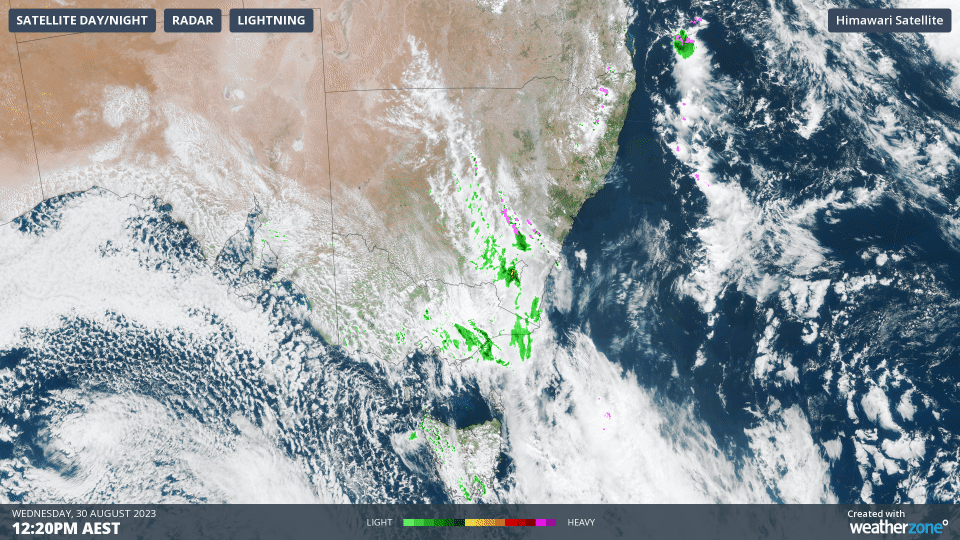
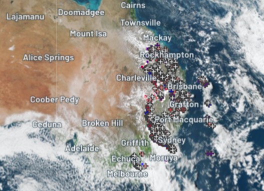
The pink blobs on the loop represent lightning. For a view of the multiple individual lightning strikes at a single moment in time, see the image below.
The storms haven't brought widespread heavy falls, but there have definitely been one or two spots recording sizeable totals in a brief period between 9 am and 3 pm Wednesday, especially in northeastern NSW/southeastern Qld, including:
- Brisbane: 12.4 mm
- Murwillumbah (NSW Northern Rivers): 38 mm
Wednesday's storms are moving across eastern Australia along the line of a trough, which you can see on the 3 pm synoptic chart below.
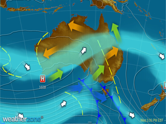
As mentioned earlier, this is a classic spring pattern, and it's no surprise to see it on a day with some very warm, springlike air, especially to the east of the trough.
- Temperatures reached 27.5°C in Sydney on Wednesday afternoon, the warmest reading of a very warm Sydney winter by more than two degrees.
- Brisbane didn't get quite as warm, with a brief stormy downpour around 2 pm capping the max at 25.7°C
As we write this story around 4 pm on Wednesday, there are some relatively severe storms just south of Sydney, so we'll update this story if any severe weather warnings are put in place, or if any extremely heavy rainfall with the risk of localised flash flooding is recorded.

Meanwhile in far southern NSW, Victoria, Tasmania, and South Australia, it has been a much cooler day, however the chilly air associated with a cold front has not penetrated much further north than the NSW/Victoria border.
By Thursday the storm activity will have largely cleared and the cool air will make its way slightly further north, with Sydney going for a top of 19°C for the last day of winter. That will still be a degree above the long-term average.