
Renewed flooding on the way to NSW South Coast
Sodden ground is beginning to soak, and rivers are about to swell and flow faster in South Coast New South Wales, only a few days after flooding hit the area. There's barely been enough time to clean up the mess the last flooding rain left behind.
Some of the region had their biggest rainfall in about eight years only a few days ago with widespread 100-to-300mm falling in about three days. It was the heaviest rain in seven-to-eight years at Mount Darragh, in the Merimbula hinterland, with 357mm, and in Moruya (259mm), Point Perpendicular (249mm), Shoalhaven River (221mm) and Bega (207mm).
There is the potential for 100-to-150mm of rainfall between lunchtime Saturday and sunset on Sunday east of the ranges, most likely south from about Moruya. Properties are under threat, particularly those with water still sitting on the ground. Some roads are also likely to go underwater in low-lying areas.
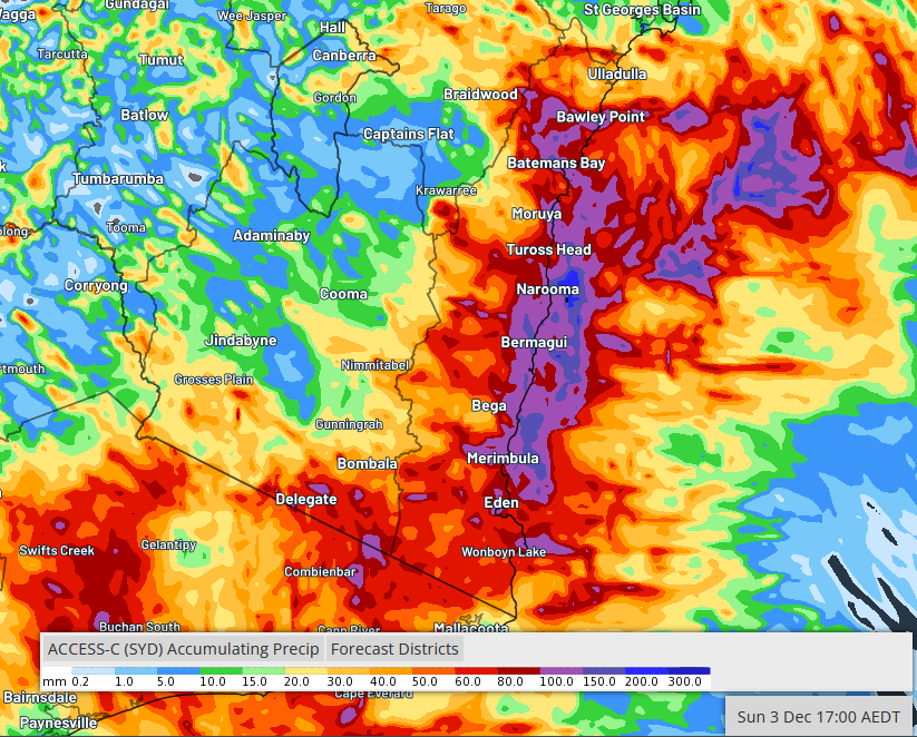
Image: Possible accumulating rainfall for Saturday 2nd December and Sunday 3rd December as interpreted by the BoM Access-C model.
A low-pressure trough is likely to deepen and draw in ample moisture from the warmer-than-normal waters offshore. Thankfully, this coming rain-and-thunderstorm outbreak should only be brief, lasting little more than a day. The offending trough is expected to weaken late on Sunday and be replaced by a drying high-pressure ridge, allowing flooding to ease.