
Relief for firefighters and sweaty SE Australian residents
Significant rainfall across large parts of New South Wales has provided relief for firefighters, while much cooler temperatures across southeastern Australia have brought an end to the streak of well above-average early summer temperatures.
Or to summarise the current weather situation in one word: "phew".
Rainfall totals of around 10-25 mm were recorded to 9 am Wednesday in locations in and around the Pilliga forest (in the NSW North West Slopes and Plains forecast district) where the largest fires were burning.
Further rain is falling across much of the eastern third of NSW this Wednesday, with the map below showing rainfall expected to have accumulated in NSW by 11 pm (AEDT) Wednesday evening.
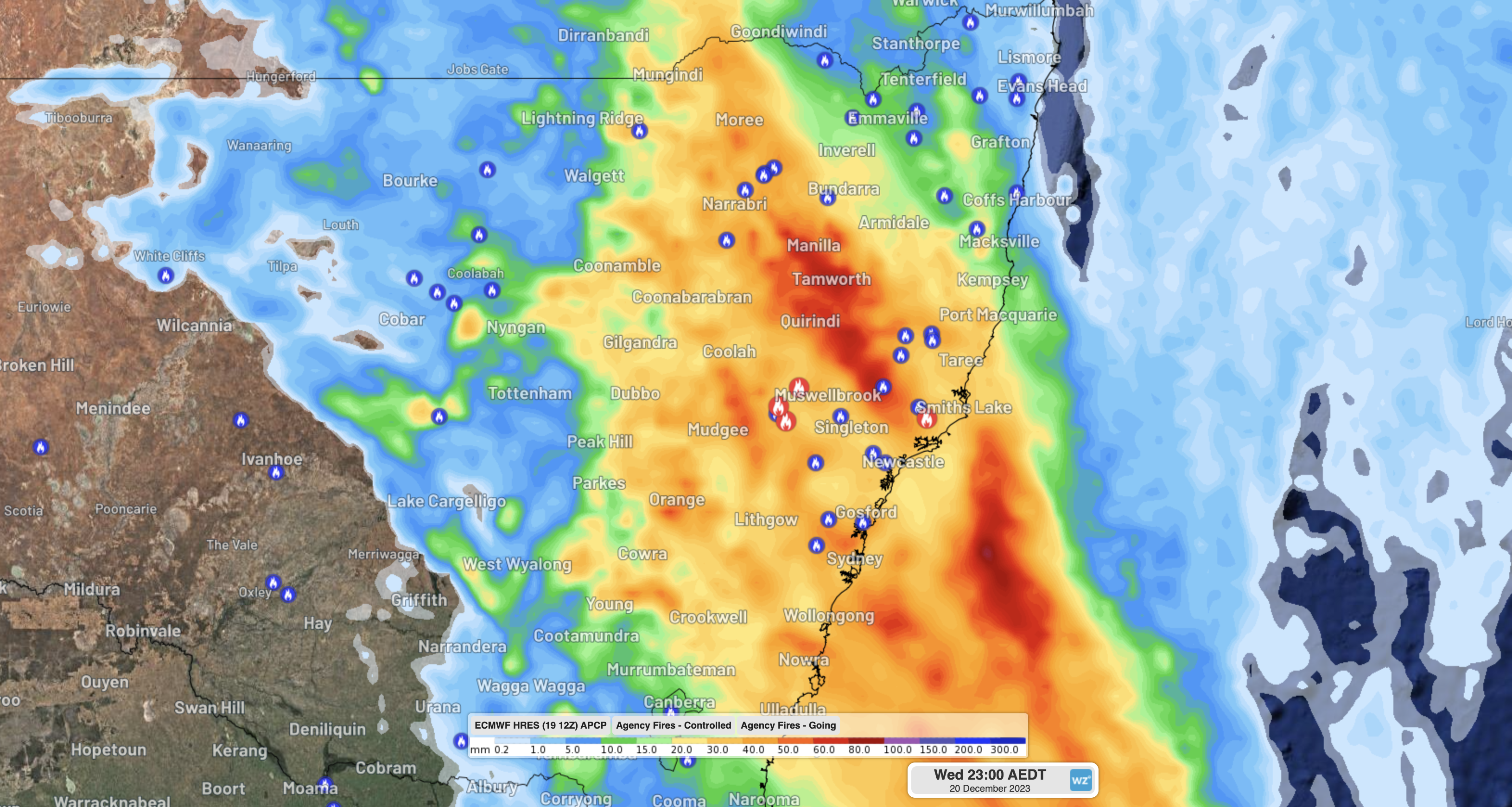
Note that the blue symbols mean fires that are currently under control or being controlled, while red symbols indicate fires that are still out of control.
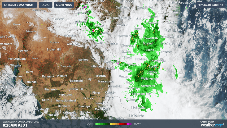
If you compare the region where the three red symbols are located in the upper Hunter Valley (northwest of Newcastle) with the three-hour Wednesday morning radar loop below, you'll see that the area is copping a solid drenching today.
So with luck, the NSW fire situation should have moderated by the time the rain becomes mostly confined to coastal parts of the state by Wednesday evening.
Meanwhile heat has finally eased in parts of the state that have seen an exceptionally warm start to summer 2023/24.
- Last Thursday, we wrote that Sydney had endured its hottest first fortnight of summer on record. The city's above-average maximums continued right through to Tuesday until cooler air arrived late on Tuesday evening, with the mercury pummeting by 7.8 degrees between 8 and 9 pm.
- Sydney was 18.5°C at 6:30 am Wednesday and just 18.2°C at 11:30 am. If the current steady rain continues, the city may fail to reach its expected top of 22°C.
- What seems certain is that Wednesday December 20 will be the first day of December 2023 when Sydney's maximum has failed to exceed the average December max temp of 25.3°C.
It's also a very cool Wednesday by summer standards in the other southeastern Australian capitals, with expected maximums of just 20°C in Melbourne, 21°C in Adelaide, 17°C in Hobart, and 19°C in Canberra.
No significant heat is expected across southeastern Australia for at least the next week, meaning most of the cities just mentioned can expect a Christmas Day maximum temperature somewhere in the low-to-mid twenties.
And don't forget to check the latest Christmas Day forecast for all the capital cities on the Weatherzone homepage.