
Relief ahead for drenched NSW coast
The end is in sight to the relentless soaking on parts of the New South Wales coast, with a period of much drier weather ahead.
This will come as exceptionally good news for anyone whose washing has been accumulating in great piles in homes across Sydney as well as coastal areas within a few hours of the city – and especially the South Coast.
- To 9 am Monday, Sydney has seen 13 straight days with 3 mm of rainfall or more, for a running total of 212.8 mm for May 2024. That's not a record rainy streak, but it's close.
- The Sydney average for the whole of May is 117.3 mm in records going back to 1859.
- Sydney has also experienced exceptionally low average sunshine hours in May 2024 to date, with an average of just 2.5 hours per day – compared to the long-term daily average of 5.9 hours for May.

Image: Kiama is finally seeing a little sun again after rain every day in May so far. Source: iStock.
Numerous locations further south have seen considerably more rain than Sydney, including:
- Point Perpendicular (at the northern entry to Jervis Bay, about three hours south of Sydney) which had received 392.6 mm to 9 am Sunday, with Monday's update still to be confirmed after yet more heavy overnight rain
- Kiama (just under two hours south of Sydney) with 366.8 mm to 9 am Monday
- Moruya (four hours south of Sydney) with 246.8 mm to 9 am Monday
But as mentioned, the pattern is finally changing, with the low pressure system sitting off the coast near Sydney making its way out into the Tasman Sea.
Further south, a cold front will impact Tasmania throughout Monday – bringing rain to the state's west coast and potential showers elsewhere – but the front will have little effect on mainland weather.
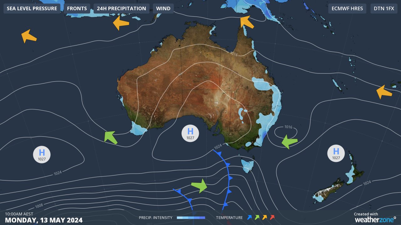
While Melbourne will see a brief drop in daytime temps on Tuesday with cooler mornings on Wednesday and Thursday, conditions in NSW will remain relatively mild for mid-May
The broad ridge of high pressure set to establish itself across southern Australia will put an end to the persistent easterlies which have funnelled moisture onshore for most of May – although the position of the high will increase the chance of showers for the Qld coast from midweek.