
Relentless NSW rain to intensify before drying trend sets in
Ongoing heavy rain is highly likely in Sydney and other parts of coastal NSW for the rest of the working week, but from the weekend onwards, a welcome drying trend will set in.
But for now, persistent heavy rain continues. Let’s look at some rainfall statistics for Sydney, which has been relentlessly soggy in August 2025 to date:
- To 9am this Wednesday, August 20, 262.8mm of rain had been received at the city's main weather station at Observatory Hill, near the southern pylon of the Sydney Harbour Bridge.
- For perspective, August is typically Sydney’s fourth-driest month, with an average monthly rainfall of 79.9mm.
- So Sydney has already tripled its August average, with a further 22.4mm already accumulated by 3pm this Wednesday and plenty more rain likely this evening and on Thursday and Friday.
- The number of rain days (days of 0.2mm or more) is also noteworthy. As things stand now, Sydney has had 16 rain days to date this August, with several more likely. The record is 23.
While no extreme daily or monthly rainfall records have yet been broken in Sydney this month, August 2025 has been remarkable for the consistency of heavy rainfall. Already, eight days have seen 20mm or more.
It’s also worth noting that Sydney passed its annual average rainfall of 1222.6mm during Tuesday – with more than a third of the year to go.
Why is it raining so much in NSW?
A slow-moving high pressure system centred over the Tasman Sea east of Tasmania is dragging moist air towards the NSW coastline which is interacting with a coastal trough.
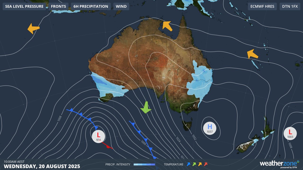
Image: Synoptic chart for Wednesday, August 20, 2025, showing air circulating anti-clockwise around the high
The high is located further south than usual for this late in winter, creating a persistent onshore flow more commonly seen in NSW from late summer through to early winter – historically Sydney’s wettest time of year.
Above-average sea surface temperatures are also playing their part in enhancing the amount of available atmospheric moisture through evaporation.
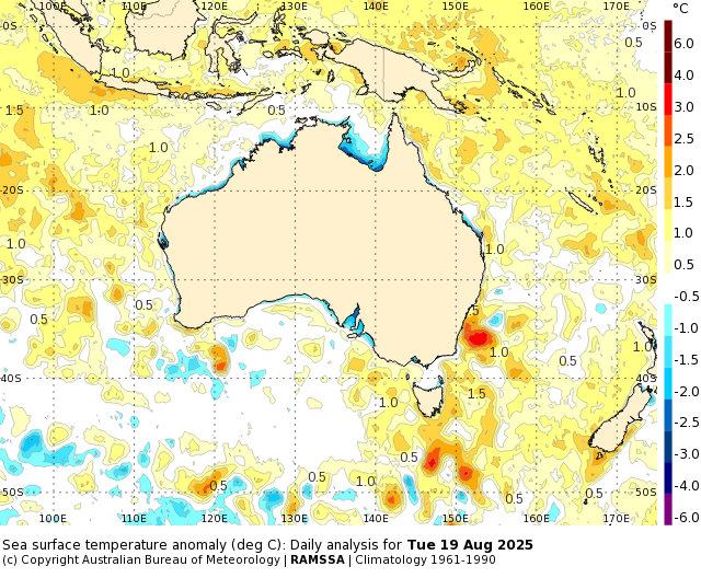
Image: Sea surface temperature anomalies showing an area of very warm water (around three degrees above average for this time of year) near Sydney. Source: BoM.
Rainfall intensifies on Thursday along the NSW coastline
Just when you think the clouds couldn't squeeze out another drop, this system looks to intensify on Thursday, especially north of Sydney.
"On Thursday, a coastal trough just off the NSW coast will clash with an inland trough and upper cold pool that's been lingering over inland northern NSW," Weatherzone meteorologist Joel Pippard explains.
"With the high levels of converging air over the coast and Great Dividing Range, and much warmer sea surface temperatures for this time of year, thunderstorms with intense rainfall are possible."
Pippard says the atmosphere could become "absolutely unstable" – a term referring to an atmospheric setup where the air lower down is warm and humid enough compared to the cooler air aloft to spontaneously lift itself and create heavy showers or thunderstorms.
This could mean some extreme rainfall rates over parts of the North Coast and Mid North Coast of NSW at times on Thursday, possibly extending as far south as Sydney and the Illawarra region.
We’ll keep you updated on this potentially dangerous weather situation as the week progresses. Please check the Weatherzone warning page for the latest warnings and monitor the NSW SES website for the latest flood and road advice.
What about from the weekend onwards?
As mentioned earlier, a drying trend will commence from the weekend onwards, as the Tasman Sea high moves east towards New Zealand and westerly winds more typical of late August set in over southeastern Australia.
A maximum of 23°C is forecast for Sydney next Tuesday, which would be a welcome burst of late season warmth and indeed the warmest day of winter 2025 to date. It should also bring a welcome opportunity for Sydneysiders to hang out some washing.