
Record-breaking spring rainfall in inland Western Australia
Heavy rain has fallen in parts of Western Australia's parched inland, with record-breaking spring rainfall recorded in some areas.
In the 24 hours to 9 am Monday (AWST), 58.8 mm fell at Leonora, a small mining and pastoral town just over 800 km northeast of Perth in the northern part of the Goldfields forecast district. This was:
- Leonora's wettest day in nine years
- The town's heaviest day of spring rainfall on record
- Leonora’s biggest September rain day on record, in what is typically the driest month of the year with a monthly average of less than 10 mm.
- More than a quarter of the town's average annual rainfall in a day
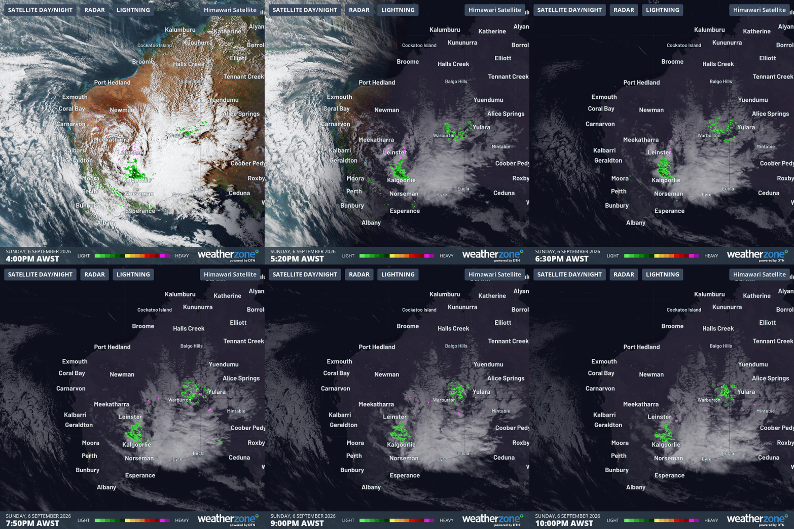
Image: 6-hour radar and satellite loop over WA from 4 pm (AWST) to 10 pm on Sunday, September 6, 2026. Source: Weatherzone.
What caused the unusually heavy spring downpour?
Monday morning's synoptic chart shows the dominant ridge of high pressure centred just south of the western portion of the continent.
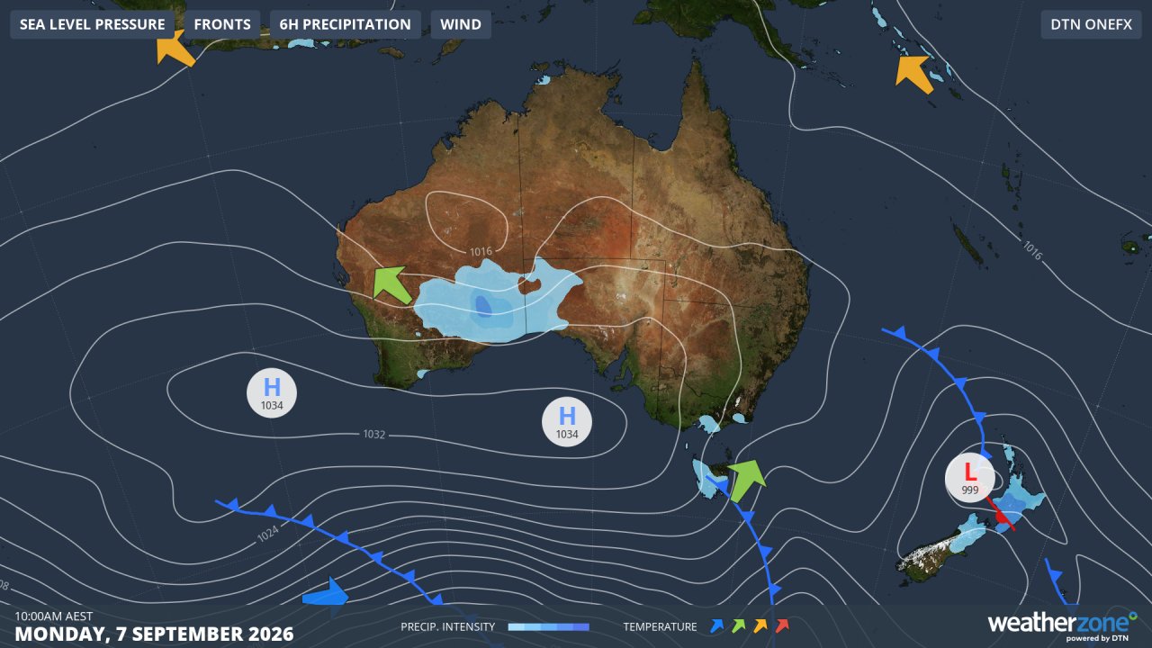
Image: Synoptic chart for Australia early on Monday, September 7, 2026. Source: Weatherzone.
An upper-level trough at the northern extent of the area of high pressure (where the isobars dip slightly) is responsible for the area of blue shading.
The shading indicates where the heaviest WA rain occurred on Sunday fuelled by a tropical moisture feed, and where rain continues to fall this Monday.
The role of El Niño in this weather event
El Niño typically creates higher than normal pressure over Australia's latitude, and that has provided a key foundation for the slow-moving, persistent nature of this rainfall event.
As Weatherzone meteorologist Joel Pippard explains:
"The very slow-moving weather pattern over Western Australia, with the relatively stationary trough 'cradled' between two areas of high pressure, is associated with El Niño, because higher pressure over Australia is one of the main atmospheric measures of El Niño.
How this WA rainfall aligns with seasonal predictions
The seasonal predictions for September rainfall, issued at the start of this month, almost hit the bullseye with this rainfall event.
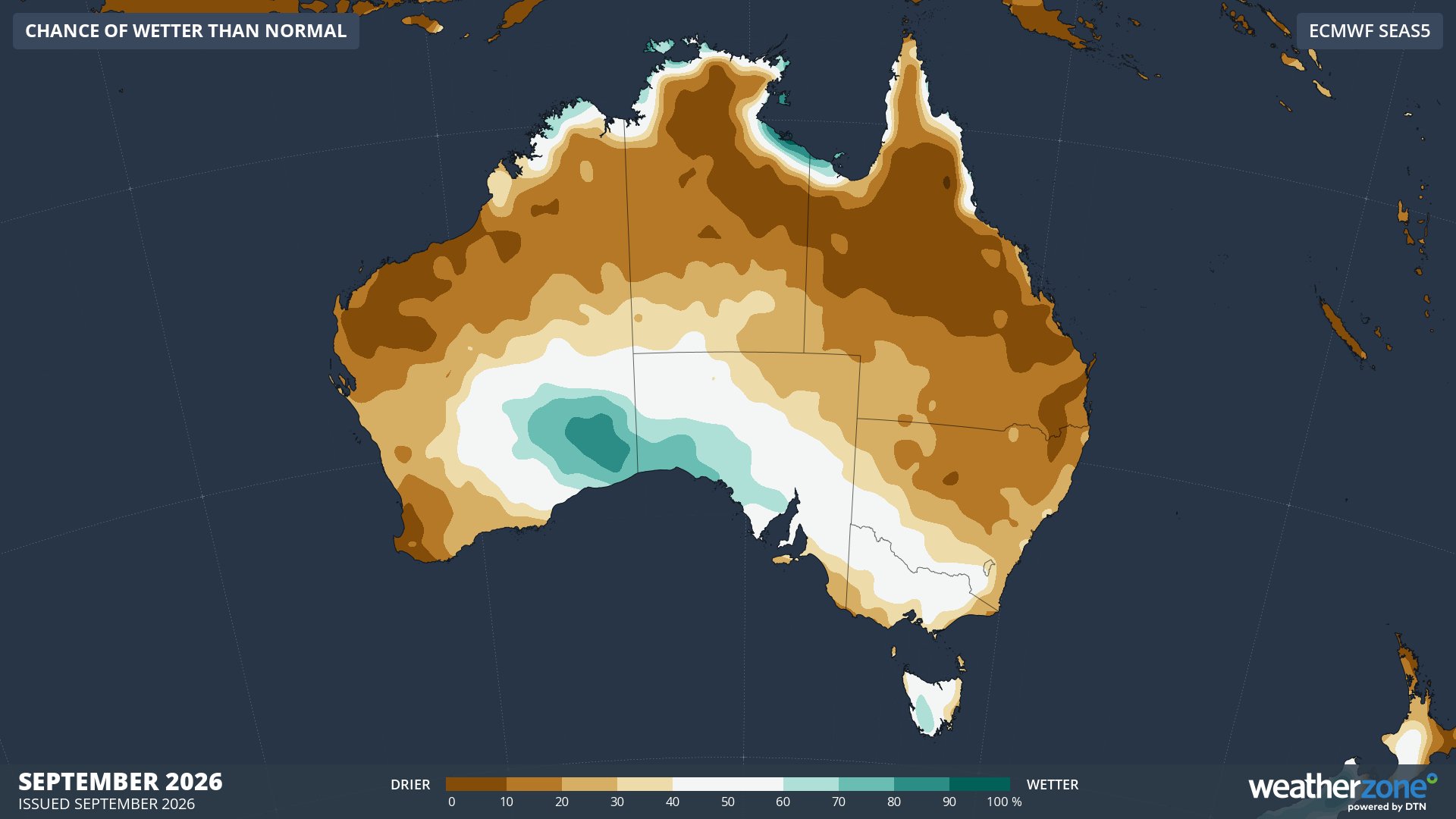
Image: Chance of wetter-than-normal conditions in September, 2026. Source: Weatherzone.
As the image above shows, most of Australia was expected to be drier than normal during September, but the main exception was an area of eastern WA extending a few hundred kilometres north of the coastline (the blue zones).
The blue zones either included, or were very close to, the areas that got drenched overnight.
Will inland WA rainfall rain continue this week?
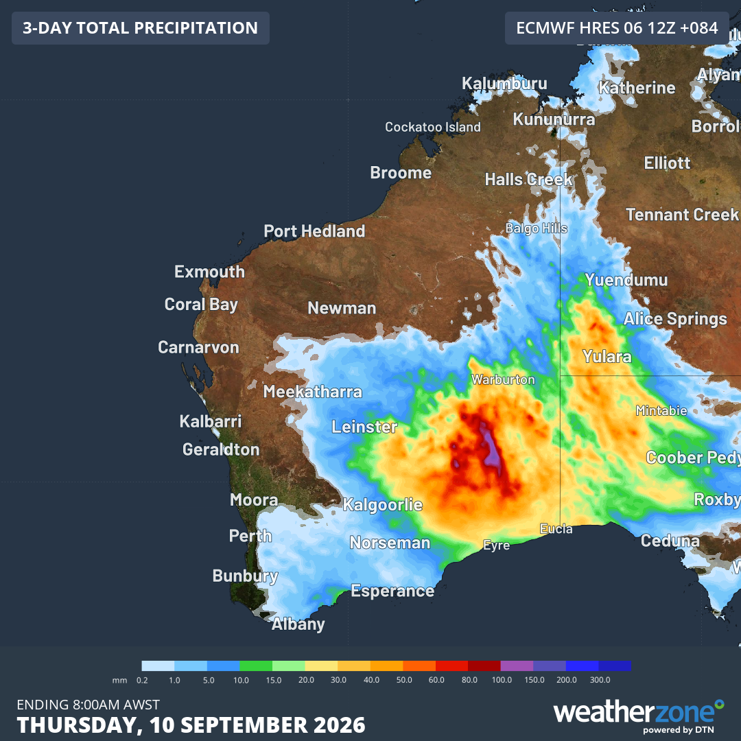
Image: Predicted rainfall accumulation to 8 am (AWST) this Thursday, September 10, 2026. Source: Weatherzone.
As the image above indicates, there's plenty more rain in store for inland WA until at least Thursday, before the pattern finally begins to change as the high slowly moves east towards the end of the working week.
Perth is too far west to receive any rain from this system, however an approaching cold front should deliver a few showers to the WA capital by the weekend.