
Record rain in Vic, 300 mm possible in Tas
Record-breaking October rain has inundated parts of Victoria during the last 24 hours, while parts of Tasmania could be on their way to amassing more than 300 mm of rain in less than 48 hours.
Rivers are rising rapidly in southeastern Australia today as a band of heavy and persistent rain soaks catchments in Tasmania, Victoria and southern NSW.
The animation below shows a band of thick cloud causing heavy rain over southeastern Australia on Thursday morning. This slow-moving rainband has developed along a cold front and low pressure trough that are linked to a deep low pressure system over the Great Australian Bight.
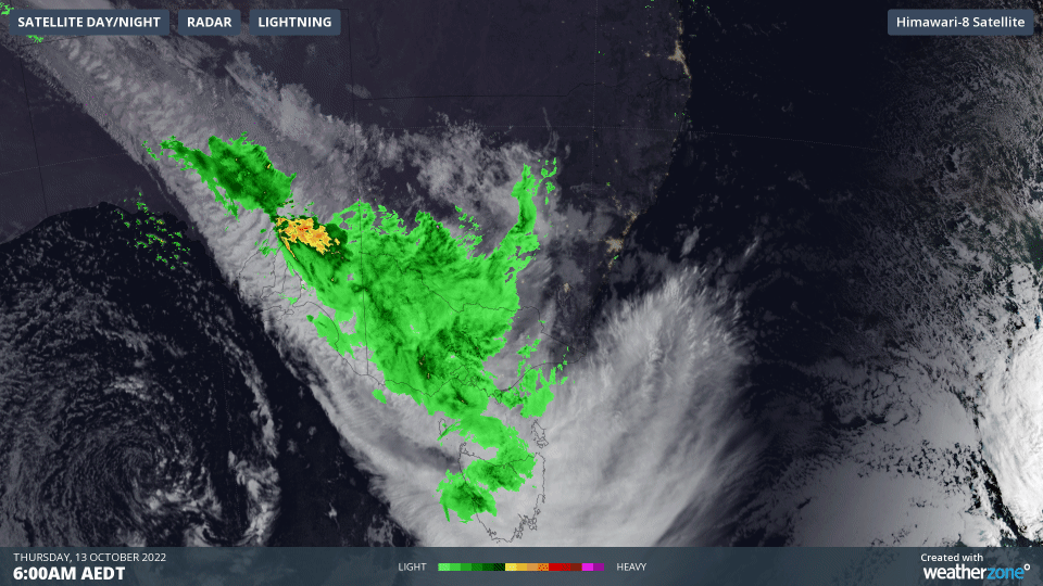
Video: Composite visible satellite and radar images from Thursday morning.
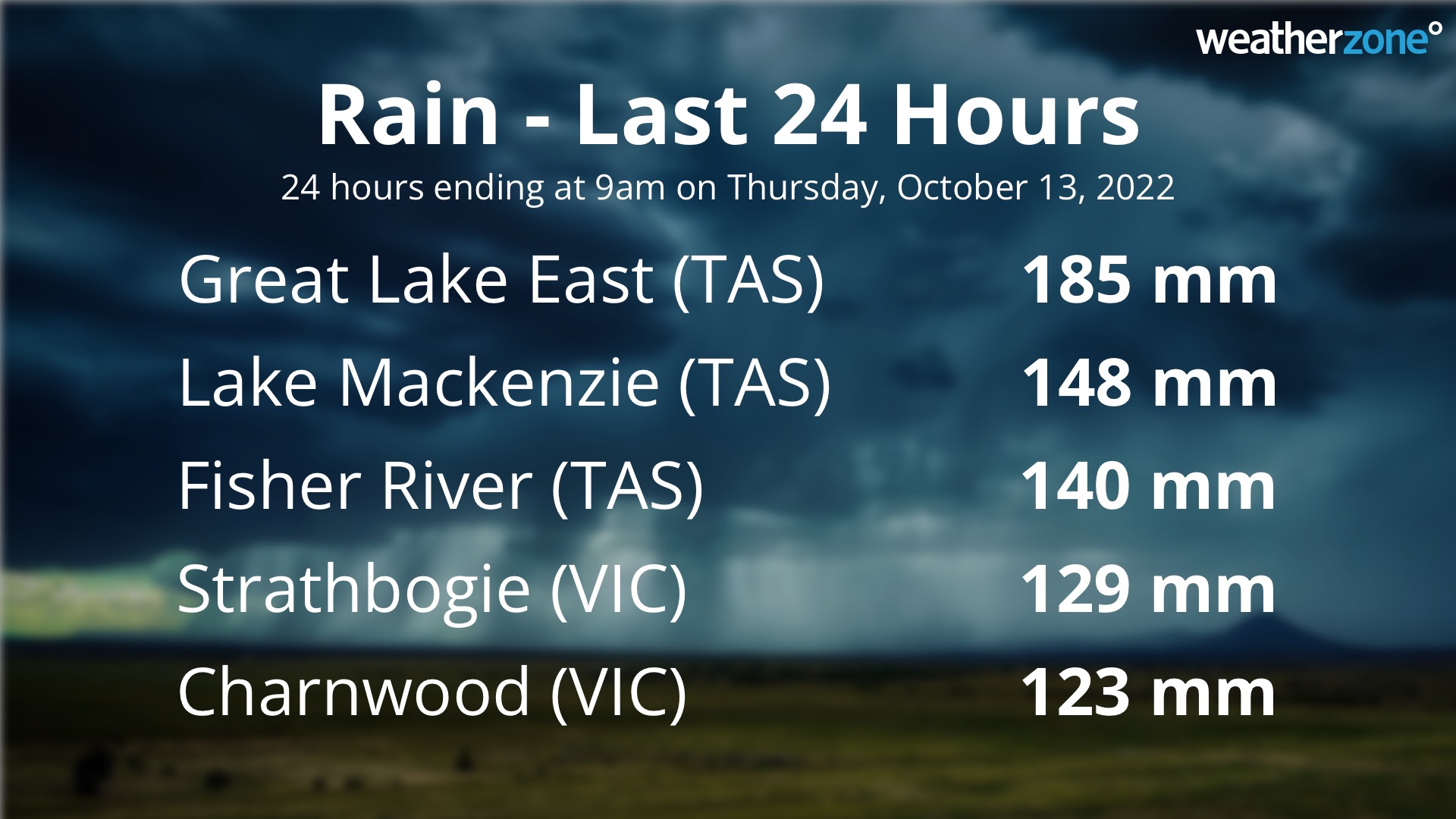
Parts of northern Tasmania and northeast Victoria had already collected more than 100 mm of rain during the 24 hours ending at 9am on Thursday. This included 185 mm of rain at Great Lake East and 148 mm in Tasmania and 129 mm at Strathbogie in Victoria.
A few places in Victoria also saw their highest daily October rainfall on record during the 24 hours to 9am on Thursday, including Mangalore Airport (75.8 mm), Bendigo (65.6 mm) and Mildura Airport (44.8 mm).
Rain will continue to spread over parts of Victoria, Tasmania, NSW and SA during the rest of Thursday into Friday as the cloudband slowly shifts further east.
The heaviest rain on Thursday is likely to target northeast Victoria and northern Tasmania, where moisture-laden northerly winds will produce persistent and heavy rain over elevated terrain due to orographic lifting.
Some forecast models suggest that 50 to 120 mm is possible in northeast Victoria during Thursday into early Friday morning, while some areas in northern Tasmania could pick up another 100 to 200 mm.
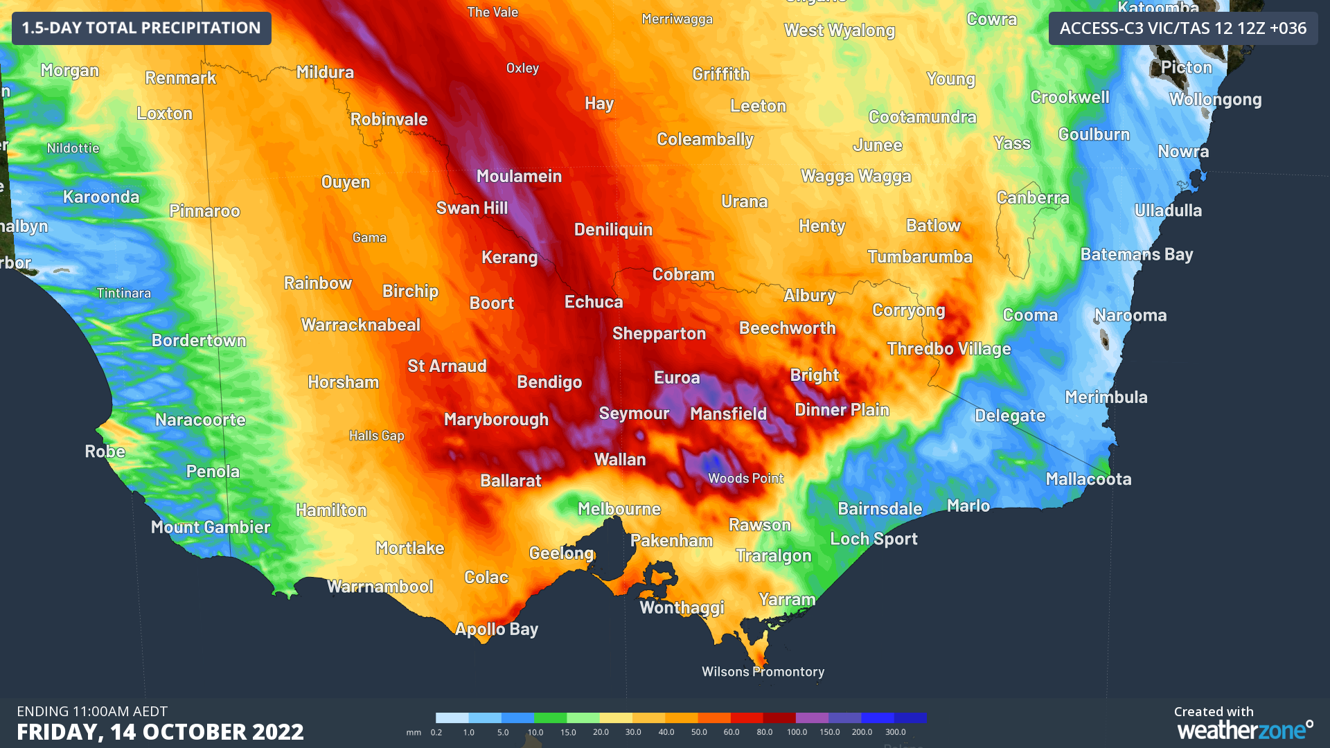
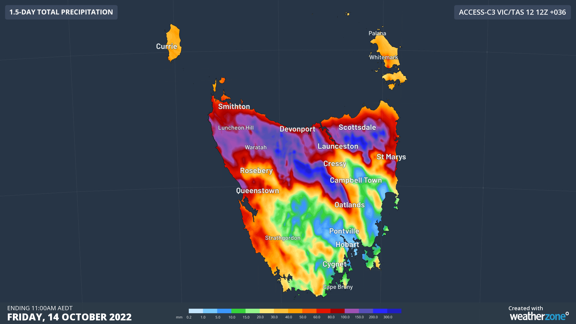
Images: Forecast accumulated rain during the 36 hours ending at 11am AEDT on Friday, according to the ACCESS-C model.
By the time this rainband clears out of Victoria and Tasmania on Friday morning, some places could have collected more than 300mm of rain and numerous rivers are likely to be in moderate or major flooding.
Rain and thunderstorms will also spread further north and east across NSW and southern QLD on Thursday and Friday, adding more water into already flooded rivers.
Numerous flood warnings and severe weather warnings are in place across southeastern Australia, so be sure to check the latest warnings in your area for the most up-to-date information.