
Record October heat bakes southeast Qld, northeast NSW
October temperature records were broken on Monday as hot and blustery winds fanned numerous fires across southeast Queensland and northeast NSW.
West to northwesterly winds developing ahead of an approaching southerly change caused a stream of hot air to flow over southeast Qld and northeast NSW on Monday.
This heat was so intense it caused some areas to register their highest October temperatures in decades, even breaking records in some places.
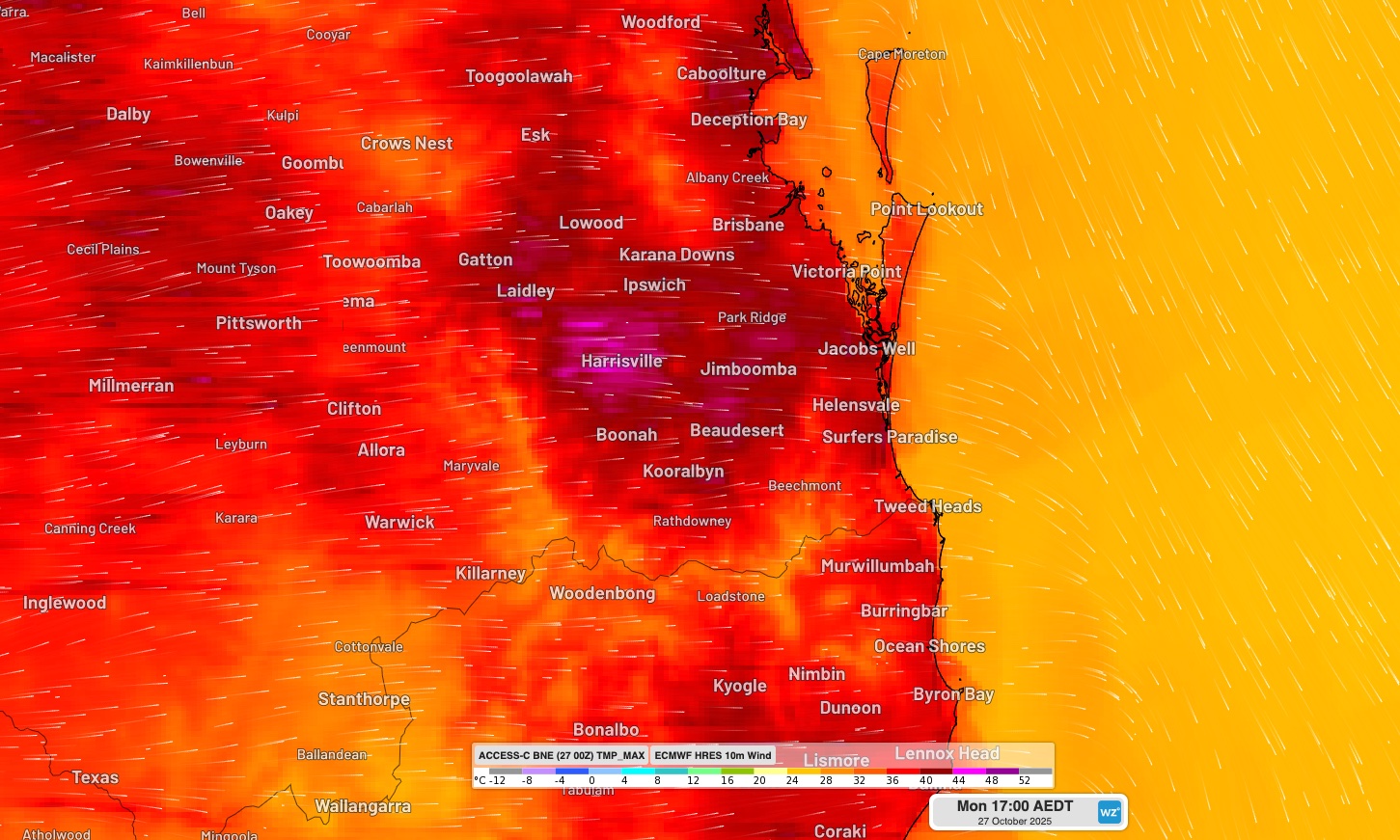
Image: Modelled daily maximum temperature and instantaneous wind at 4pm AEST on Monday, October 27, 2025. The map shows hot westerly winds flowing over southeast Qld and northeast NSW.
Brisbane reached 38.7°C on Monday afternoon, which was its highest October temperature since 2004. Brisbane Airport’s 39.1°C was its equal highest October temperature on record, matching 1957.
The following locations also broke their daily maximum temperature records for October on Monday:
- Sunshine Coast 39.1°C, previous record 37.0°C in 2004
- Coolangatta 38.3°C, previous record 35.6°C in 2004
- Gold Coast 38.0°C, previous record 36.8°C in 2004
- Byron Bay 35.9°C, previous record 34.0°C in 2004
Monday’s hot and windy weather also caused Extreme fire danger ratings in northeast NSW and southeast Qld, with numerous fires burning amid the torrid conditions.
Smoke from a large fire burning near Moonie extended more than 300 km to the east, covering the Gold Coast region and other areas south of Brisbane.
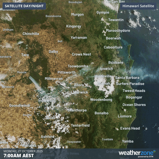
Image: Visible satellite images showing smoke blowing across southeast Qld on Monday, October 27, 2025.
A cool southerly change will push through northeast NSW and southeast Qld on Monday night, causing a big drop in temperature. Brisbane is only forecast to reach 22°C on Tuesday in the wake of the cool change.