
Record March rain to cause major flooding in April
The major flooding caused by last week's heavy rain over northern NSW and southern Queensland will persist into April as floodwater slowly drains from the landscape.
A stream of tropical moisture passing over Australia's eastern inland caused a burst of heavy rain in northern NSW and southern Queensland early last week.
Amid this deluge, Moree Airport received 187mm of rain in three days and 150mm during the 24 hours to 9am on Tuesday, March 23. This was Moree's heaviest daily March rainfall on record and its second wettest day, for any month, in records dating back to 1879.
Unsurprisingly, the heavy rain inundated the landscape and caused such widespread flooding that it could be seen from space.
The images below show extensive flooding in and around the Gwydir and Mehi Rivers to the east of Moree on March 25.
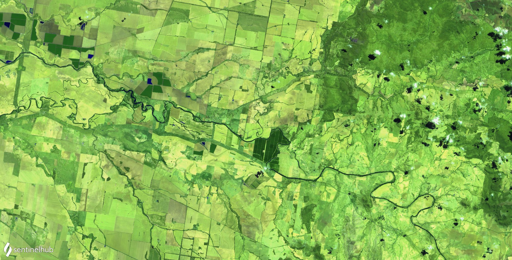
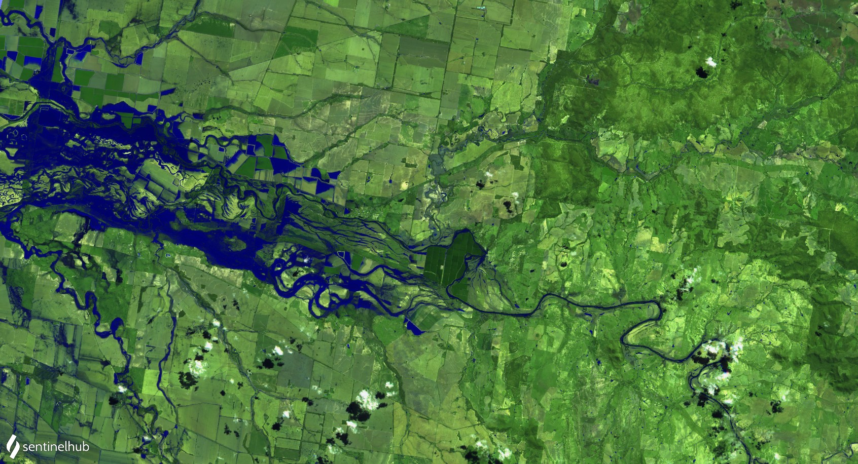
Image: False-colour satellite images taken on March 5 (top) and March 25 (botton) by the Sentinel-2 satellite. The images show 'before-and-after' views of the flooding in rivers to the east of Moree, NSW. Source: Sentinel Hub
The floodwater shown in the image above has since moved further downstream, however a vast amount of water is still draining from the landscape, with extensive flooding continuing in both northern NSW and southern Queensland.
According to the Bureau of Meteorology"this floodwater “has the potential to cause major flooding along the Barwon River at Mungindi from early April onwards."
"Moderate to major flooding may also develop along the Barwon Darling River downstream of Mungindi as the floodwaters progress. Predictions will be made once the upstream peaks are observed."
On Monday, March 29, major flood warnings were also still in place for the Condamine and Weir Rivers. Check the latest flood warnings over the coming days and weeks for the most up-to-date information on these floodwaters.