
Rare heavy summer rainfall in southwest WA
Heavy rain is falling parts of Western Australia’s South West Land Division, in what is a relatively unusual event for summer, largely due to the remnants of ex-Tropical Cyclone Mitchell.
The majority of rain in the continent’s southwest falls in winter, via cold fronts pushing north from the Southern Ocean. Occasionally these fronts arrive in summer but they tend to deliver little rainfall accumulation beyond the far southwest corner.
For example, Perth – with its so-called "Mediterranean climate" – receives just over 400mm of rainfall on average in the three winter months combined, and less than 40mm on average across the summer months.
But if you add the influence of a decaying tropical cyclone like ex-TC Mitchell into the mix, the usual summer picture can change drastically.
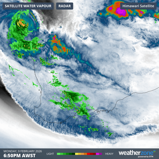
Image: 12-hour loop showing atmospheric water vapour and rainfall activity over southwest WA from 7pm (AWST) on Monday, February 9, 2026, to 7am on Tuesday, February 10.
As the loop above shows, moisture has streamed across southwest WA in a generally southeasterly direction from the point where ex-TC Mitchell made landfall near Carnarvon.
"The remnants of Tropical Cyclone Mitchell have linked up with a trough and cold front in the south," Weatherzone meteorologist Joel Pippard explains.
"The front and trough have now mostly stripped the moisture from the former cyclone, and are spreading it east and south."
Rain has not fallen everywhere. Much of the far southwest has remained totally dry, while Perth is sitting on the western edge of the main rainband, and received just 2.2mm in the 24 hours to 9am (AWST) on Tuesday. That’s not much, although it was still the city’s heaviest rain day to date in 2026.
But significant totals have fallen in numerous locations in the 24 hours to 9am Tuesday, including:
- 65mm at Morawa in the Central West forecast district, where the average monthly rainfall for January is just 20.2mm.
- 29.2mm at Newdegate in the Great Southern, where no daily total of more than 1mm had been seen this summer.
- 24mm at Dalwallinu in the Central Wheatbelt, where only 11.2mm had been received previously in the 2025/26 summer to date.
- 16.8mm at Geraldton, which is the Central West city’s heaviest daily total since September 2, 2025.
These aren’t huge totals compared to the daily rainfall totals you see elsewhere in Australia in summer from the tropical monsoon, severe thunderstorm outbreaks, or moist east coast systems. However, they are still very significant for southwest WA.
While it’s definitely not located in the southwest, it’s also well worth mentioning that 103.6mm of rainfall was recorded at Shark Bay Airport in the Gascoyne district, most of which fell within a 12-hour period after the cyclone made landfall nearby on Monday afternoon.
The last time we mentioned Shark Bay Airport on the Weatherzone news feed, it was because it had just hit 49.2°C on January 20, which eclipsed the site’s old heat record by almost two degrees.
Meanwhile the rain will begin to dry up rapidly in the southwest as the week progresses. If you live in that area and you’re hoping for more than a few drops, now’s the time to break out your best rain dance before the moisture feed evaporates.