
Rain, wind and snow to hit several Australian states this week
A series of powerful cold fronts and low pressure systems will cause multiple rounds of rain, blustery winds and snow across a broad area of Australia this week.
Two separate pools of cold air from the Southern Ocean will spread across the southern half of Australia this week. These frigid air masses will cause a series of cold fronts and low pressure systems, which will produce a dynamic mix of wintry weather across multiple states and territories.
Rain will spread across large areas of southern Australia throughout the week under the influence of the barrage of fronts and low pressure systems. The map below shows how much rain one computer model is predicting this week, with the heaviest falls expected to occur in SA, Vic, Tas and southern NSW.
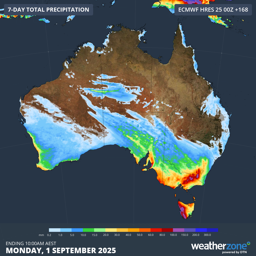
Image: Forecast accumulated rain during the 7 days ending at 10am AEST on Monday, September 1, 2025.
Not all of this week’s precipitation will reach the ground as rain. Surges of cold air will cause snow to settle across high terrain in several states between Wednesday and Saturday. This will include a hefty amount of fresh snow in alpine areas and some low-level snow outside the Alps. There is even potential for snow to settle in central NSW and reach near sea level in Tasmania by Saturday.
Wind will be a major factor of this week’s weather, with damaging wind gusts expected to occur in parts of SA, Vic, NSW, the ACT and Tas during the week. Friday will be a particularly dangerous day for wind across southeastern Australia thanks to a strong pressure gradient between a low pressure system near Tas and a high pressure system to the south of WA.
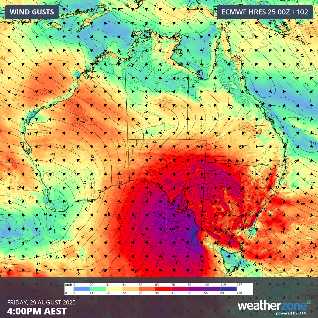
Image: Modelled wind gusts at 4pm AEST on Friday, August 29, 2025.
This week, the final week of winter in Australia, will be cold, wet and windy across a large part of the country. Severe weather is likely on multiple days and in several states and territories, so be sure to check the latest forecasts and warnings in your area throughout the week.