
Rain to soak every Australian state this week
A series of strong cold fronts will cause widespread rain across Australia this week, along with periods of damaging winds, thunderstorms and snow in multiple states and territories.
Two cold fronts and associated low pressure systems will sweep across Australia from west to east this week. The first system will cross the country between Monday and Wednesday, and the second will move through between Wednesday and Sunday.
Both systems will be strong enough to cause severe weather in multiple states and territories this week. The combination of the two systems will also result in widespread rain across southern, central and eastern Australia, including useful falls in drought-affected areas.
First system of the week
The satellite image below shows the first cold front of the week passing over WA on Monday morning, where it is causing a cold, wet and windy start to the week. Perth could struggle to reach 15°C on Monday, which would make it the city’s coldest day so far this year.
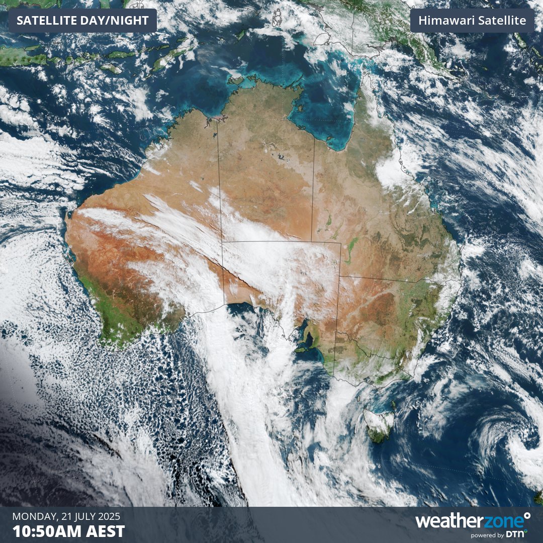
Image: Visible true colour satellite image captured on Monday morning.
This system will move further east in the next couple of days, hitting SA on Monday and then crossing southeastern Australia on Tuesday.
Blustery winds, rain and cold air will spread across the southern half of Australia between Monday and Wednesday with the passage of this cold front and an associated low pressure system. This will include damaging winds in several states, with severe weather warnings already in place for parts of SA and Vic as of 10:30am AEST on Monday. Warnings may also be issued in NSW and Tas over the next couple of days.
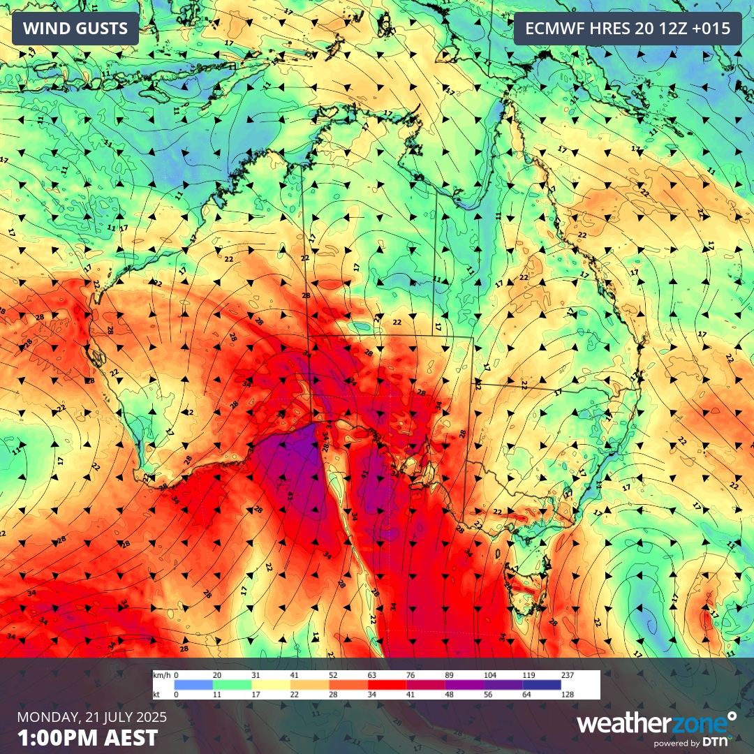
Image: Forecast wind gusts at 1:00pm AEST on Monday, July 21, 2025.
This cold front will also interact with a low pressure trough over eastern Australia to cause rain and thunderstorms over a broad area of NSW and Qld on Tuesday and Wednesday.
Second system this week
The second cold front of the week will reach southwestern Australia on Wednesday before crossing WA on Thursday, SA and central Australia on Friday and southeastern and eastern Australia on the weekend.
This front is expected to spawn a large low pressure system that will draw tropical moisture across Australia. This setup has the potential to generate a massive northwest cloudband that will soak part of every state and territory in the second half of this week.
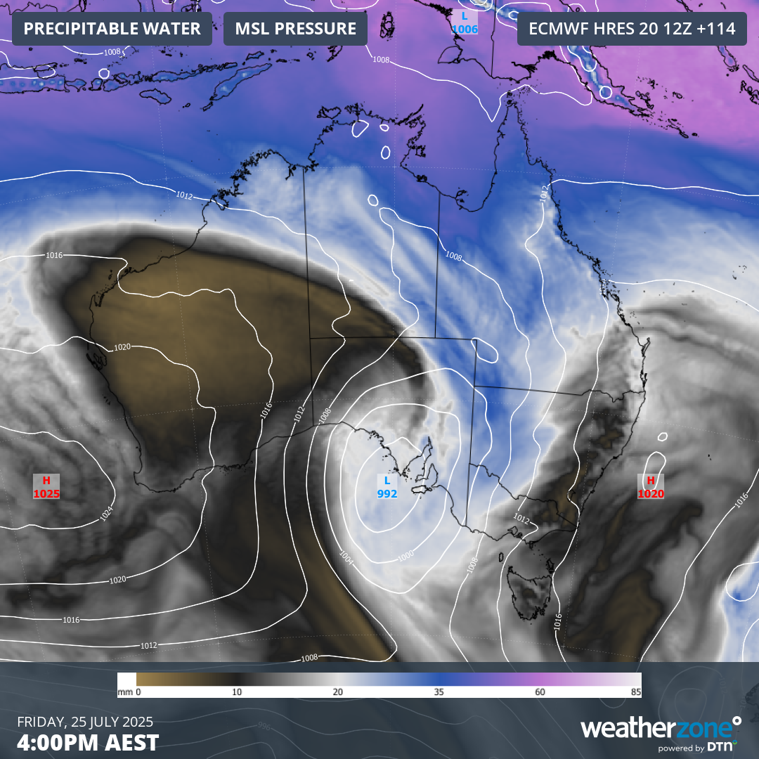
Image: Modelled precipitable water and mean sea level pressure over Australia on Friday afternoon, showing a low pressure system directing a large stream of tropical moisture across eastern and southeastern Australia.
In addition to rain, this front and low will also cause further blustery and potentially damaging winds across parts of southern Australia later this week. It should also get cold enough for more snow in the Alps and there’s even a chance of some snow flurries in the south of WA on Thursday.
Big week of rain for Australia
The combined influence of this week’s cold fronts and low pressure systems will deliver a decent amount of rain to part of every state and territory in Australia between now and the weekend. Due to the eastward movement of these weather systems, the bulk of this rain will fall on and west of the Great Dividing Range. This means that the Murray-Darling Basin and many thirsty agricultural areas of SA, Tas, Vic and WA will also see a good drop of rain in the next seven days.
The map below shows how much rain is expected to fall across Australia this week.
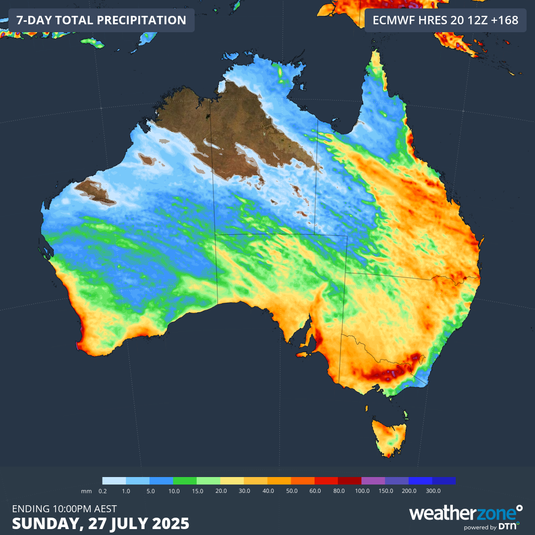
Image: Forecast accumulated rain this week, according to the ECMWF-HRES model.
Some of this week’s rain will soak areas that have experienced record-breaking rainfall deficiencies over the past 1.5 years, as shown on the map below. While this won’t be enough to eradicate these long-term rain deficits, it will be welcome moisture in the ground.
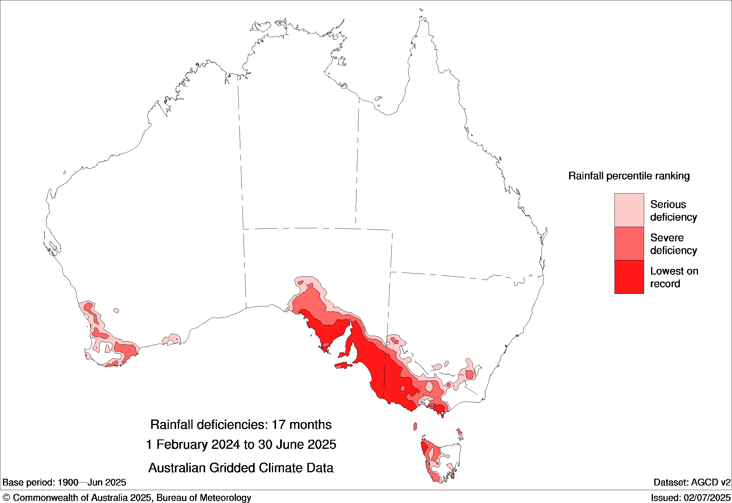
Image: Rainfall deficiencies for the 17-month period ending in June 2025. Source: Bureau of Meteorology
The dynamic weather patterns affecting Australia this week will cause dangerous conditions in multiple states. Check the latest forecasts and weather warnings in your area before heading out.