
Rain spreading across inland Australia
Rain has begun to fall across parts of inland South Australia, Victoria and western New South Wales, with moderate falls likely by the end of the working week.
Heavier rain will also develop in northwest Tasmania from Wednesday evening through to Friday as a series of troughs crosses the state.
Let’s take a look at the origins of the inland moisture, as well as some of the rainfall totals already observed with this system, and how much rain is yet to come (and where).
Moisture feed from the Indian Ocean
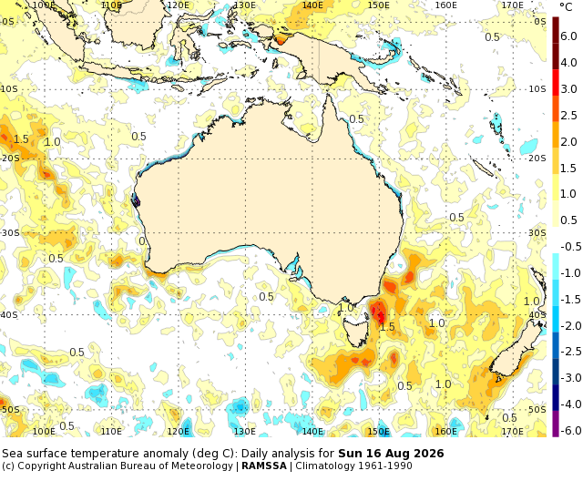
Image: Sea surface temperature anomalies across Australia on Sunday, August 16, 2026. Source: BoM.
The inland rain falling on Tuesday is being driven by a feed of tropical moisture all the way from the waters off northwestern WA, where sea surface temperatures (beyond the immediate coastal fringe) are above-average for this time of year.
A northwest cloudband has formed across Australia. While these cloud features often look spectacular on the satellite image, they don't always deliver large amounts of rainfall across their entire length. However, rain is falling in some eastern inland regions due to a trough over western NSW.
How much rain has fallen so far?
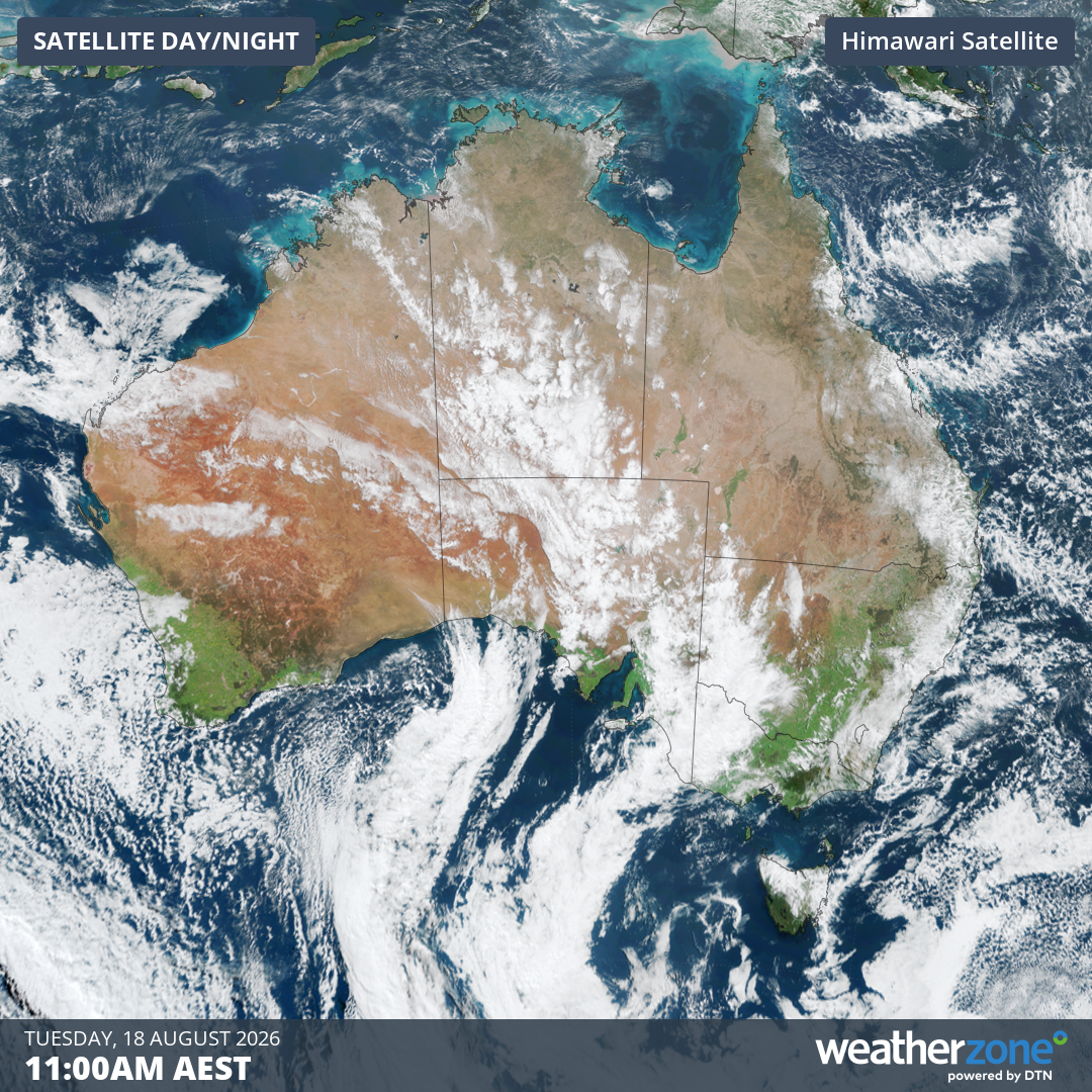
Image: Satellite image over Australia at 11 am (AEST) on Tuesday, August 18, 2026. Source: Weatherzone.
In the 24 hours to 9 am Tuesday, the highest inland rainfall reading associated with Indian Ocean moisture and the northwest cloudband was of 21.2 mm at Braemar, a South Australian cattle station about 260 km NE of Adelaide.
Numerous other inland locations saw totals above 10 mm.
The heaviest rainfall totals anywhere in Australia in the 24 hours to 9 am Tuesday were along the east coast, where totals reached around 40 mm on parts of the NSW Mid North Coast and 30 mm on Queensland’s Sunshine Coast.
This rain was due to an onshore flow from the Tasman and Coral seas, enhanced by above-average sea surface temperatures, especially off the NSW coast.
Where will rain fall in coming days?
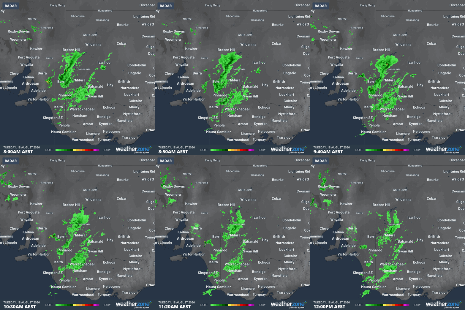
Image: Rain radar loop for the four hours to midday (AEST) on Tuesday, August 18, 2026, for parts of eastern Australia's inland. Source: Weatherzone.
Rainfall totals up to 20 mm or slightly higher could be recorded across large parts of inland Victoria and southern inland NSW in coming days, with showers also likely in central and northern inland NSW.
As mentioned at the top of this story, northwest Tasmania looks set for the heaviest falls, with Wednesday looking particularly soggy for the far northwest of the state, with 24-hour totals of around 40 mm possible.
All of the southeastern capitals should see at least a few showers during the rest of the working week, but the rain should be heaviest on or west of the Great Dividing Range.
The role of the Indian Ocean Dipole (IOD) in inland rain events fed by tropical moisture
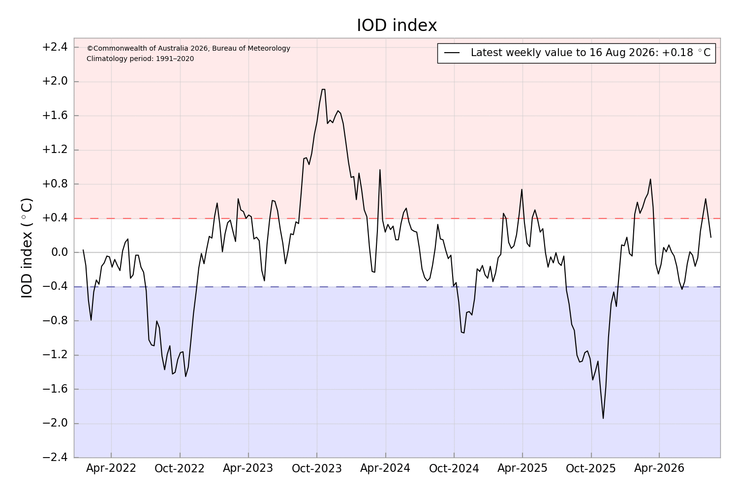
Image: Weekly IOD index values up until Sunday, August 16, 2026. Source: BoM.
When discussing northwest cloudbands, it’s always worth mentioning the current status of the Indian Ocean Dipole (IOD) – a key climate driver which influences daily weather across large parts of Australia.
The IOD is an index that measures the difference in sea surface temperatures between western and eastern parts of the tropical Indian Ocean.
With a positive IOD, cooler-than-average waters in the eastern tropical Indian Ocean typically bring below-average rain and higher temperatures to central and southern Australia.
Conversely, the warmer-than-average waters in eastern parts of the tropical Indian Ocean during a negative IOD typically bring above-average rain and cooler days to large parts of Australia.
The IOD is currently in a neutral phase. So you can’t directly attribute this week’s inland rain to the current phase of the IOD. But it’s not hindering this event.