
Rain spreading across increasingly damp SA, and more to come
Barely a week after a soaking, much of South Australia has had rain this weekend, substantial in some of the state's west and south, with more on the way.
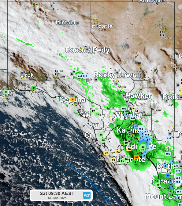
Image: satellite, radar, rain observations in the 24 hours to 9am 13 June 2026. Source: Weatherzone.
Recent rain in the 24 hours to 9am was the heaviest in -
- 2 years at Yankalilla (26mm),
- 11 months at Parawa (44mm), Port Lincoln (27mm), Coulta (28mm) and Inman Valley ( 24mm), and
- 3-4 months at Ceduna (31mm), Streaky Bay (26mm), Lock (21mm), Kingscote (20mm) and Cummins (18mm).
It was also the heaviest June rain in 31 years at Wirrulla (19mm), 13 years at Lock, 12 years at Coulta and 10 years at Ceduna.
In the first few days of this month, a 48-hour wet spell bringing widespread 20-to-50mm (as much as 100mm or so in the Adelaide Hills) got winter of to a damp start across the state. The ground was already reasonably well watereed from two rain events in the last few weeks of May.
All up, the 30 days to 13th June has been the wettest 30 days in -
- 5 years at Minlaton (117mm)
- 4 years at Port Lincoln (120mm), Darke Peak (104mm) and Port Victoria (103mm)
- 3 years at Mount Lofty (244mm), Birdwood (158mm), Williamstown (143mm), Cummins (107mm), and
- 2.5 years in some Adelaide suburbs, including West Terrace (119mm), Burnside (147mm) and Hope Valley (107mm).
This amount of rainfall is roughly twice the monthly average for this time of year and has boosted soil moisture significantly.
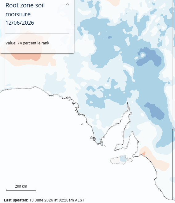
Image: Root zone soil moisture measured 12 June 2026, indicating near or above average for the agricultural area apart from the area southeast of Adelaide. Source: BoM.
It has been a remarkable turnaround. This time two years ago, the soil was very dry. Much of SA was in drought.
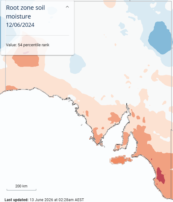
Image: Root zone soil moisture measured 12 June 2024, indicating below average or very much below average for the agricultural area, even in the lowest 1% in the area southeast of Adelaide. Source: BoM.
Looking ahead, widespread rainfall of 20-to-50mm with isolated falls exceeding 100mm can be expected across SA's agricultural area. This outcome is due to moisture from the Indian Ocean feeding a likely slow-moving low pressure system.
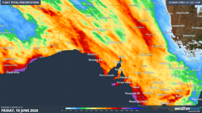
Image: Forecast rainfall for the 7 days to 9:30pm CST according to ECMWF model. Source: Weatherzone.