
Rain on the way for parts of eastern Australia
Showers and thunderstorms will develop over large areas of NSW and Queensland during the next three days.
An upper-level trough interacting with moisture-laden onshore winds will produce widespread showers and storms over eastern Australia between Thursday and Sunday.
This multi-day rain event will affect coastal and inland areas of NSW and Queensland, with some places possibly in line for their best drop in months.
However, while this is exciting news for drought-weary farmers and communities in eastern Australia, it's important to keep expectations in check. Showers and thunderstorms will be hit and miss during the next few days, with some places likely to see heavy rain and others possibly missing out altogether.
Rainfall will initially be light and confined to eastern districts of Queensland and NSW on Thursday.
Showers and thunderstorms will ramp up and become more widespread on Friday, affecting most districts in the eastern half of NSW and parts of central and southeast Queensland.
Showers and thunderstorms will continue to affect a broad area of eastern Australia on Saturday, possibly becoming more confined to central and southeast Queensland and northeast NSW.
Drier weather should return to most areas on Sunday as the upper-level trough starts to move offshore and showers contract towards the nation's east coast.
Rainfall totals from this system are difficult to predict and will vary quite a lot from district to district, town to town and farm to farm.
The onshore winds feeding this system should cause the heaviest rain to occur on the eastern side of the ranges, where some areas could see 30-50mm by Sunday. Further inland, rainfall totals will probably range from less than 1mm in some places to 30mm or more if you happen to see a thunderstorm or two.
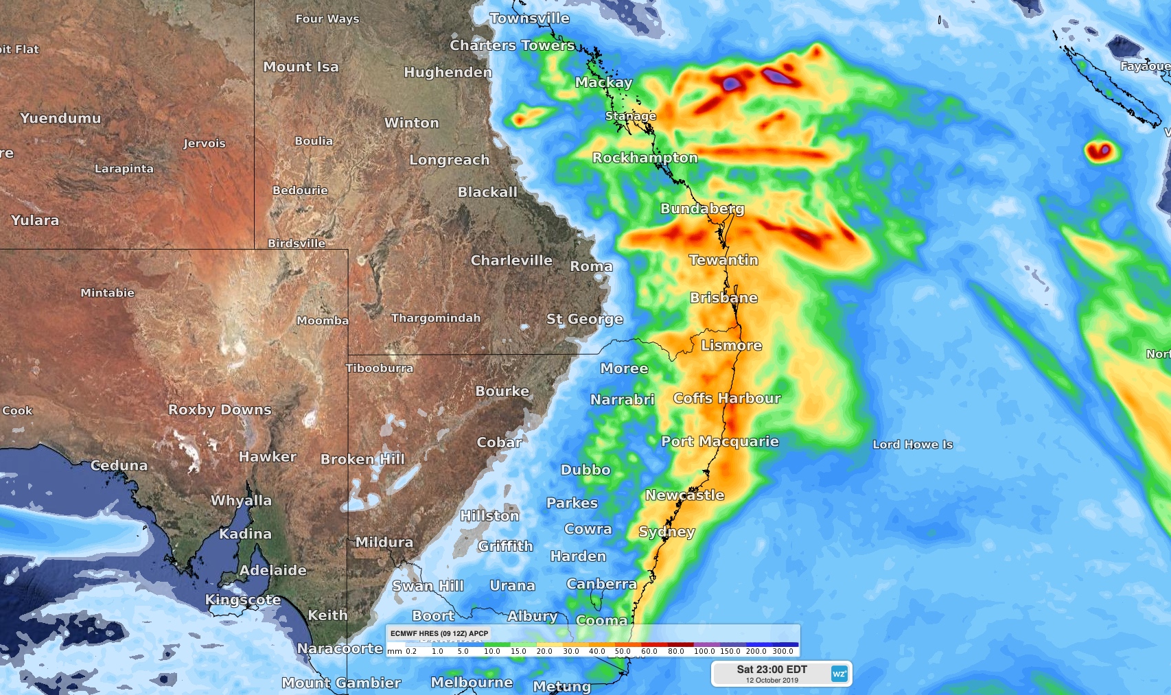
Image: Forecast rainfall between Thursday and Saturday according to the ECMWF-HRES model.
This system won't bring enough rain to break the drought that's currently gripping a large swathe of eastern Australia. However, it may cause locally severe weather, so be sure to keep up to date with the latest warnings during the next few days.