
Rain on the horizon for eastern Australia
Showers and thunderstorms will increase over fire and drought affected areas of eastern Australia during the next week.
A near-stationary low pressure trough over Australia's eastern interior will gradually deepen during the next several days, drawing moisture-laden easterly winds across large swathes of Queensland, NSW and Victoria.
This moisture will be converted into rain and thunderstorms on multiple days, as a series of upper-level troughs pass over southeastern Australia during the coming week.
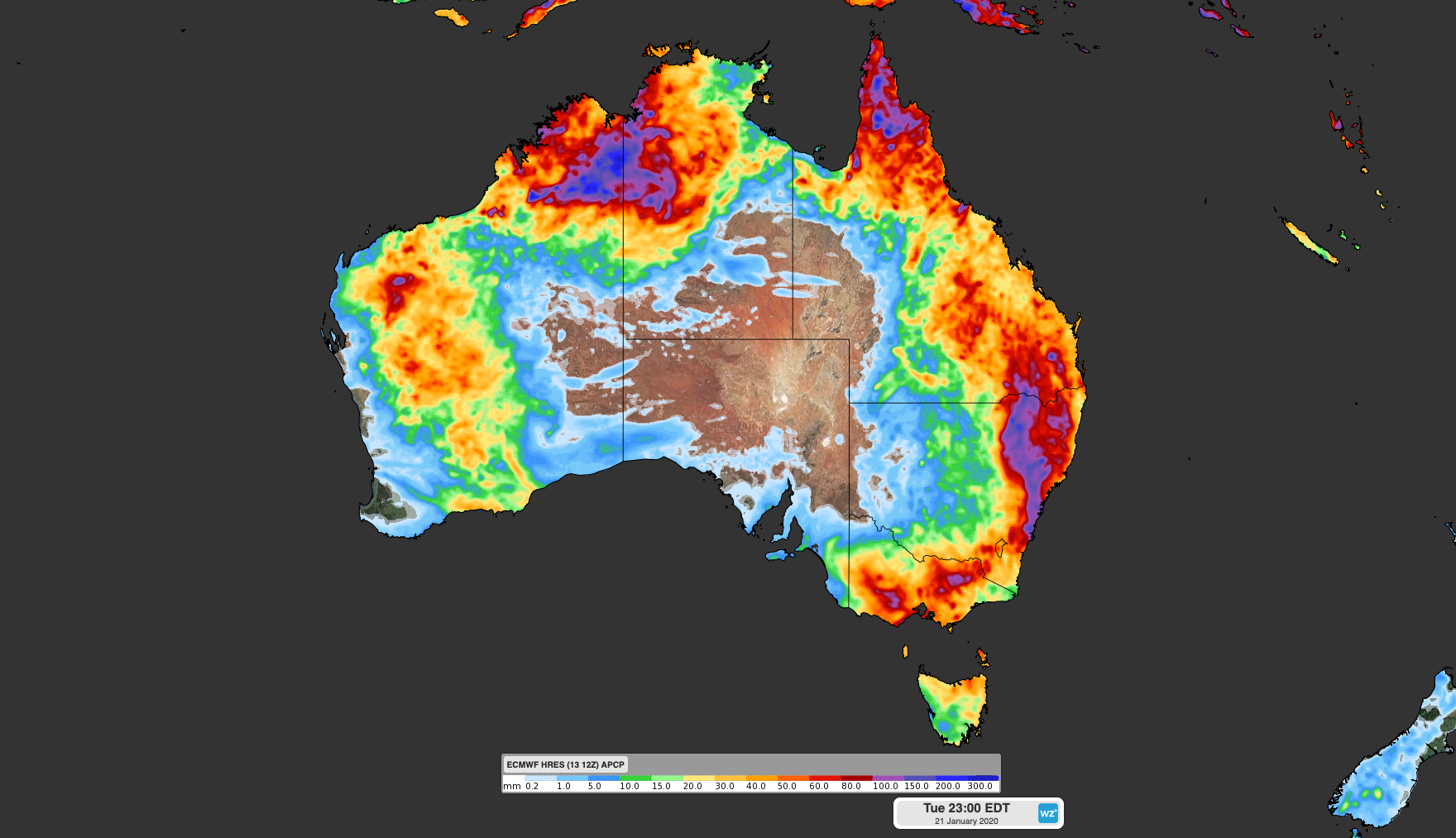
Image: Forecast accumulated rain for the eight days ending on Tuesday, January 21st. Data from the ECMWF-HRES model.
While this type of weather pattern is typical during summer, it's the first widespread rain and storm event we have seen in eastern Australia so far this season.
Showers and storms will start to increase over Queensland, NSW and Victoria from Wednesday and continue to affect parts of each state every day until at least early next week.
The focus of the heaviest falls will shift around a bit from day to day, although parts of each state should see some decent rain from this system.
Forecast models suggest that widespread totals of 20-40mm are likely between now and Tuesday next week in northern, central and eastern Queensland, the eastern half of NSW and parts of Victoria. Some places in NSW and Queensland will pick up 50-100mm during the next week, with isolated totals over 100mm a fair chance.
This week's seemingly abrupt change in weather, from exceptionally warm and dry conditions in December to widespread rain and storms in January, follows the breakdown of two dominant climate drivers that influenced Australia's weather patterns towards the end of 2019.
The first driver was the strongest positive Indian Ocean Dipole (IOD) event in at least 20 years. A positive IOD refers to a pattern of sea surface temperatures across the tropical Indian Ocean that often result in below-average rain and above-average temperatures in parts of Australia between winter and early summer.
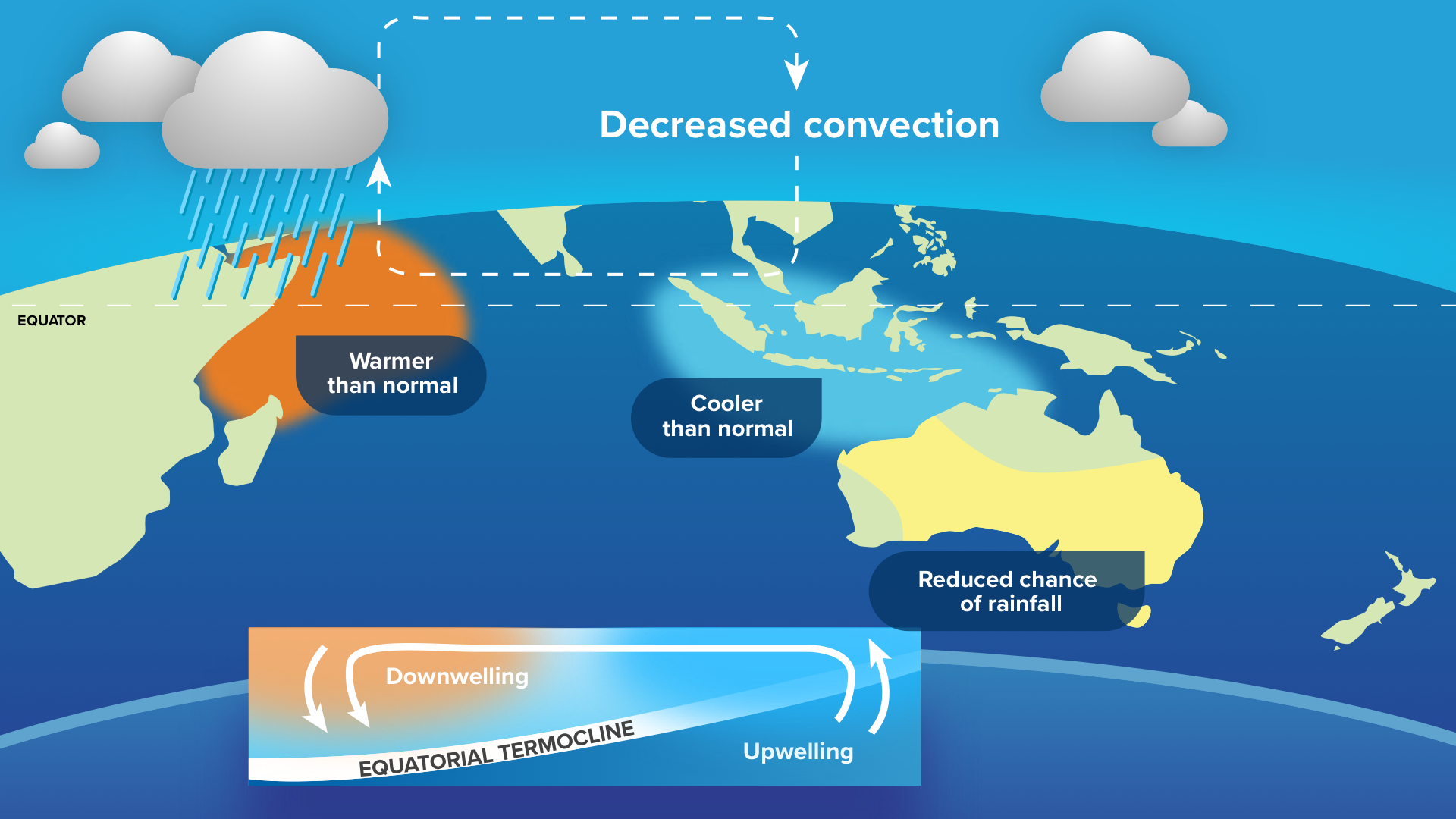
Image: Pattern and effects of a positive Indian Ocean Dipole (IOD), showing reduced rainfall in large parts of Australia.
Last year's positive IOD pattern persisted from late-May until the end of December and helped make 2019 Australia's driest and warmest year on record.
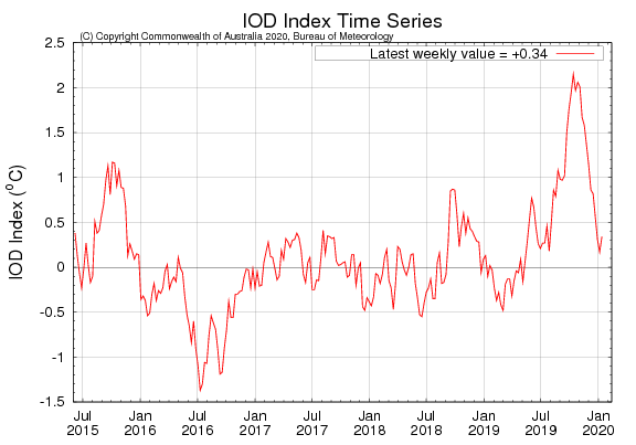
Image: Indian Ocean Dipole (IOD) index, showing a prolonged positive phase during 2019 and a strong peak in October. Source: Bureau of Meteorology
The other dominant climate driver in 2019 was a negative Southern Annular Mode (SAM) episode, which persisted from mid-October to late December. Negative SAM occurs when the belt of westerly winds surrounding Antarctica shift further north than usual. When a negative SAM occurs in spring and early summer, westerly winds increase over Australia's southern and eastern states. This pattern helped cause unusually warm and dry weather in eastern Australia, along with enhanced bushfire weather, during late spring and early summer last year.
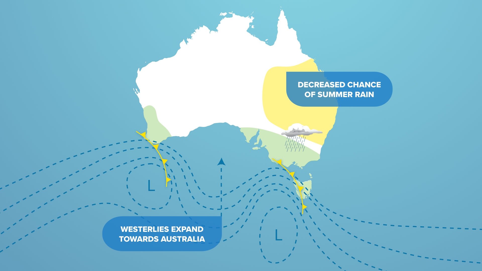
Image: Effects of a negative Southern Annular Mode (SAM) during late spring and summer.
By December 2019, 100 percent of NSW and 67.4 percent of Queensland were affected by drought. While the impending rain won't break this drought, it will help extinguish some of the fires currently burning across eastern and southeastern Australia.
At 9pm on Monday, there were 105 fires still burning in NSW alone.