
Rain and storms in NSW
Showers and thunderstorms are bringing some respite to fire-affected areas of NSW.
A near-stationary low pressure trough has been producing showers and thunderstorms in parts of eastern and northern NSW during the last four days.
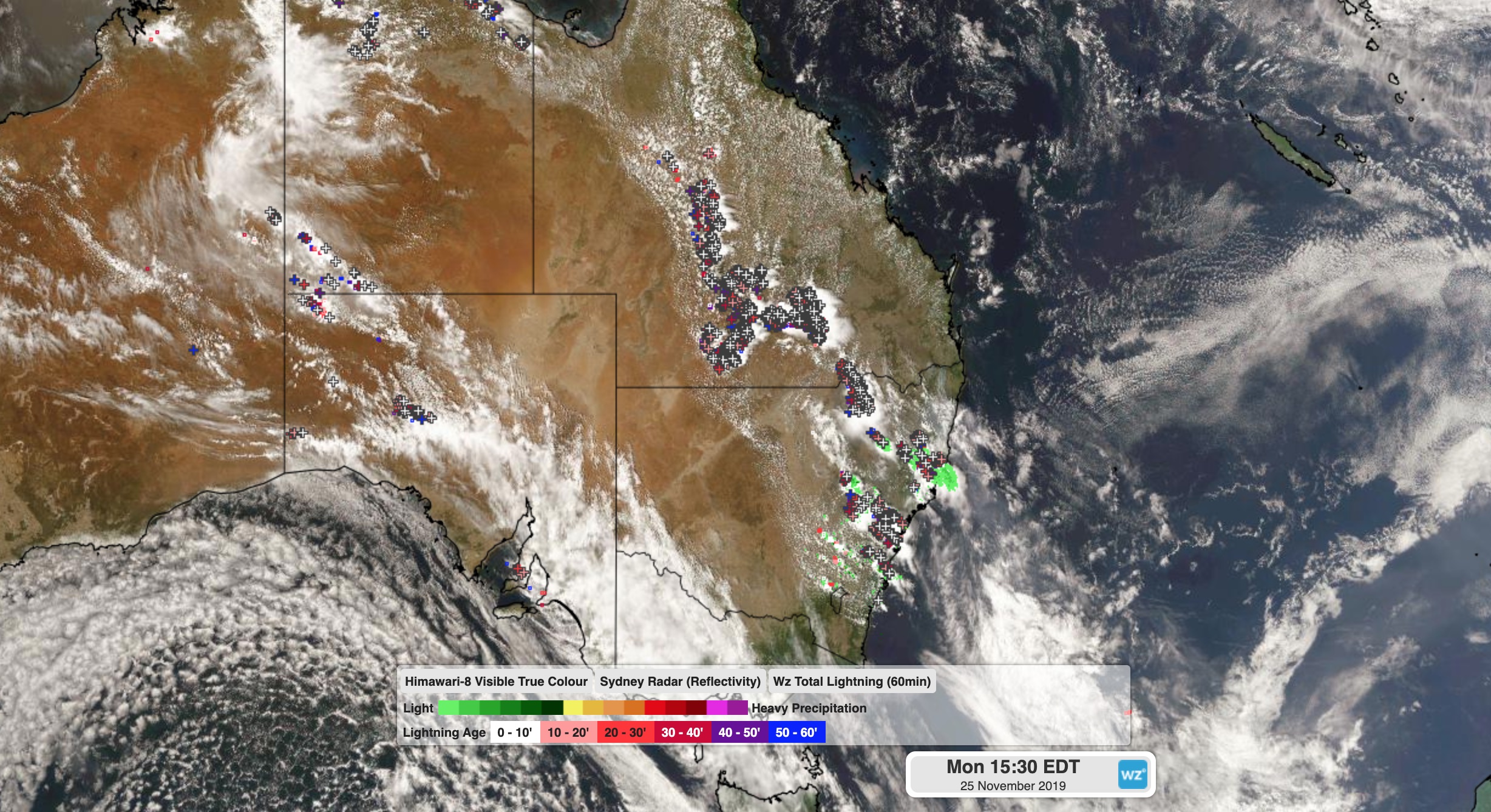
Image: Satellite image showing thunderstorms over eastern Australia on Monday.
Some areas in northeast NSW have seen more than 30mm of rain from this system. During the 24 hours to 9am on Monday, Glen Innes (35mm), Narrabri (26mm) and Guyra (18mm) all had their heaviest rain in 7-8 months.
While this spell of wet weather has helped extinguish some of the state&'s fires, it's been a double-edged sword. Some thunderstorms over the last few days have brought dry lightning, which ignited new fires.
At 9am on Monday, there were still 67 bush and grass fires burning in NSW and 25 were uncontained. According to the Rural Fire Service, there were 1,300 personnel in the field battling these fires on Monday.
Showers and thunderstorms will continue to affect a broad area of central, eastern and northern NSW into Monday night and again on Tuesday. Some of these thunderstorms are likely to become severe, so be sure to check the latest warnings.
A cold front crossing NSW on Tuesday will also cause strong and gusty winds, which are likely to cause raised dust and elevated fire danger ratings in some areas. Cooler air behind this front could even cause snow in alpine areas of southeastern Australia later on Tuesday.
Drier weather will return to most of NSW on Wednesday as the front and trough move away from the state.