
Rain and storms ahead for eastern Australia
Rain could be on the horizon for a broad area of drought-weary eastern Australia, with two seperate system likely to bring wet and stormy weather during the next week.
A mass of moisture-laden air passing over eastern Australia will combine with a series of upper-level troughs to cause rain and thunderstorms over the next eight days.
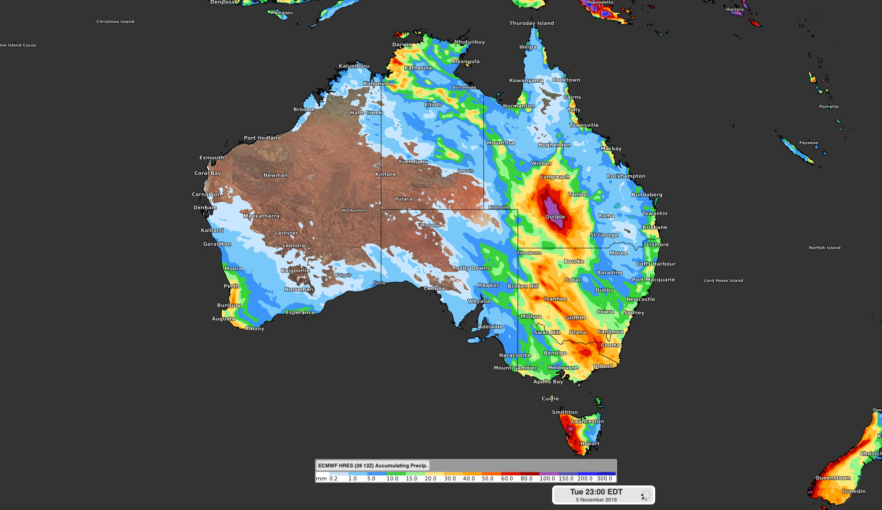
Image: Forecast accumulated rainfall during the next week according to the ECMWF-HRES model.
The first system will cause rain and storms over central and western Queensland and northern inland NSW between Tuesday and Thursday. This system could bring widespread falls of 10-30mm, with isolated totals exceeding 50mm, particularly with thunderstorms.
Rain will ease on Friday as this upper-level trough moves off Australia's east coast, although the atmosphere over NSW and Queensland will remain laden with moisture and primed for more rain.
The next upper-level trough will sweep over southeastern Australia during the weekend, leading to widespread rain and storms in and around the Murray Darling Basin between Saturday and Tuesday.
This system is still several days away, so prediction where and how much rain will fall is difficult. Computer models currently suggest that widespread falls of 10-20mm are possible in Victoria, NSW and southern Queensland, with heavier localised falls.
While this rain is likely to excite communities that are being affected by drought, it's important to keep expectations in check.
Some of the heaviest rain during the next week will come from thunderstorms, so rainfall totals could vary quite a bit from farm to farm. It's also worth pointing out that this rain won't break the drought.
As of 9am on Monday, October 28th, most inland areas of NSW and Queensland had received less than 20 percent of their average rainfall for the month.
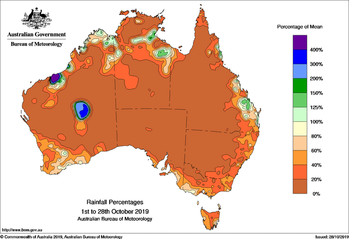
Image: Percentage of the monthly average October rainfall received across Austarlia as of 9am on October 28th.
Prior to this, both states registered their 11th driest September in 120 years of records and saw less than half of their average seasonal rainfall during winter. This trend of drier-than-usual weather even extends back several years in some parts of eastern Australia.