
Queensland tropical cyclone and flood risk, but uncertainty is high
Heavy rain and blustery winds will hit northern Queensland later this week as a tropical low or tropical cyclone crosses the coast on Friday. There is also a risk that heavy rain will spread across central and southern parts of the state towards the end of the week, but uncertainty is higher for these areas.
Tropical low heading towards northern Qld
On Wednesday morning, a tropical low was located over the northern Coral Sea to the north of Willis Island. The system’s low-level circulation centre could clearly be seen on satellite images, along with large areas of convective cloud building to the west of its centre.
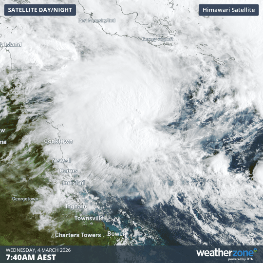
Image: Satellite images showing a tropical low over the northern Coral Sea on Wednesday morning. Source: Weatherzone.
This tropical low is currently expected to move towards northern Qld on Wednesday and Thursday before making landfall somewhere between Cooktown and Townsville on Friday. At this stage, the system should be a tropical low or weak tropical cyclone when it reaches the Qld coast. The Bureau of Meteorology gives this system a moderate risk of reaching tropical cyclone strength before landfall.
Regardless of whether the system remains a tropical low or becomes a tropical cyclone, the impacts for northern Qld should include heavy rain, localised flash flooding and blustery winds as it approaches and crosses the coast.
Following landfall, the low pressure system is expected to move inland, allowing rain and storms to spread over northern Qld into the weekend and possible early next week.
This forecast may change in the coming days as the tropical low continues to develop. The Bureau points out that “people in the north tropical coast of Queensland should monitor forecasts for updates.”
Heavy rain risk for central and southern Qld
Some computer models suggest that a second low pressure system could track towards the south near the Qld coast later this week. If this does happen, rain and storms could also spread over central and southeast Qld from Friday into the weekend, with the potential for moderate to heavy falls.
It’s important to note that there is a high amount of disagreement between computer models regarding where this low will move. Some models keep it off the coast while tracking towards the south, while others have the low sitting closer to the coast. This disagreement makes it difficult to predict where and how much rain will fall.
At this stage, there is a possibility of rain and storms spreading over central and southeast Qld from Friday into the weekend. However, there isn’t enough confidence in the forecast to say which areas will see heavy rain and flooding.
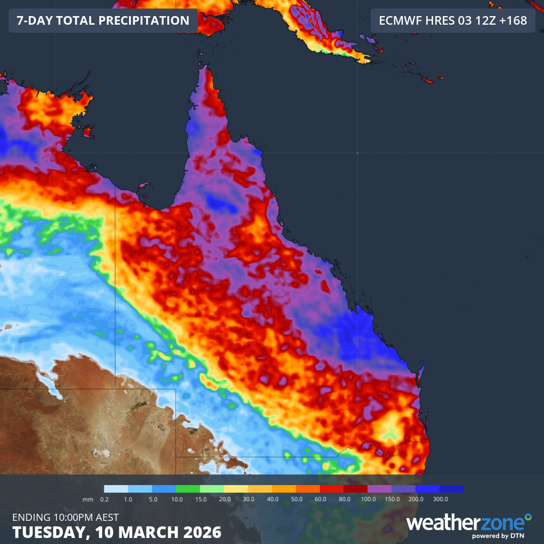
Image: Forecast accumulated rain during the next seven days, according to the ECMWF-HRES model. Source: Weatherzone.
Anyone living in central and southeast Qld should stay up to date with the latest forecasts and warnings in the coming days for the most accurate information.