
Prolonged spell of unseasonable warmth for large parts of southern Australia
Adelaide and Melbourne are just two locations in a large portion of southern Australia that will experience a run of unseasonable mid-autumn warmth lasting several days, beginning this Tuesday.
- For the next five days including this Tuesday, Adelaide is expecting maximums of 29°C, 27°C, 29°C, 28°C and 27°C. Adelaide's average April maximum is 22.2°C.
- For the next five days including this Tuesday, Melbourne is expecting maximums of 26°C, 24°C, 26°C, 25°C and 25°C. Melbourne's average April maximum is 20.4°C.
The warmth will even extend as far south as Tasmania, where Hobart is expecting a run of five days with maximums of 20°C or higher from today onwards, including a likely Friday high of 25°C in a month when the average maximum is just 17.5°C.
What’s causing the warmth?
Sometimes the most basic tool in the meteorology toolkit illustrates the situation best. The synoptic chart below shows a large high pressure system dominating the weather over Australia.
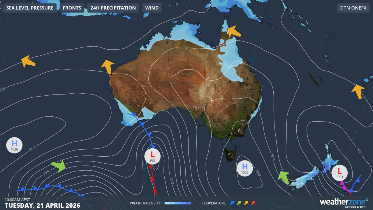
Image: Synoptic chart for Australia at 10am on Tuesday, April 21, 2026. Source: Weatherzone.
To the east of Australia, the low that was sitting over the Tasman for several days has drifted all the way east of New Zealand, but winds circulating around that system are still pushing southerlies onto the New South Wales coastline, keeping conditions slightly cooler than average.
In Western Australia, a cold front swept through the southwest overnight, bringing showers and a significant temperature drop.
But the situation is very different for the large chunk of southern Australia between the east and west coasts.
South Australia, Victoria and Tasmania are all being impacted by northerlies circulating anti-clockwise around the high, dragging warm air southwards from the interior of the continent. This pattern will remain in place for several days as the high drifts east.
Dry conditions can be expected to accompany the warmth for the rest of the working week in most of the areas mentioned.
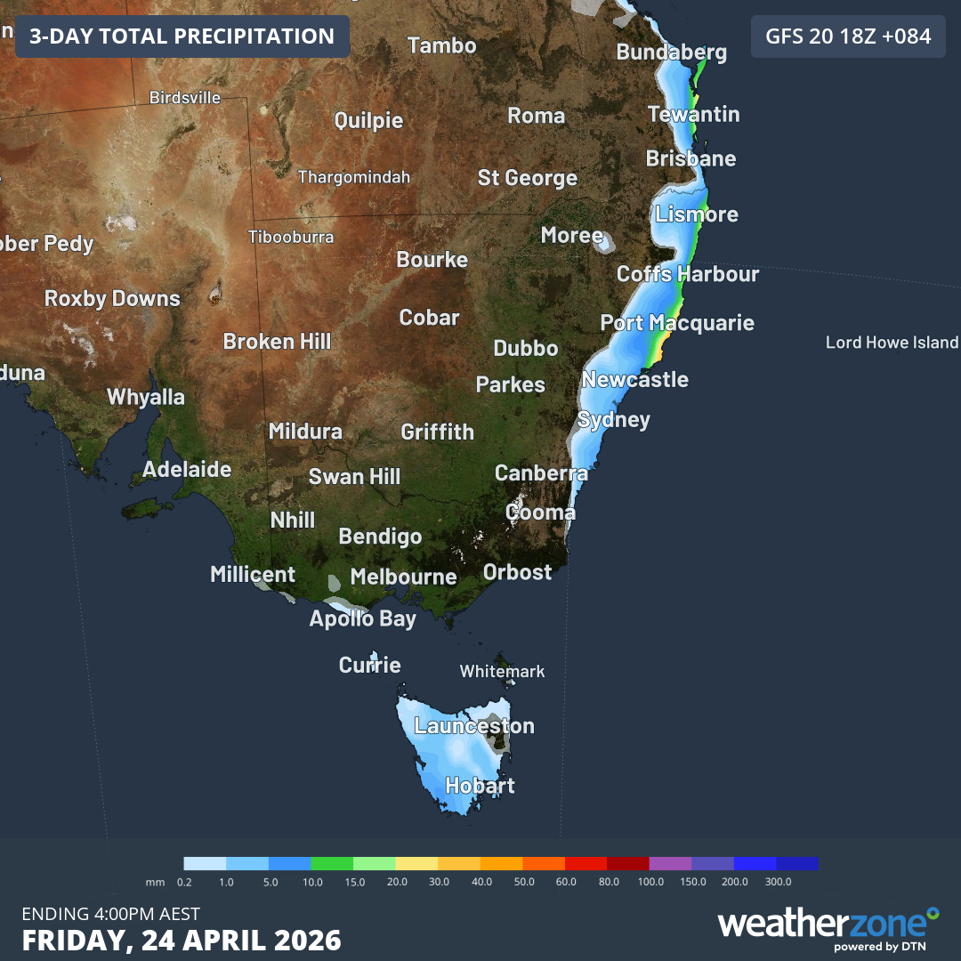
Image: Predicted rainfall accumulation for SE Australia up until 4pm (AEST) on Friday, April 24, 2026, according to the GFS model. Source: Weatherzone.
As the chart above shows, the only areas likely to see a few showers in coming days are the NSW coastline as well as parts of western, northern and central Tasmania.