
Potential for dangerous weather next week
Forecast models continue to show potential for severe weather in Australia next week. The trouble is, they are having a hard time figuring out which areas will be affected.
As we pointed out yesterday, a number of models suggest that a cut-off low will could drift across Australia next week.
These dynamic upper-level systems often cause severe weather to occur at the ground, so forecasters are keen to get useful information out to the public before it arrives.
Unfortunately, there is still quite a lot of uncertainty around when, where and how this system will play out.
The images below show where three different forecast models think the upper-level low will be sitting on Tuesday night next week.
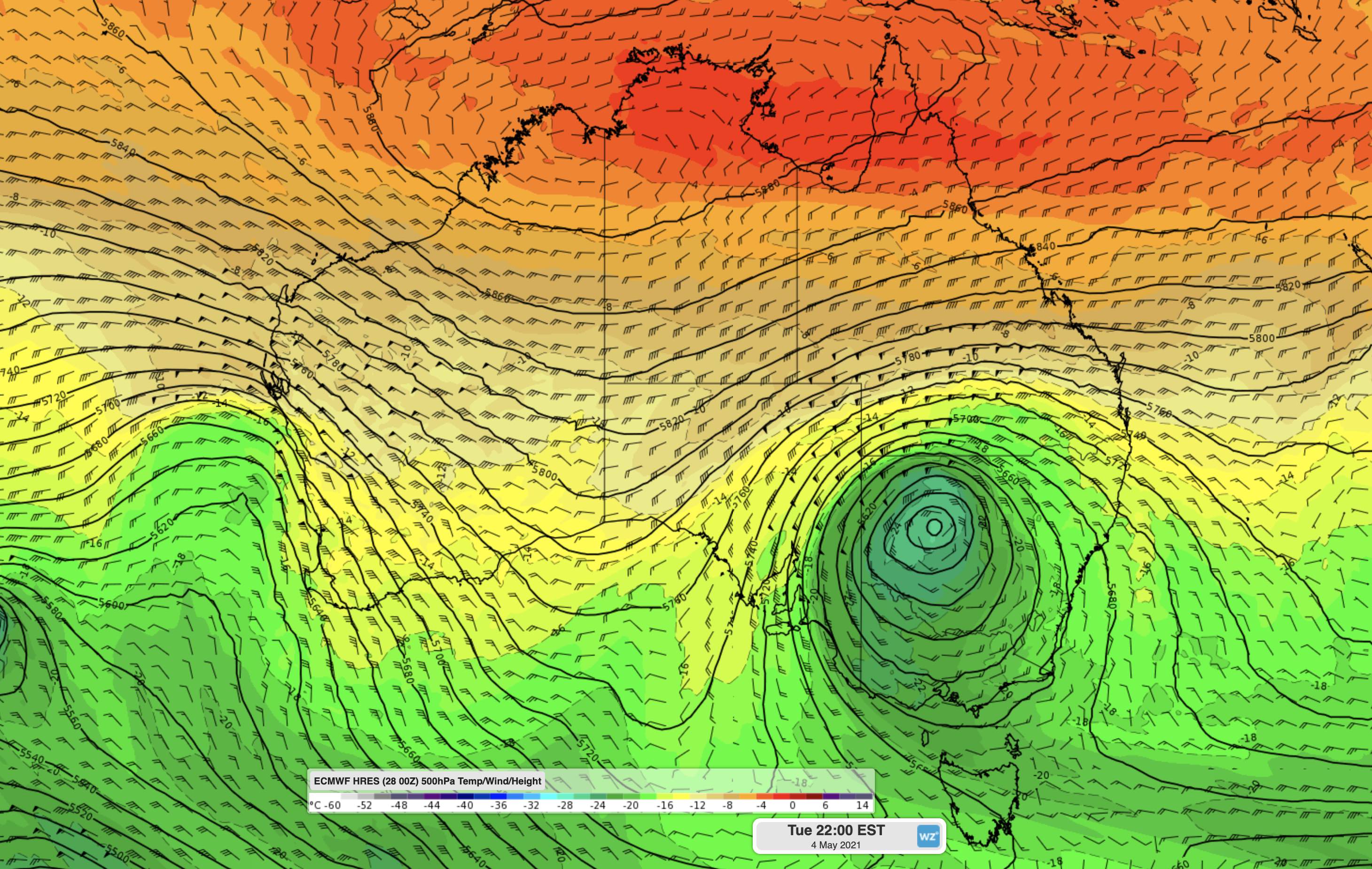
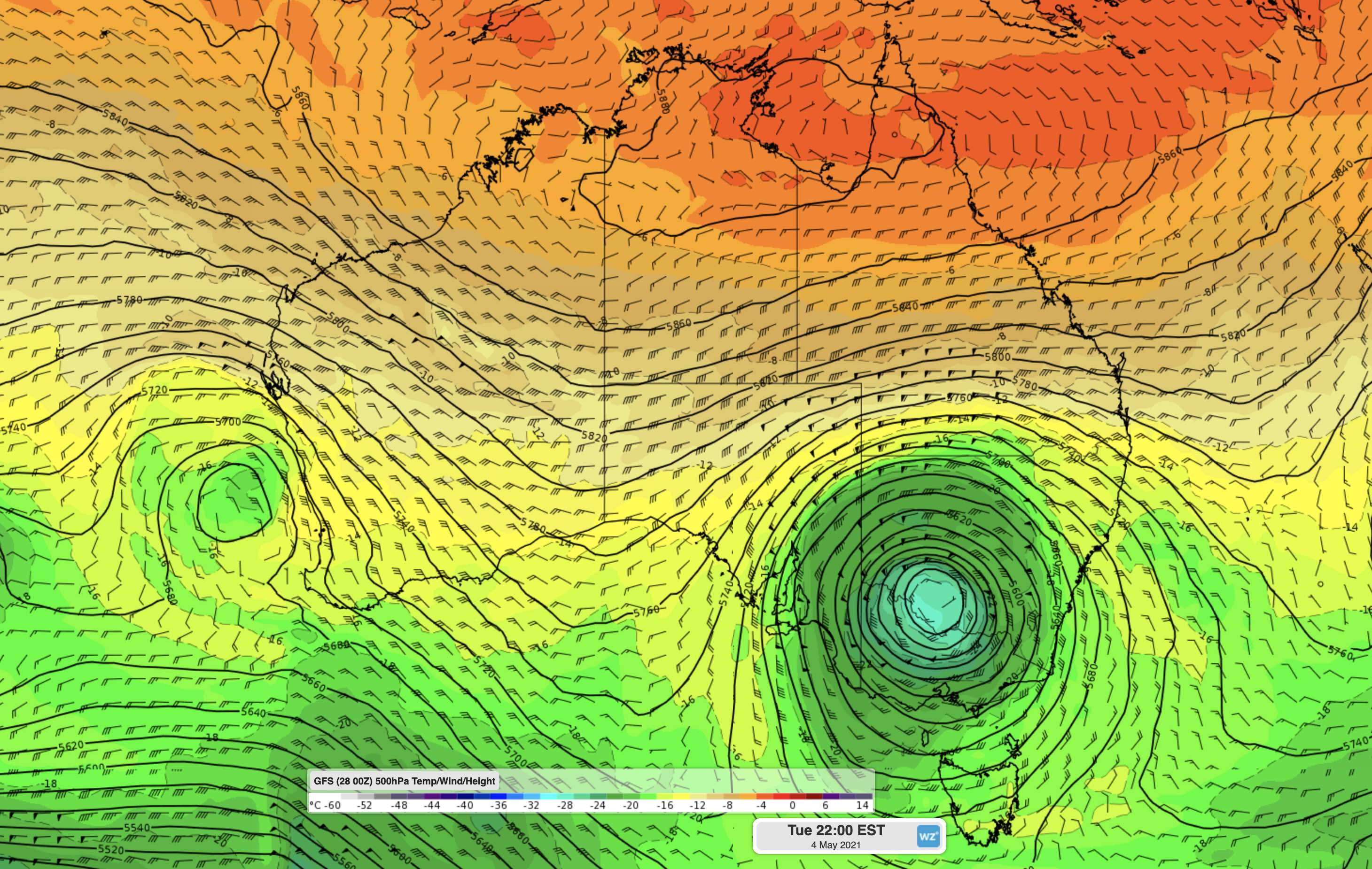
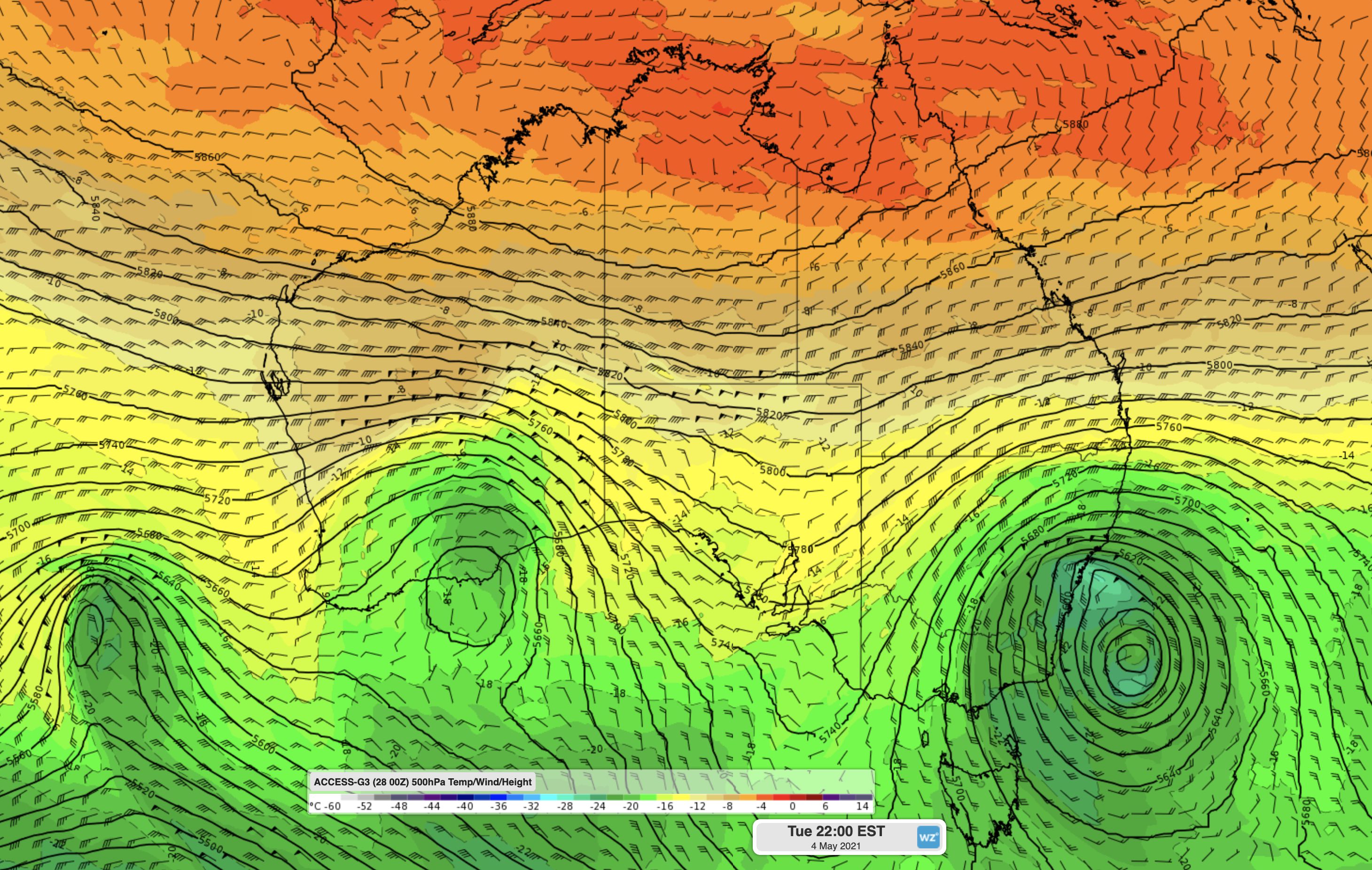
Images: Forecast 500hPa temperature/wind/height at 10pm AEST on Tuesday, May 4th from the ECMWF (top), GFS (middle) and ACCESS-G (bottom) models.
Two models (ECMWF and GFS) have a well-formed cut-off low over NSW and the other model (ACCESS-G) shows the low further east over the Tasman Sea and another upper-level trough over southern WA.
In addition to the disagreement between these models at this single time step, each individual model is also chopping and changing the position and strength of the low between each model run.
These models update four times each day. We should start to get a clearer picture of how this weather event will unfold over the next few days. Stay tuned for more updates.