
Potential for Adelaide’s biggest soaking of the year
Adelaide and large parts of South Australia look set for significant rainfall, as a moist feed of tropical air combines with a developing inland trough.
Rain is expected to develop on Friday and continue on-and-off through the weekend in the Adelaide area, with storms possible on Saturday.
This rain will be welcomed by locals even if it disrupts outdoor activities on the weekend, as Adelaide has been relatively dry to date in 2026.
As the chart below shows, the first four months of 2026 were wetter than usual in most parts of SA – and even exceptionally wet at some locations by local standards. But the area around Adelaide – including the Fleurieu Peninsula, the Adelaide Hills, and the city itself – has somewhat missed out.
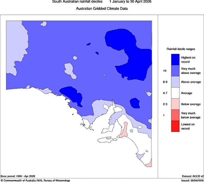
Image: SA rainfall deciles from January to the end of April, 2026, with pale red areas indicating below-average rainfall. Source: BoM.
If you expand the time frame from four months to four years, you can see a similar pattern in South Australia, with above-average rainfall in much of the state’s north, but below-average rainfall in most parts of the state’s south and southeast – Adelaide included.
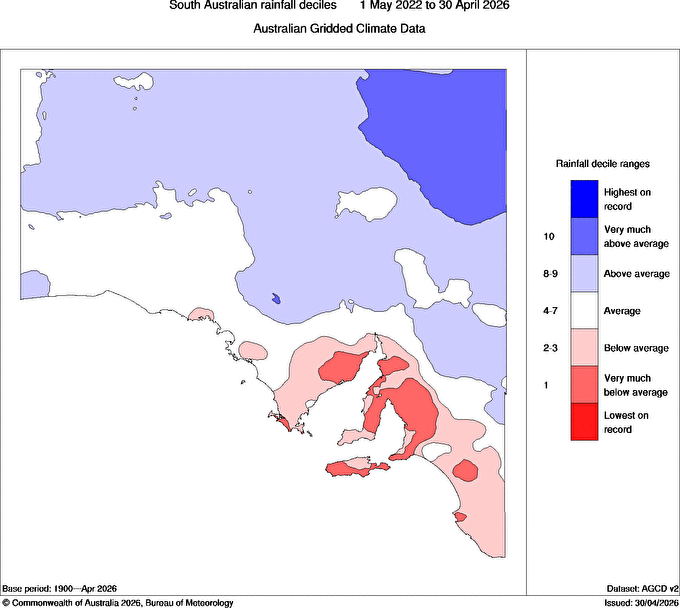
Image: SA rainfall deciles in the four years to the end of April, 2026, with the red areas indicating below-average rainfall. Source: BoM.
How much rain could fall in Adelaide?
Adelaide started 2026 with a completely dry January, and that dry city gauge was no localised anomaly.
Even up on Mount Lofty in the Adelaide Hills – where the annual average rainfall of 973mm is 81% more than the city’s 537.6mm - just 1.8mm of rain fell in January.
Since the end of January, Adelaide’s rainfall has been close to average, without any exceptionally wet spells – especially compared to other parts of the state. For example, the town of Yunta in SA’s North East Pastoral forecast district saw a record 222.6mm in March.
But from this Friday to next Tuesday, Adelaide could potentially see its wettest spell of the year – with the likelihood of 15 to 15mm over the five-day period, although some models are predicting as much as 40mm.
Rain from an unusual direction
One aspect of the incoming weather system is that it will arrive from the north and northeast. As mentioned in our story earlier this week on the widespread rain set to affect several states, that’s virtually the opposite of the usual direction for significant Adelaide rain, especially with winter approaching.
'It's also a slow-moving system, with the trough and front sliding southeast rather than pushing east due to the blocking high over the Tasman,"Weatherzone meteorologist Jess Miskelly explains.
"This means the system will be in the vicinity longer, hence able to cause more rain."
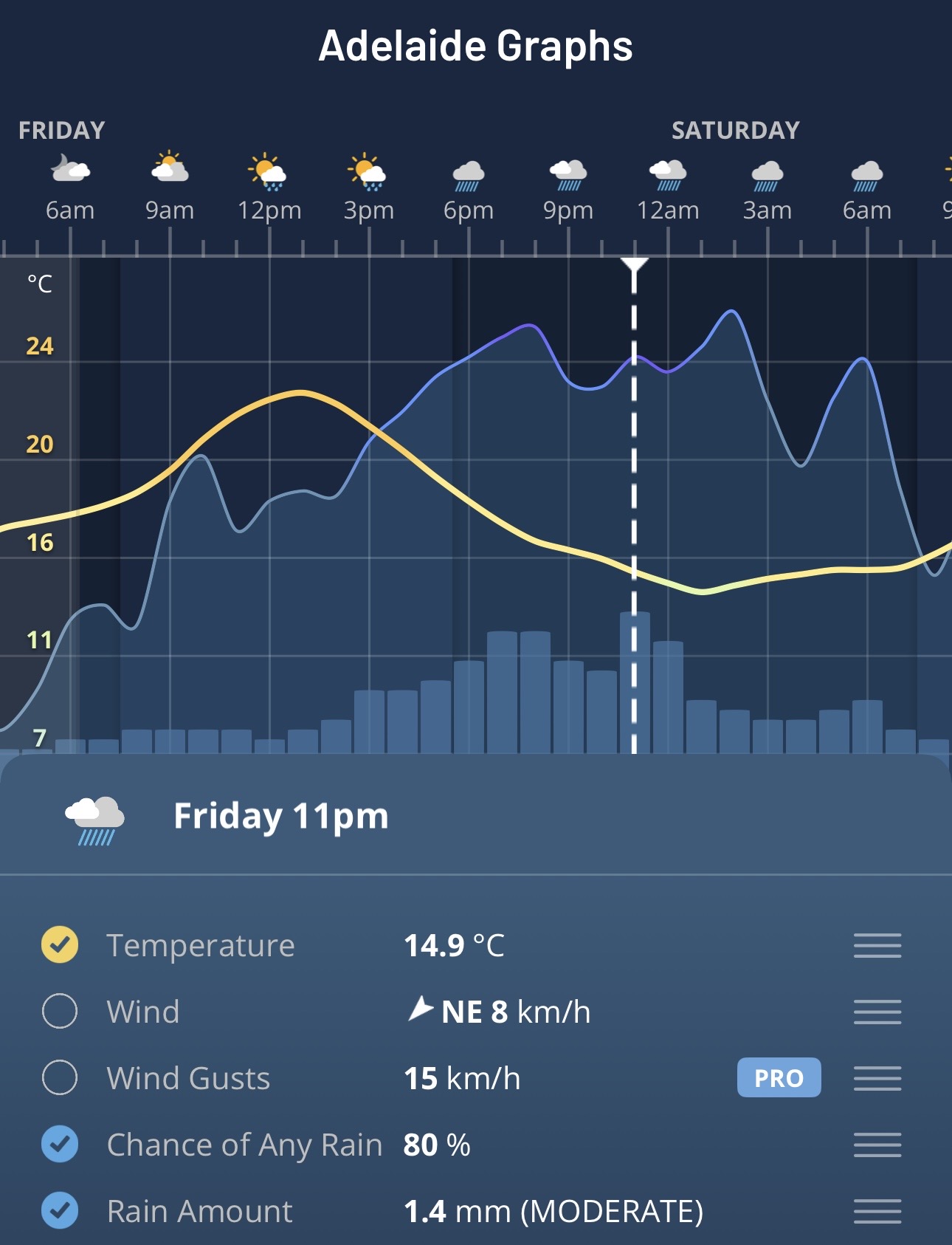
Image: Hourly graphs for Adelaide, SA, on the Weatherzone app.
The rain that falls in Adelaide and elsewhere in SA this week will obviously help top up water storages, and it could boost water levels in Lati Thanda-Lake Eyre, where there’s extensive water to a depth of as much as 2.2 metres, according to the Lake Eyre Yacht Club.
Interestingly, there could even be a minor reverse effect in this system, where Lake Eyre and other normally dry SA salt lakes provide small additional amounts of moisture for the rain heading further south.
Instead of being a net absorber of moisture, those areas will be giving back to the atmosphere, even if it's only a relatively small amount. But this rainband would still happen without the influence of the lakes.