
Possible negative IOD developing this winter
Warm sea surface temperatures near Indonesia are expected to heat up further over winter, possibly triggering a negative Indian Ocean Dipole (IOD) event.
What is the Indian Ocean Dipole (IOD)?
The IOD is an index that measures the difference in sea surface temperatures across the equatorial Indian Ocean.
A negative IOD occurs when cooler-than-average water sits on the western side of the Indian Ocean, near the Horn of Africa, and warmer-than-average water lies on the eastern side of the Indian Ocean, near Indonesia. A positive IOD is the opposite of this pattern (cooler water in the east, warmer in the west).
Each phase of the IOD also influences atmospheric conditions above the Indian Ocean and surrounding countries. For Australia, a negative IOD typically increases the likelihood of above average rain over large areas of the country, while also promoting cooler days in the country’s south and east.
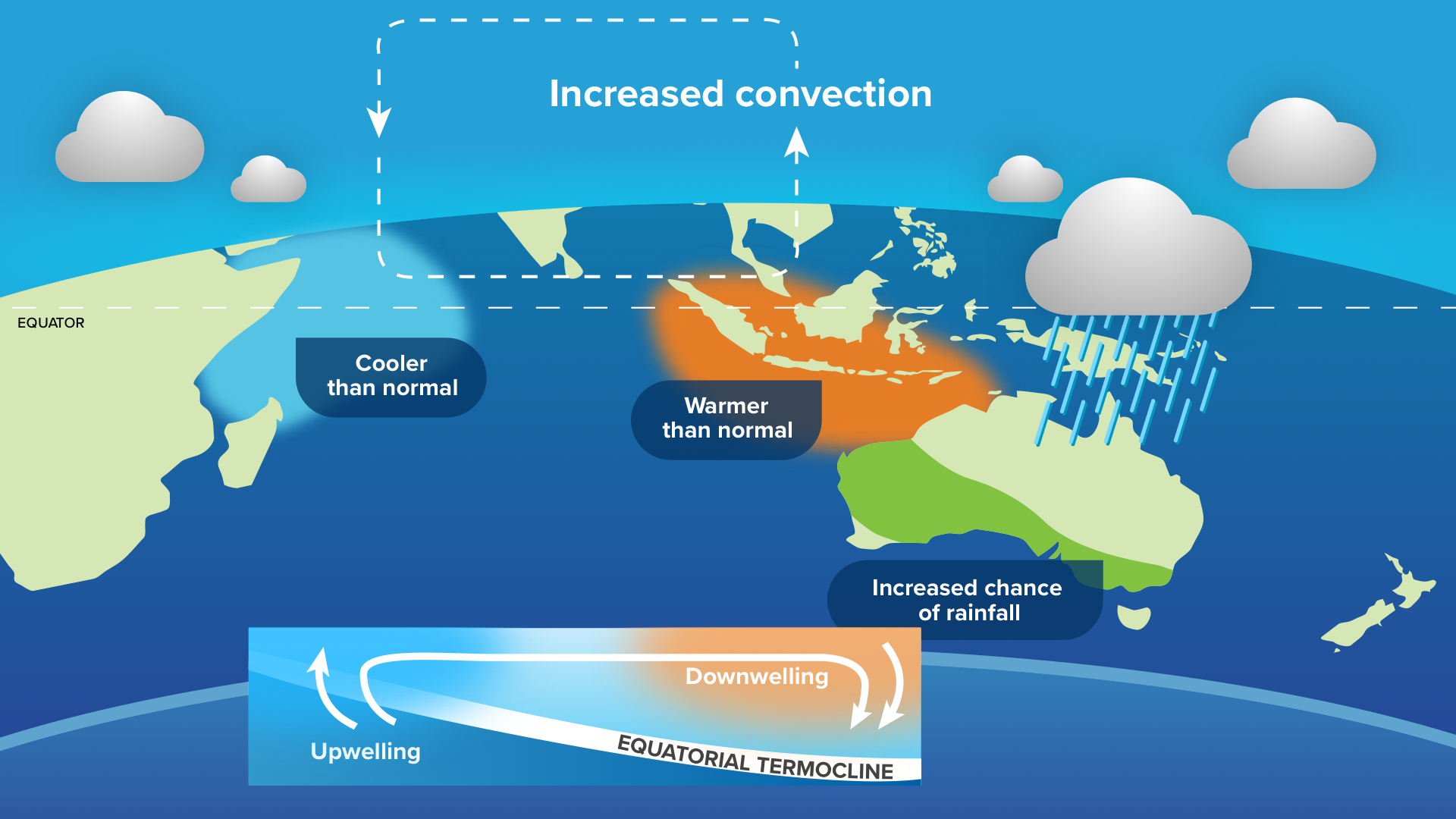
Image: typical oceanic and atmospheric patterns during a negative IOD.
IOD events typically occur between May and November and break down when the Australian monsoon arrives in late spring or early summer.
Negative IOD pattern emerging
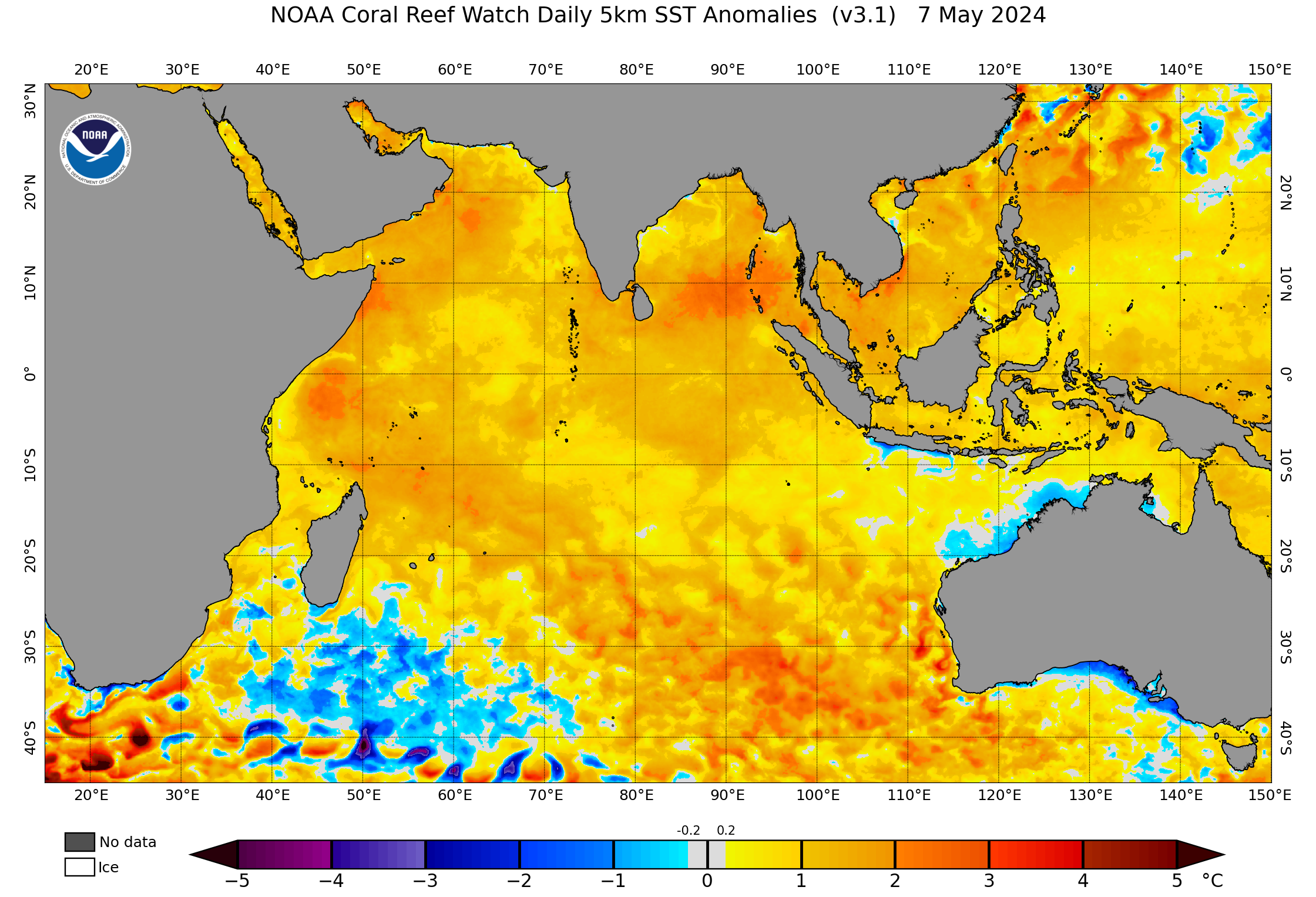
The IOD is currently in a neutral phase, meaning neither a positive nor negative IOD is occurring. Waters have mostly been warmer-than-average across much of the Indian Ocean over past few months until the last couple weeks with the strengthening of the southwest monsoon.
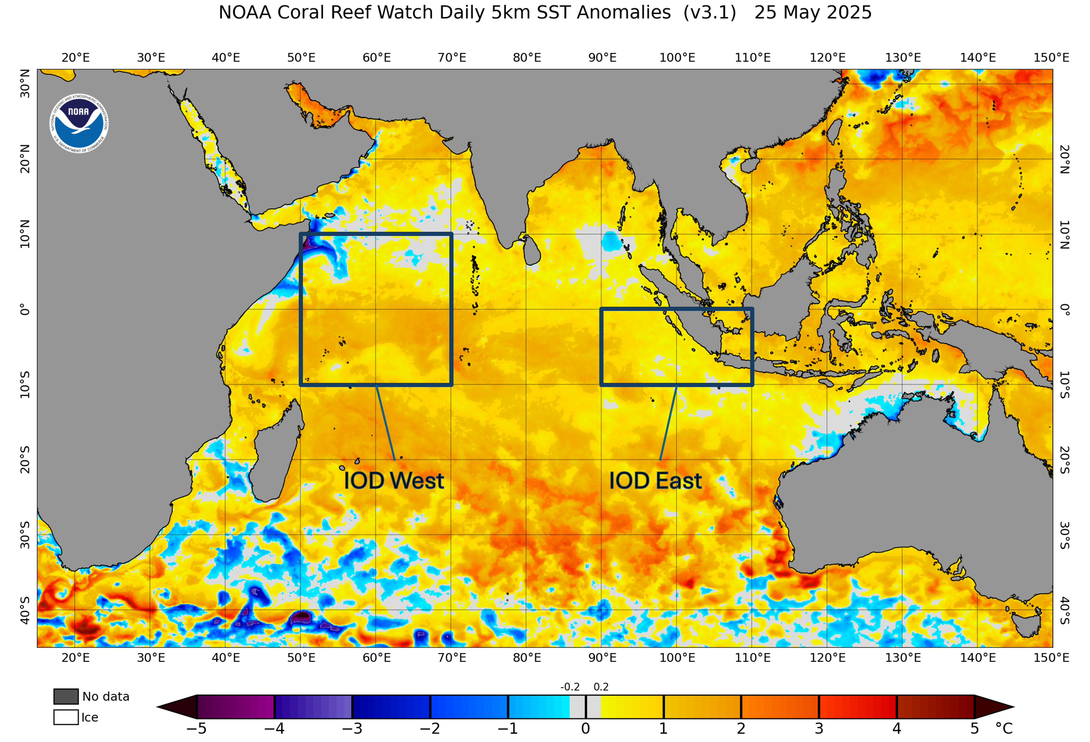
Image: Sea surface temperature anomalies across the Indian Ocean and the IOD monitoring regions on May 25, 2025. Source: NOAA
The map below shows how winds flowing towards the east and west have behaved across the first 24 days of May over the Indian Ocean. The yellow shading shows either where westerly winds are faster than usual, or where the easterlies are blowing weaker than usual. In contrast, the blue shading shows where easterly winds are faster than normal or westerlies are abnormally weak. These wind anomalies are important to monitor because enhanced westerly winds towards Australia can mean more cloud and rain over the continent.
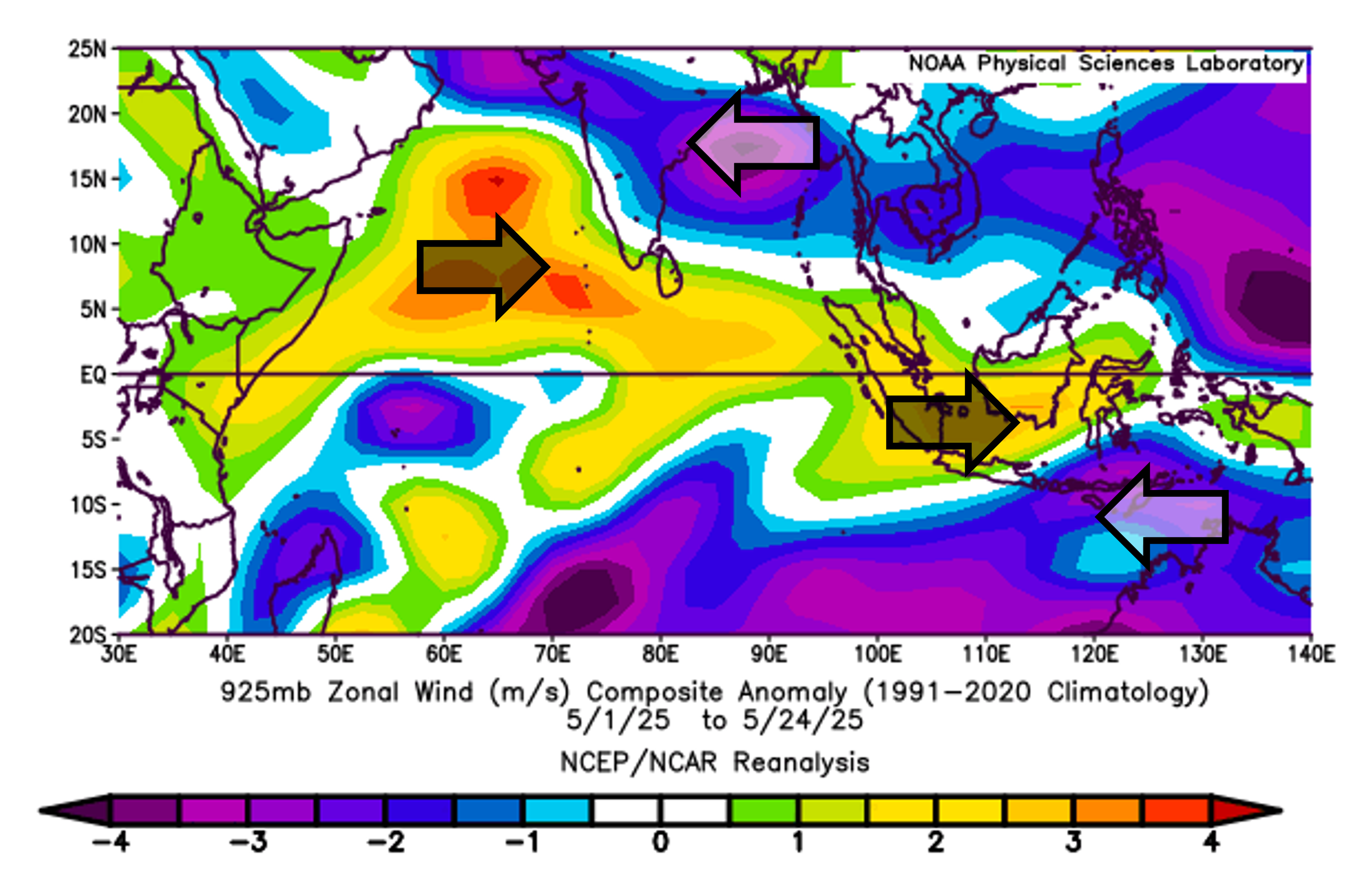
Image: 925 hPa Zonal Wind (m/s) anomalies across the first 24 days of May 2025, yellow shading represents more westerly winds (or weaker easterlies) and blue shading represents stronger easterly winds. Source: NOAA Physical Sciences Laboratory
The burst of stronger southwesterly winds (in yellow) over the northern Indian Ocean has caused upwelling of colder waters near the Horn of Africa, and cooler waters to develop in the Arabian Sea.
Similarly, dry season southeast winds (in blue) have driven upwelling and cooling along Australia’s north coast. However, these southeasterly winds have yet to make significant inroads into the Indonesian region (westerly anomalies, in yellow, can represent weaker easterly winds for this time of year), helping pool warm water along the eastern Indian Ocean.
In Australia, a negative IOD occurs when we see sustained IOD values below -0.4°C. The latest weekly IOD value was +0.28°C, after fluctuating within the neutral or weakly positive range in the past few months.
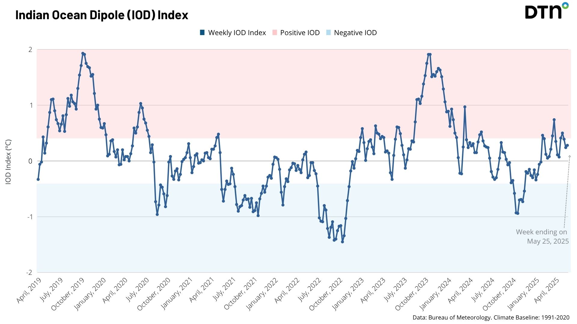
Image: IOD index over the past 6 years.
Most forecast models suggest that the IOD index could drop below -0.4°C through the second half of winter, or early in spring, peaking around August and September before returning to neutral values in October or November.
Looking at the forecast sea surface temperature (SST) anomalies for September 2025 below, a clear tongue of warm water is present off Indonesia, directly in the IOD East region. With closer to normal water temperatures near the Horn of Africa, the IOD would be tilted towards the negative phase if this forecast model comes to fruition.
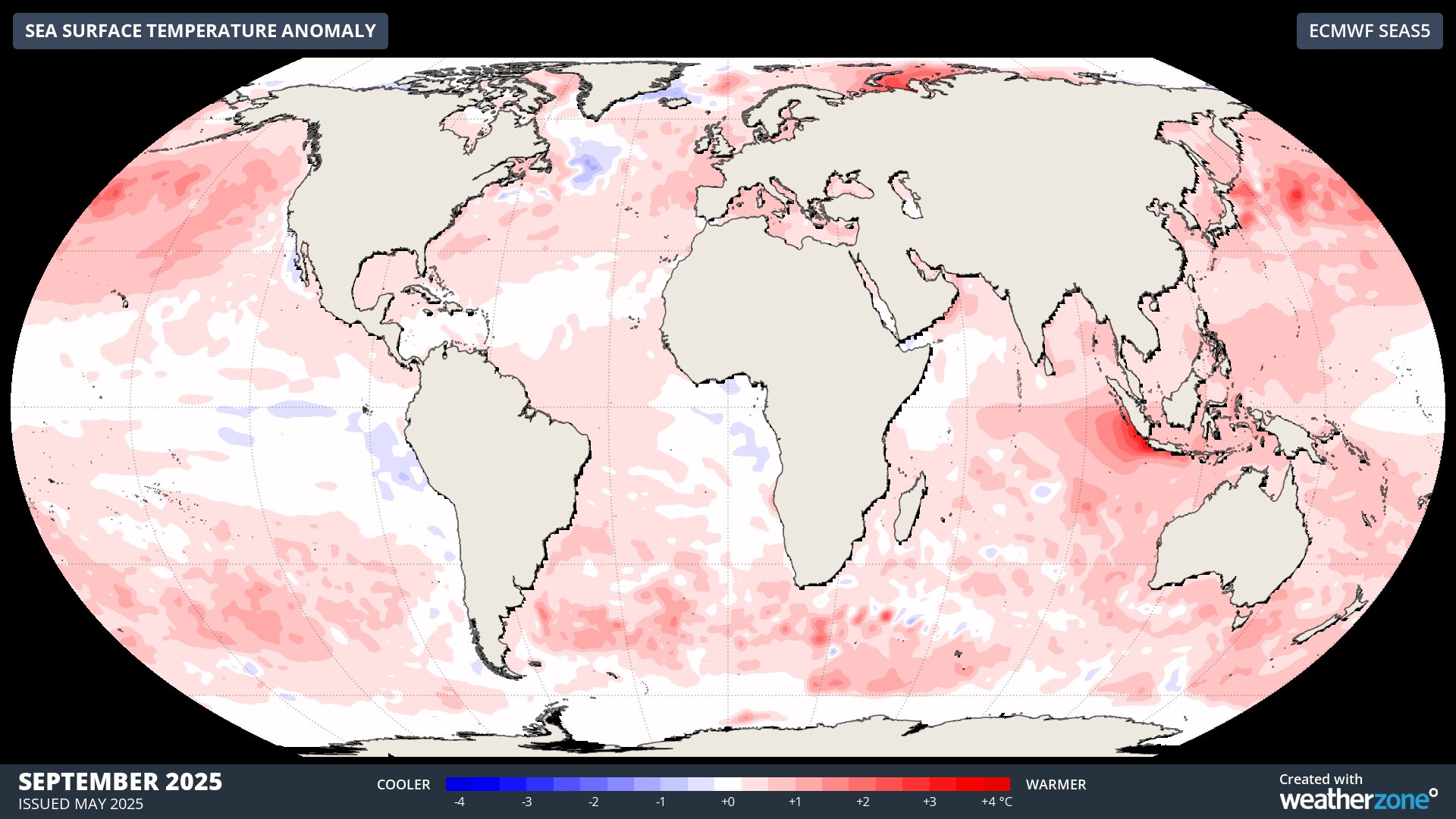
Image: forecast global SST anomalies for September 2025.
What does a negative IOD bring?
IOD events typically occur between May and November and break down when the monsoon moves over Indonesia in late spring or early summer. The maps below show how the increased moisture to the northwest of Australia in a negative IOD would typically impact Australian weather between August and October.
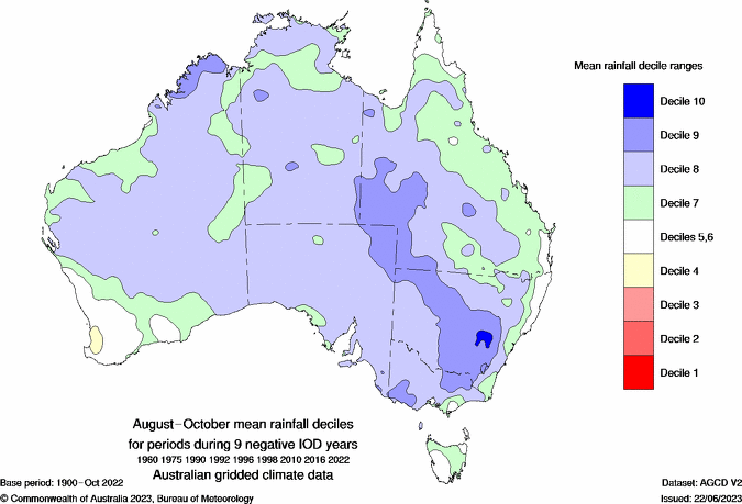
Image: Typical changes to rainfall when a negative IOD occurs between August and October. Source: Bureau of Meteorology
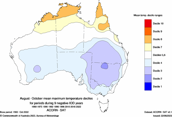
Image: Typical changes to maximum temperature when a negative IOD occurs between August and October. Source: Bureau of Meteorology
A negative IOD event brings increased chances of northwest cloud bands as moisture streams across the country. As seen below, this increases the rainfall potential across northern, central and southeastern Australia, while bringing cooler days (and milder nights) with the added cloud cover.
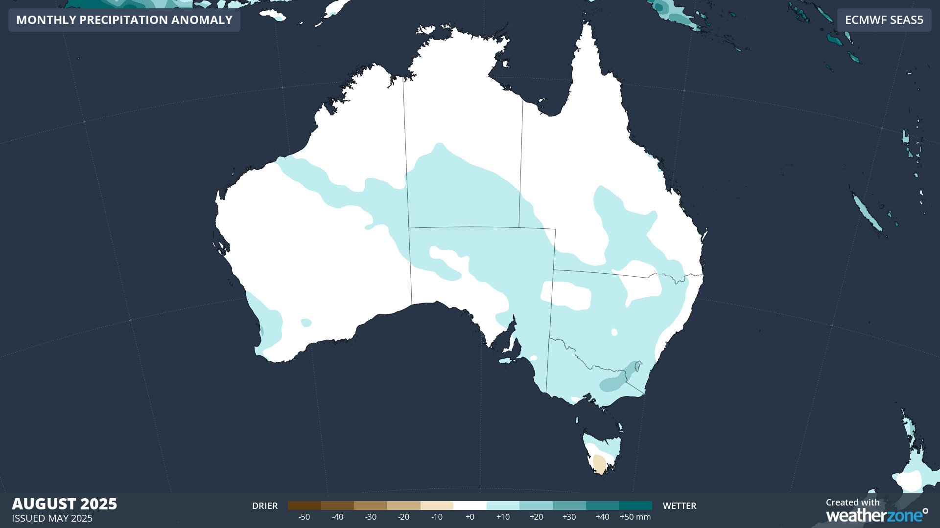
Image: Australian rainfall anomaly forecast for August 2025.
For the snow lovers, the influx of moisture from the northwest can coincide with cold air brought by fronts, bringing healthy dumps of snow.
While there are several indicators suggesting that we could see this negative IOD event developing this winter, this event is not set in stone just yet. The next month will be decisive for this event, so we will keep you updated in the coming weeks.