
Polar blast sends shivers across WA
Parts of Western Australia have just shivered through their coldest weather in years as a polar air mass spread across the state.
The satellite images below show a huge area of speckled cloud moving over WA on Thursday. This type of cloud indicates the presence of cold air moving towards the north from the Southern Ocean.
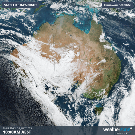
Image: Visible satellite images captured over Australia on Thursday.
Perth only managed to reach 14°C on Thursday under the influence of this wintry air mass, making it the city’s coldest day in three years. Elsewhere across the state, Thursday was the coldest day in:
- 7 years at Esperance Aero (10.3°C)
- 5 years at Hillarys Boat Harbour (13.6°C)
- 4 years at Jacup (9.9°C) and Newdegate Research Station (10.0°C)
- 3 years at Swanbourne (13.6°C) and Garden Island (13.3°C)
- 2 years at over 30 weather stations
The air mass was so cold that even with sunny breaks, much of the region couldn't reach about 15°C.
Thursday’s chilly maximum temperatures were followed by even icier minimums on Friday morning, as clear overnight skies combined with the lingering cold and dry air mass.
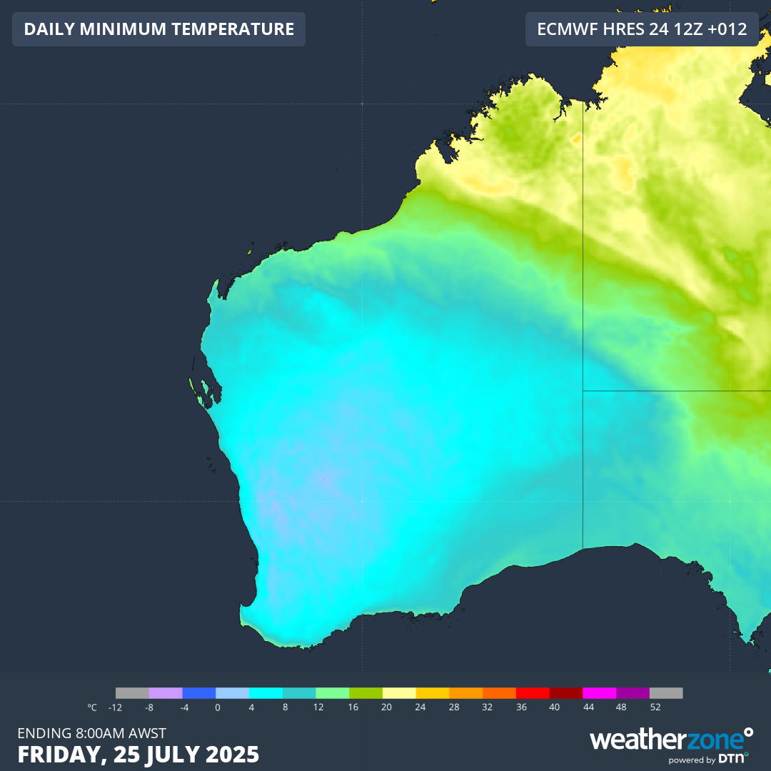
Image: Modelled minimum temperatures over WA on Friday morning.
Perth dropped down to 0.3°C shortly before 7am AWST on Friday, making it the city’s coldest morning in 15 years. This was also only 0.3°C above Perth’s lowest July temperature on record.
Friday was also the coldest morning in 8 to 12 years for Pearce (-0.3°C), Jandakot (-1.3°C) and Dwellingup (-0.9°C).
Temperatures will remain noticeably cool over the southern half of WA on Friday into the weekend as cold air lingers over the state.