
Polar air reaches Australia
Satellite images capturing Thursday's last light showed a huge mass of polar air starting to spread over southern Australia.
Visible satellite imagery from Japan's Himawari-8 satellite revealed a large region of speckled cloud extending from the Great Australian Bight well into the Southern Ocean on Thursday afternoon. This broad area of speckled cloud is a tell-tale sign that a large mass of cold polar air has broken away from the Antarctic region and is venturing into the relatively warm mid-latitudes.
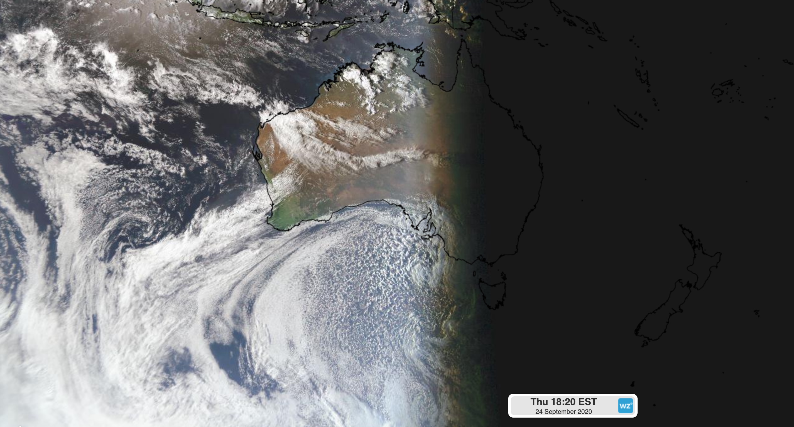
Image: Visible satellite image captured late on Thursday by the Himawari-8 satellite, showing speckled cloud within a polar air mass to the south of Australia.
The leading edge of this frigid polar air mass started to spread over southern Australia on Thursday. It will continue to move across southeastern Australia between Thursday night and Saturday morning, causing wintry temperatures, rain, hail, thunderstorms and snow in multiple states and territories.
This is a notably cold air mass for this late in spring and it will see snow falling to low levels.
The air could get cold enough for snow flurries on South Australia's Flinders and Mount Lofty Ranges on Friday morning. Later on Friday, snow could reach down to around 500 metres elevation in parts of Victoria and Tasmania. As the cold air spreads further north, snow will also blanket parts of southern and central NSW late on Friday and into Saturday morning, possibly falling to around 700 metres elevation.
The combination of cold air, cloud and rain (or snow) on Friday could cause some places in southeastern Australia to have their coldest day this late in spring for more than a decade.