
Plummeting Southern Annular Mode to influence Australia's weather
The Southern Annular Mode (SAM) index has plunged to its lowest level since 2016 this week, which could affect weather patterns near southern Australia during the coming weeks.
The SAM is an index that measures the north-south displacement of a band of westerly winds flowing between Australia and Antarctica.
When the SAM index is negative, these westerly winds move towards Australia and when it is positive, they contract towards Antarctica.
The SAM index has just plunged to a value of around minus three, which is the lowest it's been in about three years.
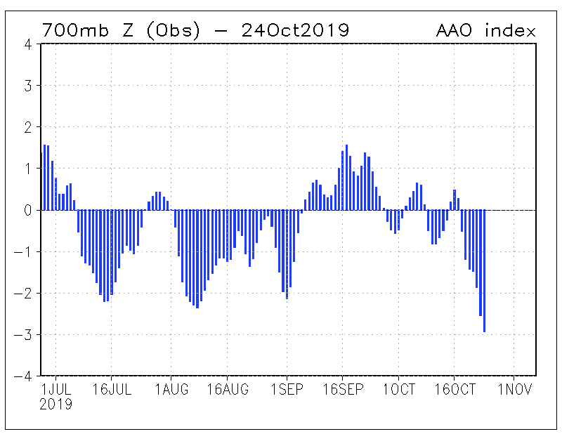
Image: Southern Annular Mode index values during the last four months, with the latest value dropping to near minus three on October 24th. Source: NOAA
Negative SAM episodes at this time of year can increase the chance of:
- more rain than usual in western Tasmania and parts of southern Victoria and far southern SA
- less rain than usual elsewhere in southeastern/eastern Australia
- heatwaves in southern Australia
This week's plummeting SAM is linked to a 'sudden stratospheric warming' that commenced in late August. While this rapid warming originally occurred about 30km above Antarctica, it is now 'coupled' with the troposphere, meaning it's influencing weather patterns near the ground.
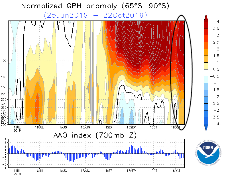
Image: Geopotential height anomalies in the atmosphere near the south pole (top) and corresponding SAM index values (bottom) during the last few months. The red blob at the top right shows the recent stratospheric warming that has persisted since late August. The orange tongue that extends towards the bottom of this graph (inside balck circle) shows the stratospheric warming extending towards the surface in recent days. Source: NOAA
It's difficult to predict changes in the SAM index beyond a few days, although models suggest that this week's low SAM values could persist into early November. This possibility is being picked up in BoM forecast models, with their recently released weekly outlooks showing an increased chance of above-median rain in parts of Tasmania, Victoria and SA during early November, along with a less rain than usual for eastern Australia.
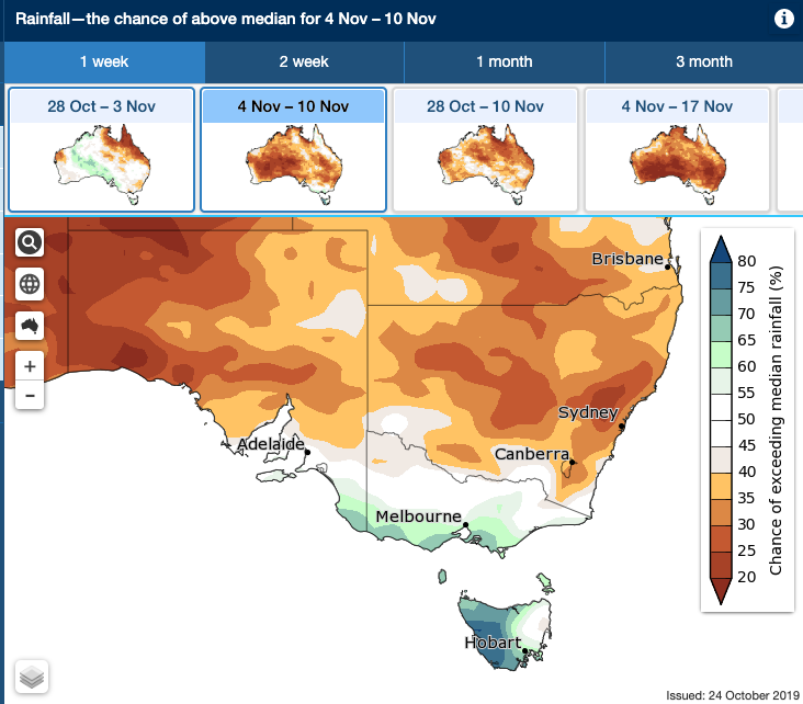
Image: Rainfall outlook for the week ending November 10th. Source: Bureau of Meteorology.
The dry and warm weather that is promoted in eastern Austarlia during negative SAM episodes also elevates the risk of bushfires in parts of Queensland and NSW during spring and early summer.