
Pilot snaps amazing Aussie anvil cloud
The first thing to know about this spectacular image taken by a Qantas pilot is that he wasn't flying the plane at the time.
Weatherzone spoke to the pilot, who assured us that two crew were seated at the pointy end of the plane when he snapped this pic of a thunderstorm with its classic anvil cloud near Coonabarabran in central NSW.

Image: The flying kangaroo's view of the weather. Source: @Keg767.
Remind me what causes anvil clouds?
As we wrote in our recent story about a storm near Canberra, anvil clouds occur when a warm updraft passes through the top of the troposphere, reaching all the way to the bottom of the stratosphere – which is the second of five layers that constitute our atmosphere.
Having cooled to the point where it can no longer rise any further, the air suddenly loses its buoyancy, hits an invisible ceiling, and spreads out. That's what makes your anvil shape.
The story of this storm
We thought we'd go a little CSI Weatherzone here to dissect this storm. We know that the image above was taken last Wednesday, March 29, en route from Sydney to Singapore.
And we know, as mentioned earlier, that it was taken near Coonabarabran in central NSW.
Here's the BoM’s synoptic chart that day at 11 am, just before QF81 departed at 11:50 am. See the trough line across central NSW? That's a classic chart for thunderstorms.
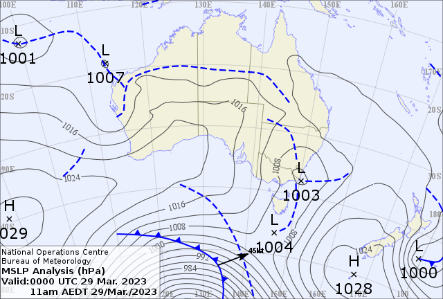
Image: The BoM has an archive of charts going back to 1999. Source: here.
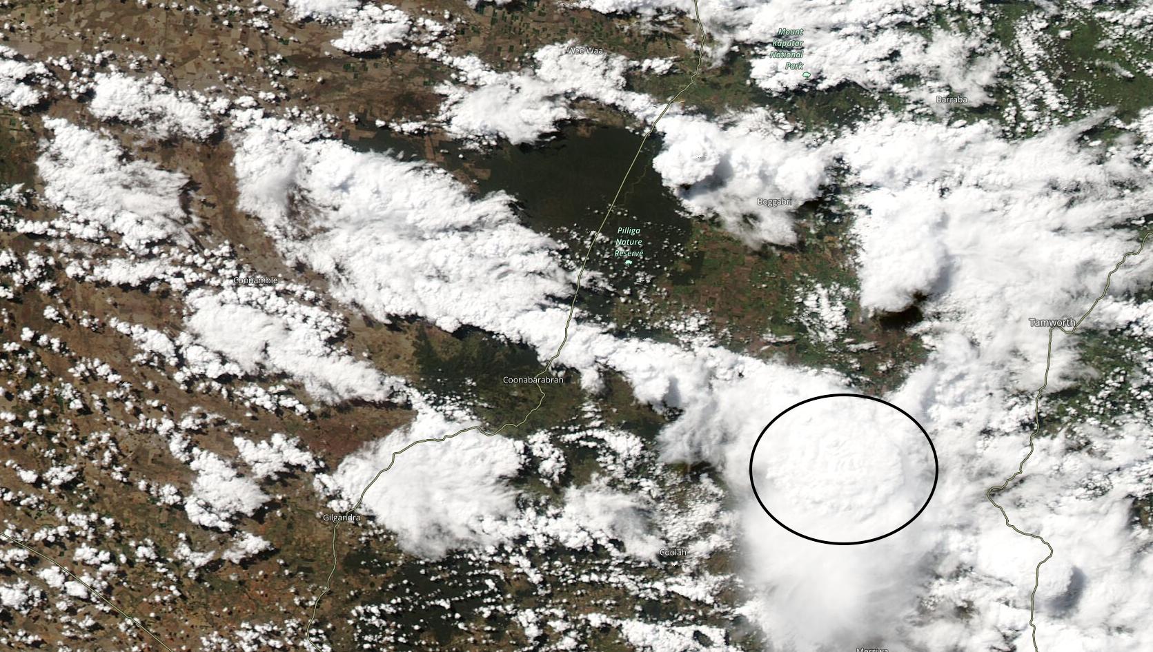
Not into synoptic charts? No problem, here's the satellite pic from early Wednesday afternoon last week.
Squint your eyes and you can see Coonabarabran in the centre of the image. To make things easy, we've circled the nearby storm. You can even see the pointy end of the anvil protruding beyond the circle to the northeast.
If that image is a little too static, we can do even better!
Via NASA, here's a satellite loop which captures several hours of cloud movement over central NSW last Wednesday. It might take you a couple of views to spot it, but near the end of the loop you can actually see the cloud in our storm spread out as it ascends.
nsw_storm_v2_1
So that's the story of a thunderstorm which for the record, dumped 16 mm of rain on Coonabarabran in just 20 minutes last Wednesday.
This was far from the most dramatic or damaging Australian storm of the year. In fact, it was a garden variety thunderstorm, albeit a pretty big one. But when we saw the pilot's fantastic pic from such a unique angle, we wanted to know more, and we thought you would too.