
Perth’s warmest July day in 32 years, heavy rain to follow
Perth has had its warmest July day since 1994, with the mercury reaching 25.7°C at 3:09 pm (AWST).
- Perth had hit the 25-degree mark only once previously this century. That was on July 18, 2017, when the maximum was exactly 25.0°C.
- The record high for Perth in July is 26.3°C on July 18, 1976, at the old official city weather station in Kings Park.
- Since the weather station moved to its current location at Mt Lawley in 1993, the highest July reading was 25.8°C on July 21, 1994. Today was the warmest July day since then.
Why was it so warm in Perth today?
Much like during summer heatwaves, Perth’s warmest winter weather occurs during persistent easterly or northeasterly winds, when warm air from the continent’s interior is pushed towards the coast.
The synoptic chart below shows the large high pressure system centred over southern SA which is dominating Australia’s weather this Wednesday. Air circulating anti-clockwise around the high warmed up significantly as it headed Perth’s way.
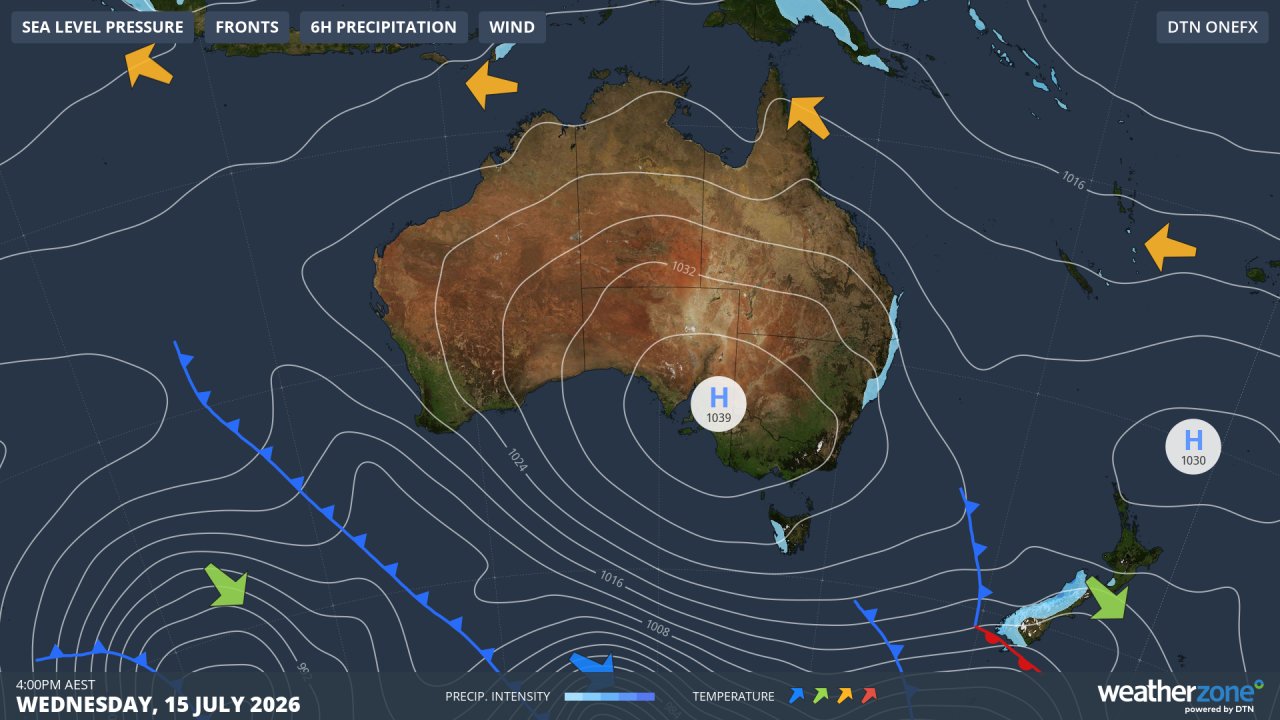
Image: Synoptic chart for Wednesday, July 15, 2026. Source: Weatherzone.
But the unseasonably mild winter spell is set to end on Thursday, and the synoptic chart again tells the story, with a cold front lurking in the Indian Ocean off southwest WA.
Heavy rain with possible storms
After a mild start to Thursday with the maximum in Perth rising to the low 20s, a dynamic few days of weather will set in across the South West Land Division.
Showers will arrive on Thursday afternoon and evening, with thunderstorms possible as warm and cool airmasses clash.
Heavy showers will persist for at least a couple of days, with the potential for total accumulations exceeding 50 mm in Perth during this event, especially if storms eventuate and deliver intense downpours.
If heavy rain does fall, not too many people will complain at a time of year when locals rely on a good drenching to replenish gardens and reservoirs.
After June’s rainfall was close to average, July has been relatively dry by Perth winter standards, with only 22 mm in the gauge so far, in what is typically the city’s wettest month of the year with an average of 147.8 mm.
Please check the Weatherzone warnings page for the latest information on thunderstorms and more.