
Perth facing driest July in 14 years
Perth is facing the very strong likelihood of having its driest July since 2012, with no significant rainfall expected before the end of the month.
To date in July 2026, Perth has received 56.8 mm of rainfall
Perth's average rainfall for July (historically the wettest month of the year) is 147.8 mm.
The last time Perth had less than 100 mm in July was in 2020, with a total of 83.4 mm.
That means this July will almost certainly be the driest since 2012, when just 34.6 mm of rainfall was recorded (the lowest on record for the month).
Why has Perth been so dry this month?
Perth receives almost all of its winter rainfall (and the vast majority of its annual rainfall) from cold fronts originating in the Southern Ocean which sweeping across Western Australia’s South West Land Division. In July 2026, those fronts have been relatively infrequent, and not particularly moisture-laden.
The absence of rain-bearing cold fronts is consistent with weather patterns associated with the recent very strongly positive Southern Annular Mode (SAM).
The SAM is a major climate driver that measures the north-south movement of the westerly wind belt encircling Antarctica. During a positive SAM (as we’ve had through much of July 2026), the belt of westerlies is further south. That typically means less rain for Perth and the southwest.
And it’s not just Perth that has had a dry month
Manjimup, in the state’s South West forecast district, has had 52 mm (to date this month July average 173 mm).
Albany, in the state’s South Coastal forecast district, has had 50.1 mm to date this month (July average 146.6 mm).
Northam, in the Central Wheat Belt, has had just 12.2 mm to date this month (July average 81.6 mm).
As things stand now, the large wheat belt town of Northam is facing the unwelcome prospect of its driest July in 149 years of records. The driest was 13.6 mm in 2012.
When will the winter rains return?
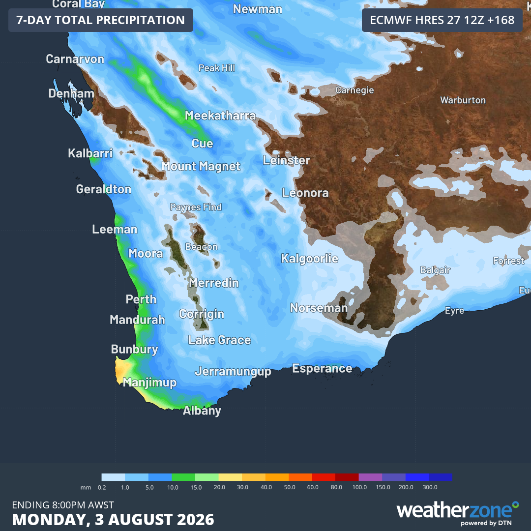
Image: Rainfall accumulation predicted for southwest WA up until 8 pm (AWST) on Monday, August 3, 2026, according to the ECMWF model. Source: Weatherzone.
A cold front will clip the southwest on Saturday, bringing showers, although rainfall totals are not expected to be particularly heavy at this stage.
The good news is that the SAM has recently returned to negative territory, increasing the likelihood of more frequent rainfall events throughout August.
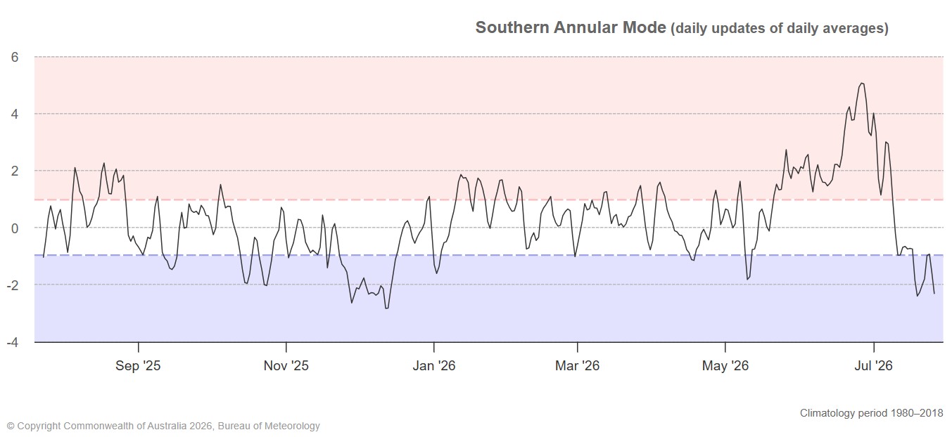
Image: The last 12 months of SAM data to July 26, 2026. Source: BoM.
It’s important to state that a negative SAM doesn’t lock in the prospect of significant rainfall in coming weeks. Sometimes, the nodes of cold, wet weather tend to peak on the eastern side of Australia rather than in the west.
But the signs are good.
For the record, Perth received close to its average rainfall in June 2026, with 121.6 mm (June average 127.2 mm).
So while July has been dry, and while the city will not repeat its 2025 feat of receiving above-average rainfall in each winter month, a wet August could still bring the seasonal total close to average.