Parts of Brisbane could feel close to 50C today
A hot and humid airmass has been making southeast Qld feel oppressive on Monday.
A very hot air mass is sitting over the southern half of Qld on Monday, with temperatures likely to reach the mid-40s in the state’s southwest and the mid-to-high 30s in the southeast during the day.
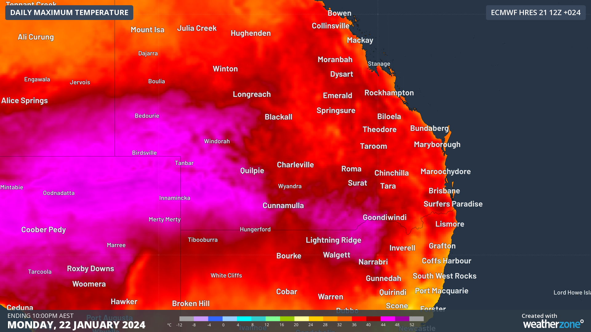
Image: Maximum temperature forecast for Monday, January 22, according to the ECMWF model.
Unfortunately for anyone living in southeast Qld, Monday’s heat is being exacerbated by high humidity, which is making the air temperature feel around 4 to 8ºC warmer than thermometers are indicating.
At 10:20am AEST on Monday, the temperature in Brisbane felt like 40.5°C, despite the air temperature only sitting on 34°C. This sweltering ‘feels like’ temperature was due to excessive levels of water vapour in the atmosphere, with a dew point of nearly 26ºC at the time.
The dew point is the temperature to which air must be cooled to achieve a relative humidity of 100%, or saturation of moisture in the atmosphere, at which point condensation will occur. The higher the dewpoint, the greater the amount of moisture in the atmosphere, which makes it more difficult for human bodies to cool down through the evaporation of sweat.
Below is a guide for how different dew point temperatures would make you feel if you were accustomed to Australia’s sub-tropical climate:
- >24ºC – Oppressive, uncomfortable for most, possible heat stress issues
- 20-24ºC – Muggy and quite uncomfortable
- 15-20ºC - Starting to feel muggy, though still comfortable for most
- 10-15ºC – Comfortable 5-10ºC – Dry
- < 5ºC – Very dry
The map below shows the high dewpoints forecast over the region on Monday afternoon.
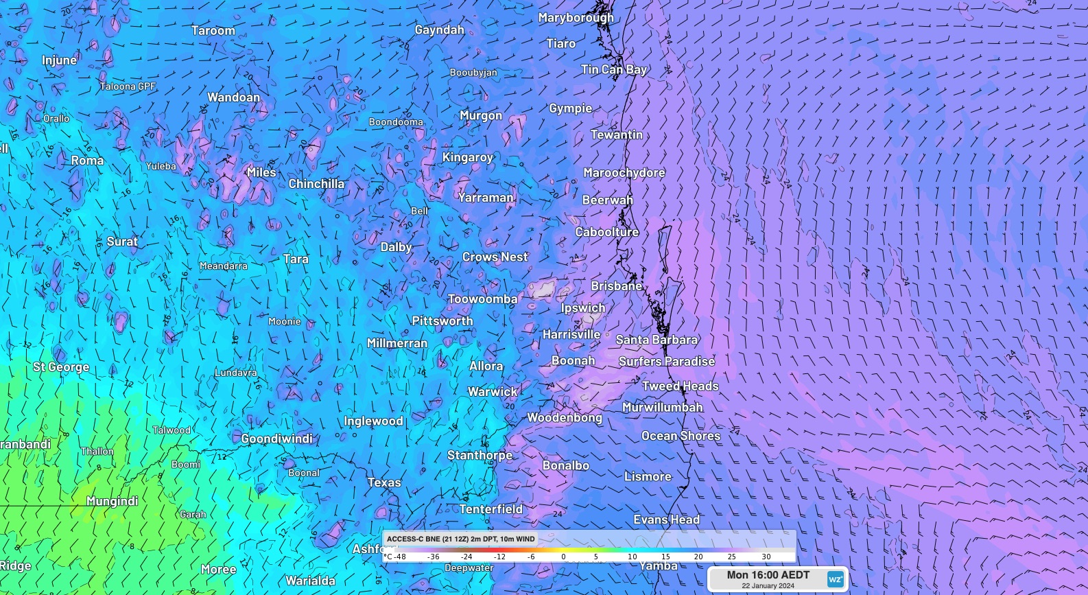
Image: Dewpoint and wind forecast at 3pm AEST on Monday, according to ACCESS-C
The ‘feels like’ temperature in parts of Brisbane could reach the mid-to-high 40’s and in some areas could possibly hit 50°C on Monday afternoon.
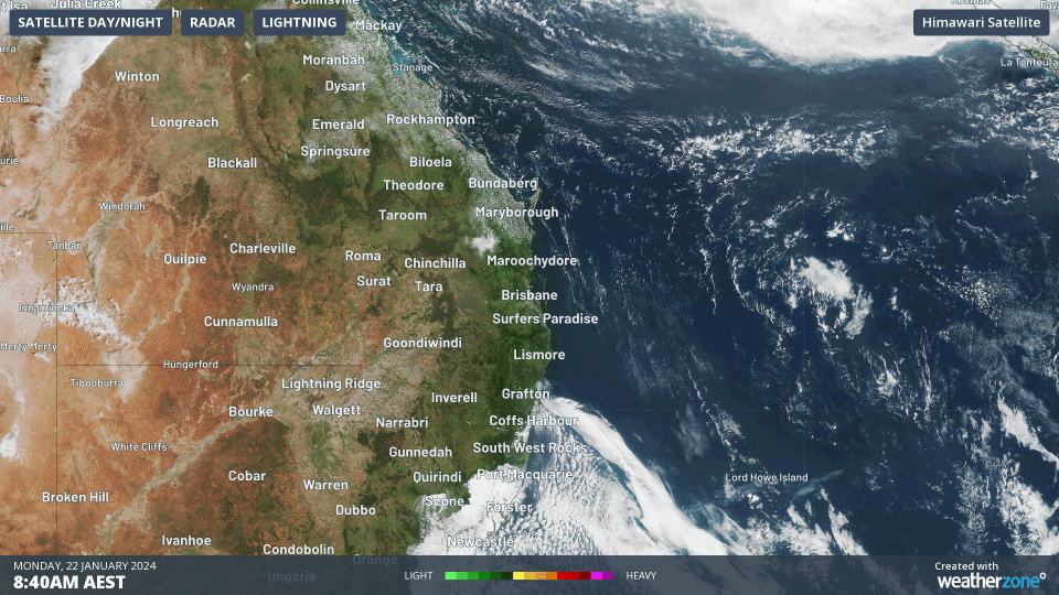
Fortunately, a southerly change that is moving up the northern NSW coast on Monday morning will make its way up to Brisbane by the early evening. The change can be seen cayyring cloud along the NSW coast on the satellite images below.
This southerly is expected to arrive in Brisbane around 5:30 to 6:30pm AEST, bringing rapid relief from the heat and humidity as it sweeps through the city.