
Out-of-season tropical cyclone threat to the northwest of Australia
A tropical cyclone could form over, or move into Australia's western area of responsibility later this week, with the system's remnants likely to bring rain and thunderstorms to parts of Western Australia from Sunday.
While Australia's tropical cyclone season officially finished at the end of April, the atmosphere is currently rumbling to life over the equatorial Indian Ocean to the northwest of Australia.
A tropical low pressure system was located to the west of Sumatra and north of the Cocos Islands on Tuesday, almost 3000 kilometres northwest of Western Australia.
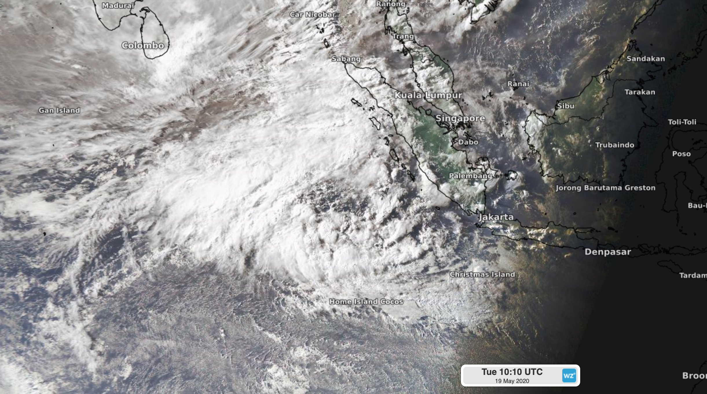
Image: Cloud forming around a developing tropical low to the west of Sumatra late on Tuesday.
This low will move towards the south during the next few days, likely bringing it into Australia's tropical cyclone area of responsibility on Thursday or Friday.
Conditions are favourable for the low to gain strength during the coming days, with a chance that it will become a tropical cyclone before the weekend.
According to the Indonesian Agency for Meteorology Climatology and Geophysics, the likelihood that this low will become a tropical cyclone increases from 10 percent on Wednesday to 20-40 percent on Thursday. By Friday the chance rises to more than 50 percent.
Australia's Bureau of Meteorology is a bit more conservative, giving it a 5-20 percent chance of tropical cyclone development on Thursday or Friday.
If this system does become a tropical cyclone before moving into Australia's area of responsibility, it will be named by the Jakarta Tropical Cyclone Warning Centre. If it moves into Australia's region and then manages to reach tropical cyclone intensity, it will be named Tropical Cyclone Imogen by the Bureau of Meteorology.
From Saturday, the system is likely to move towards the southeast, towards Australia. The system isn't likely to reach Australia's mainland as a tropical cyclone, however its remnant low pressure system could interact with a cold front in the mid-latitudes to cause widespread rain, thunderstorms and potentially damaging winds over a broad area of Western Australia from Sunday.
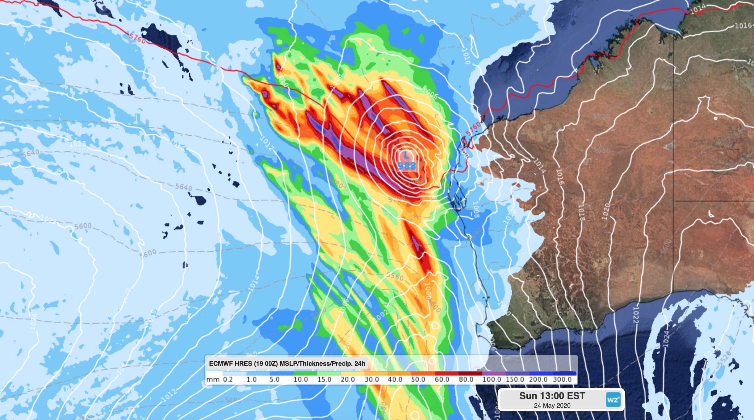
Image: Forecast 24-hour accumulated rainfall and mean sea level pressure on Sunday, according to the ECMWF-HRES model.
Warnings will be issued in Western Australia later in the week if there is a threat of heavy rain or damaging winds from this system.