
NSW drenching almost over, for the time being
Heavy rain and thunderstorms are clearing from NSW's far west and are about to clear from other parts of the state as a moisture-filled trough moves off the coast, which has and will allow flooding to ease in most areas. However, residents and travellers need to beware of another round of intense rain and storms and renewed flooding late next week.
Much of the state has been drenched by three significant bursts of rain during the past four-to-five days, causing flooding to expand and increase across much of the state. The western slopes and plains have gained widespread 30-to-100mm in this time, well above the monthly average on the plains.
In the past day and a bit, rainfall has intensified further east with the movement of the trough, bringing about 90mm to Dubbo. The central-west town has now had its wettest year to date in 49 years, amassing more than 880mm for the year so far, one-and-a-half times the annual average. Dubbo is now within only 10mm of achieving its wettest year to date in 72 years.
Just to the north, Coonabarabran picked up 62mm in under 24 hours, a 19-month high and also its highest daily rainfall in October in 49 years.
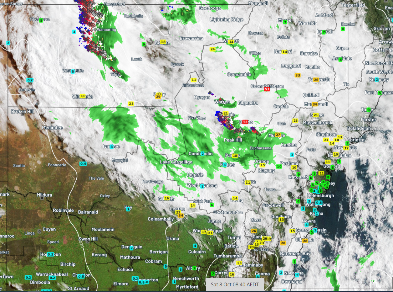
Image: Satellite, radar, and recorded rainfall in the 24 hours to about 9am on Saturday 8th October.
Flooding in the central west has forced some roads to be closed and caused Macquarie and Bell rivers to swell. Flooding has reached a level similar to that experienced only two weeks ago.
The central west and much of the state will get some drying relief during the next few days as an area of high pressure takes over but flooding is a fair chance to redevelop and increase late in the week as another trough moves in.
This next trough is expected to deliver the most rain to the south of the state and into northern Victoria where there is the potential for more than 100mm to fall. The central west and northwest of the state should gain lighter falls but still enough to cause significant flooding.
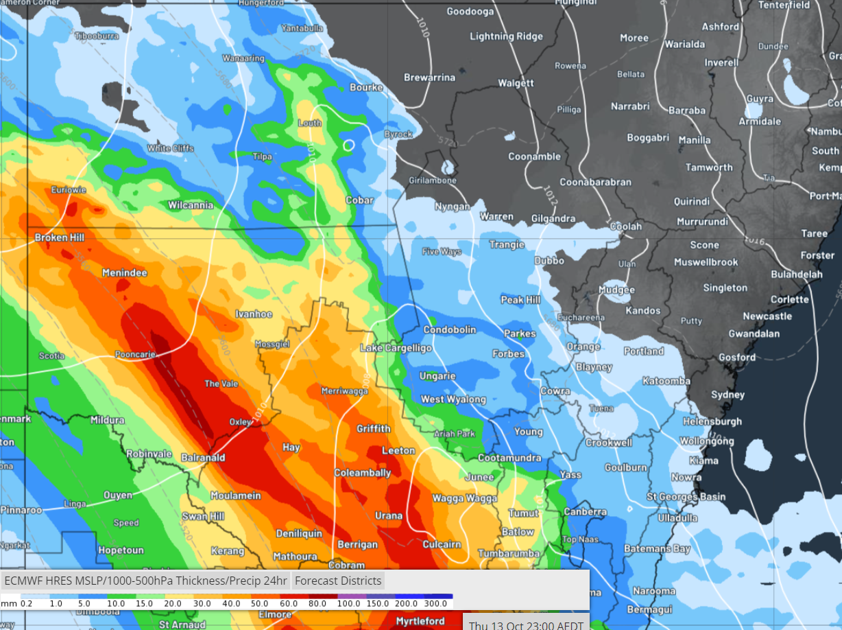
Image: Possible rainfall during the 24 hours to 11pm EDT on Thursday 13th October, indicating potential for about 100mm in the southwest.