
NSW bracing for potential 'bomb cyclone'
A cold front and intense low pressure system will cause a dangerous mix of heavy rain, thunderstorms, damaging winds and large waves parts of eastern Australia during the next 48 hours.
The satellite image below shows clouds passing over NSW and northeast Victoria, near and ahead of an approaching cold front, at midday on Monday. These clouds have been causing rain and thunderstorms.
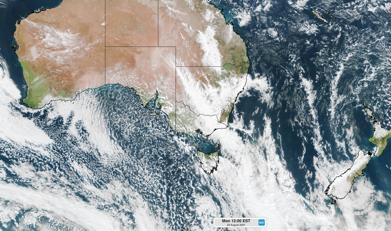
Behind this cold front, a broad region of speckled clouds can be seen developing within a mass of much cold air that’s spreading over Australia from the south.
The cold front will continue to fuel rain and thunderstorms as it spreads over northeast Victoria, NSW, the ACT and southern Queensland on Monday.
After traversing eastern Australia, the cold front will then move over the Tasman Sea on Tuesday and cause a low pressure system to rapidly deepen near the central coast of NSW.
This deepening low will cause a dangerous mix of wind, rain and surf along the southern half of the NSW coastline on Tuesday and Wednesday.
Some models suggest that the impending low could become ‘bomb cyclone’, which means its centre deepens by at least 24 hectopascals in 24 hours. Bomb cyclones have been known to cause a rapid onset of severe weather when they form close to the coast.
Rain and Thunderstorms (and snow)
Warm and humid air ahead of the cold front has been generating widespread rain and isolated thunderstorms across NSW on Monday. The rain and storms have been moving rapidly from west to east, driven by strong pre-frontal westerly winds.
This rain and storm activity is likely to continue into Monday evening as the front continues to move towards the Tasman Sea.
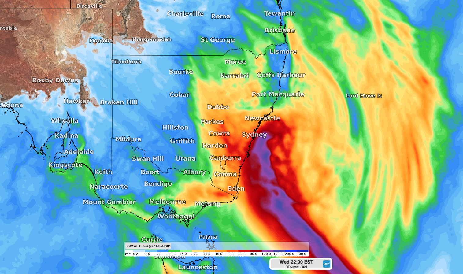
Image: Forecast accumulated rain between Monday morning and Wednesday night, according to the ECMWF-HRES model.
A southerly change moving up the NSW coast Monday night and early Tuesday morning is likely to become a focus for thunderstorm development. The gusty southerly change and any associated thunderstorms should approach Sydney shortly after midnight on Monday.
In addition to the rain and storms, some areas between central NSW and northeast Victoria will see snow on Monday and Tuesday thanks to a unique mix of moisture-laden upper-level air sitting above a layer of cold air near the ground.
Damaging winds
A strong and gusty southerly change is expected to move its way up the NSW coast during Monday night and Tuesday morning.
Wind will then strengthen further and tend southwesterly on Tuesday as a low-pressure system rapidly deepens over central NSW coastal waters.
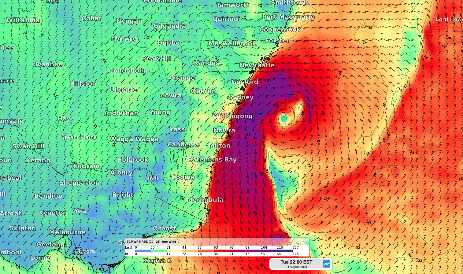
Image: Forecast wind speed and direction at 10pm AEST on Tuesday, according to the ECMWF-HRES model, showing a large region of gale-to-storm force winds off the southern half of the NSW coastline.
Strong to gale force winds, with potentially damaging gusts, should develop along the southern half of the NSW coast and ranges on Tuesday and Wednesday. The strongest winds are likely to occur between Tuesday afternoon and Wednesday morning.
While damaging winds are likely near the coast and ranges, the strongest winds from this system will occur at least several kilometers offshore near the deepening low pressure system.
Big waves
The low will also cause wave heights to increase rapidly on Tuesday and Wednesday.
Wave heights could reach around 3-5 metres along the southern half of the NSW coast, which has prompted a hazardous surf warning for coastal waters from the Hunter down to the Victorian border.
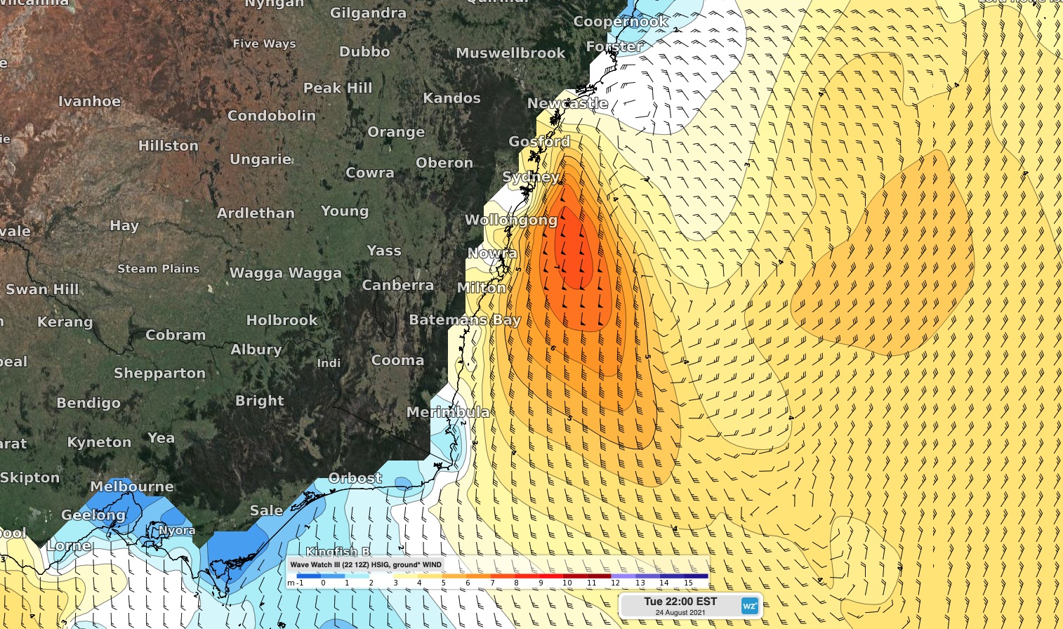
Image: Forecast wave hight and wind speed/direction at 10pm AEST on Tuesday, according to the WaveWatch III model.
The combination of large waves and high astronomical tides near a full moon could cause localised coastal inundation and beach erosion, particularly along south-facing beaches.
Looking ahead, the low-pressure system is likely to move away from the NSW coast on Wednesday, allowing conditions to improve in the middle of the week.