
Northwest cloudband to soak Australia next week
A large band of rain will spread across Australia from this weekend into the first half of next week as a surge of tropical moisture interacts with a strong cold front.
Before this rainband even develops, a cold front crossing southern Australia will cause a burst of wind and rain across parts of WA, SA, Tas, Vic, NSW and the ACT between Friday and Sunday.
This system will be followed by a stronger cold front and associated low pressure system that will drag tropical moisture across central and southeastern Australia during the first half of next week.
This second, stronger frontal system will produce a large northwest cloudband that is expected to deliver rain to a broad area of Australia stretching from northern WA down to Tasmania between Sunday and Wednesday.
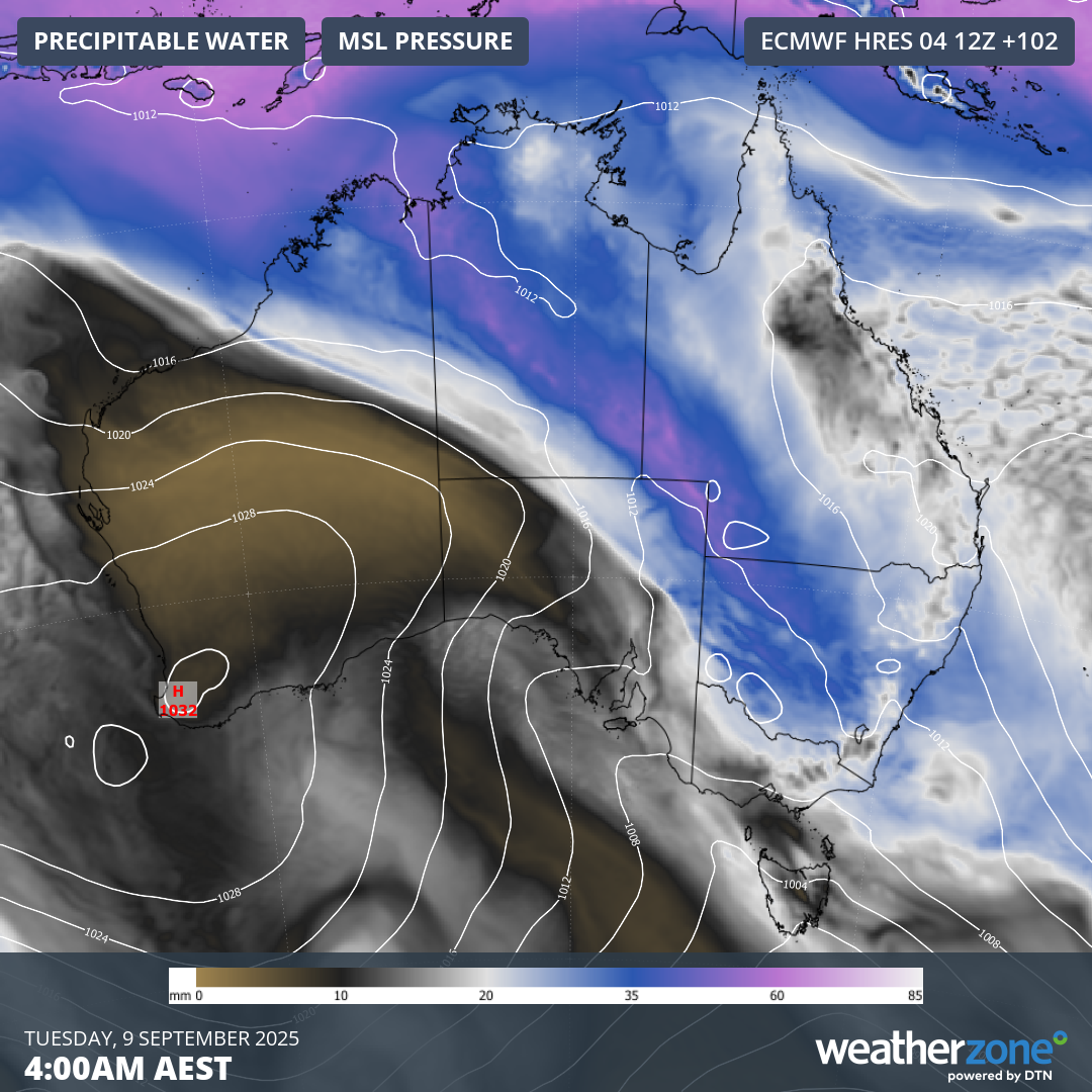
Image: Modelled precipitable water and mean sea level pressure on Tuesday morning.
The rain from the impending northwest cloudband will be enhanced by moisture being pushed towards Australia from the Indian Ocean. This injection of tropical moisture is associated with a strongly negative Indian Ocean Dipole (IOD) pattern that’s currently in place to the northwest of Australia.
The map below shows how much rain is predicted to fall across Australia between this Friday and Thursday next week. This includes the rain from the next two frontal systems combined.
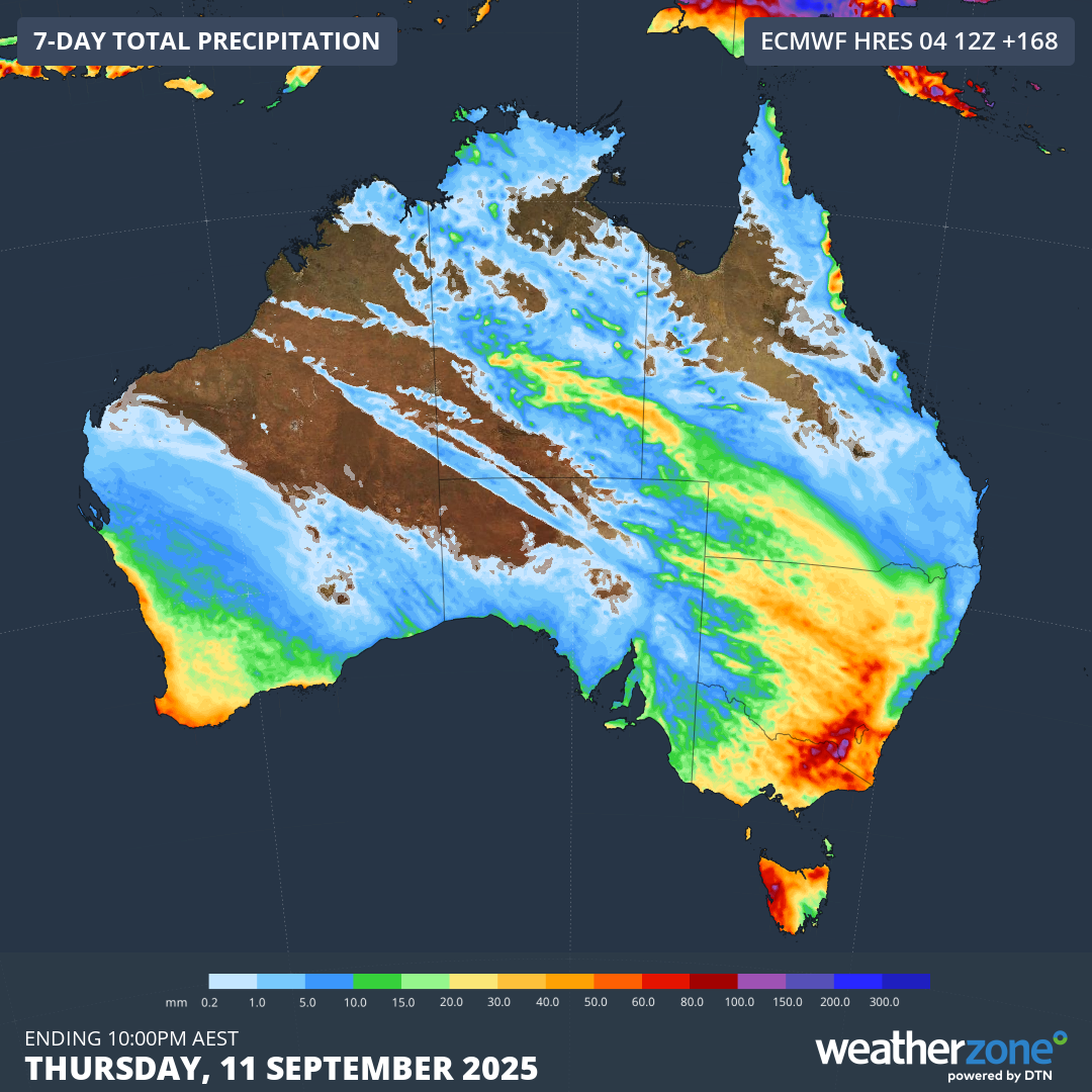
Image: Forecast accumulated rain during the seven days ending at 10pm AEST on Thursday, September 11, 2025.
Rain is likely to soak part of every Australian state and territory during the next seven days. The heaviest rain over the coming week is expected to fall over southeastern Australia, most likely in western Tasmania and about the ranges in southern NSW and northeast Vic.
Next week’s northwest cloudband will bring moderate to heavy rain over parts of the Murray-Darling Basin. This rain will be a welcome sight in areas that have endured an abnormally dry start to 2025.
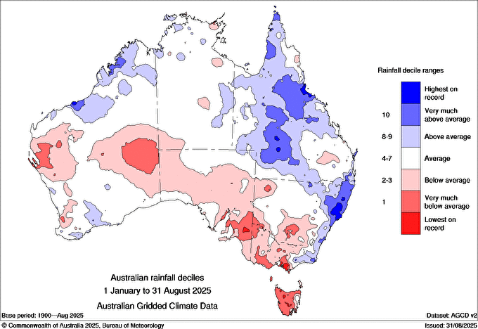
Image: Observed rainfall deciles in the first eight months of 2025, with notably below-average rainfall represented by the red shading and notably above average rain shaded in blue. Source: Bureau of Meteorology
The fronts and low pressure systems passing over southern Australia during the coming week will also cause strong to gale force winds, with damaging gusts likely in several states. Be sure to keep an eye on the latest severe weather warnings in your area.