
Northwest cloudband soaks WA, southern Australia next in line
Parts of Western Australia have recorded their wettest June day in years as a northwest cloudband caused widespread rain across the state. This system will now move east, causing rain to spread across parts of South Australia, Victoria, Tasmania, New South Wales and the Australian Capital Territory this weekend.
The animation below shows a large cloudband extending over Australia from the Indian Ocean on Thursday night into Friday morning. This feature – known as a northwest cloudband – is transporting copious tropical moisture from the Indian Ocean towards Australia.
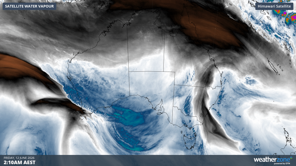
Image: Enhanced water vapour satellite images showing a northwest cloudband forming over Australia on Thursday and Friday this week. Source: Weatherzone.
Parts of WA received 20 to 40 mm of rain during the 24 hours ending at 9am AWST on Friday, with isolated falls above 80 mm. Some of the standout totals in this period included:
- 81 mm at Shark Bay, its heaviest June daily rain in 8 years
- 53 mm at Emu Spring
- 33 mm at Mount Magnet, its wettest June day in 30 years
- 27.6 mm at Onslow Airport, its wettest June day in 7 years
Rain will continue to spread over a broad area of WA on Friday, with a rainband extending from the Pilbara across the state’s interior towards the Eucla district in the far southeast. This rain, combined with what’s already fallen over the last couple of days, could cause flooding and cut off roads in parts of WA on Friday.
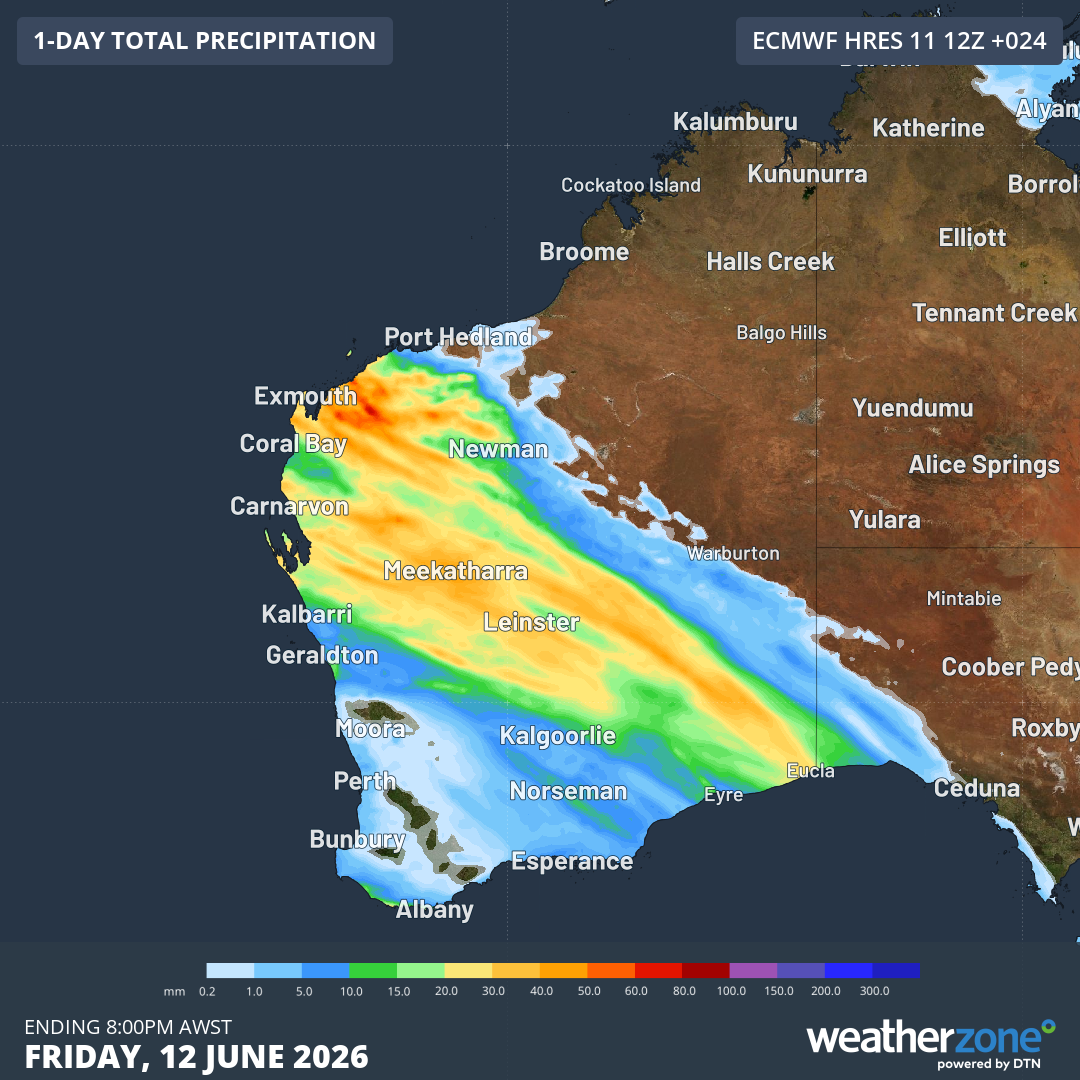
Image: Forecast accumulated rain during the 24 hours ending at 8 pm AWST on Friday, June 12, 2026. Source: Weatherzone.
Rain spreading east
After drenching WA, the northwest cloudband will track eastward over the weekend, causing rain to spread over parts of SA, Vic, Tas, NSW and the ACT.
The heaviest rain this weekend will occur over SA, Vic and Tas and the southern ranges in NSW. Accumulated rainfall totals in these areas could reach around 10 to 20 mm, with some areas likely to see falls exceeding 40 mm, most likely in western Tas.
The map below shows how much rain is expected to fall during the three-day period from Friday to Sunday.
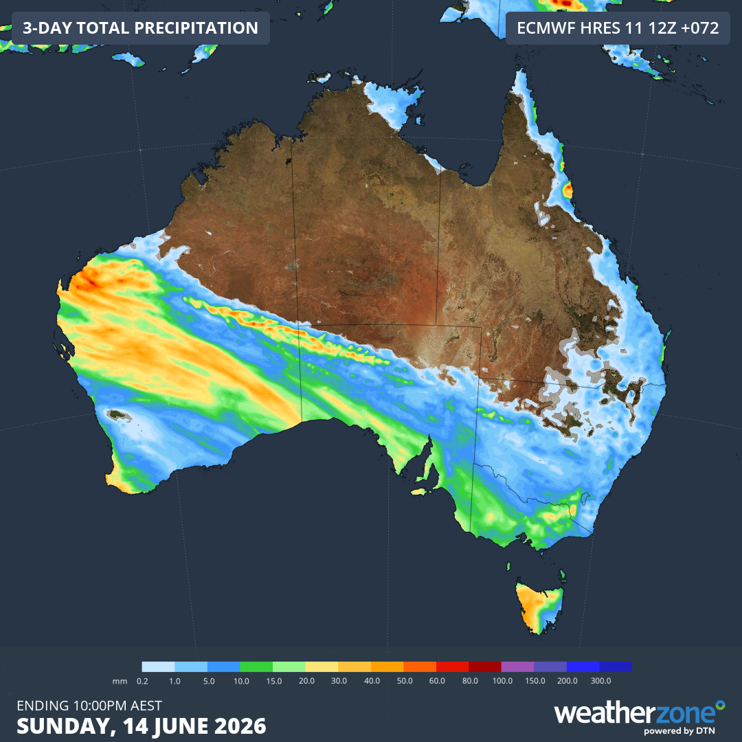
Image: Forecast accumulated rain during the 72 hours ending at 10pm AEST on Sunday, June 14, 2026. Source: Weatherzone.
Looking ahead, another northwest cloudband could develop over WA and SA between Monday and Wednesday next week, causing further widespread rain across the two states. There are signs that this cloudband and its rain will also affect a large area of eastern and southeastern Australia during the second half of next week.
While it’s still too early to know how this next system will develop with much certainty, there is potential for decent rain across parts every Australian state and territory next week.