
Northern Territory to cop flooding rainfall this week
A broad area of low pressure has developed over the NT's north with its circulation centre currently located to the west of Daly Waters. As seen in satellite imagery, cloudbands which originate over the Timor Sea, Joseph Bonaparte Gulf, Arafura Sea and Gulf of Carpentaria are feeding into the low with each cloudband delivering significant tropical moisture. The position of this low will change very little before Wednesday morning, meaning that excessive moisture will continue converging over the NT's north and rising motion associated with the low will generate flooding rainfall.
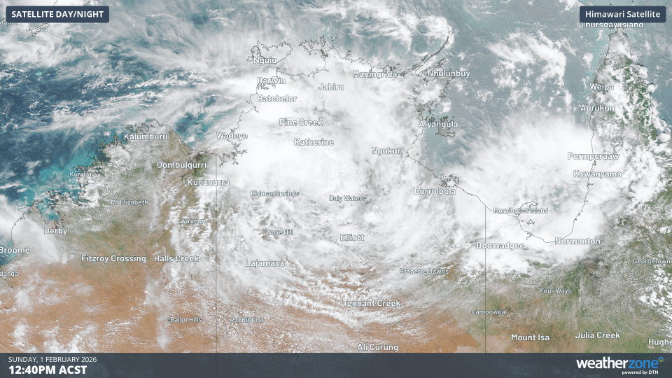
Image: Visible satellite images showing the circulation of a low over the NT's north on Sunday, 1 February 2026. Source: Weatherzone.
Forecast models currently indicate peak rainfall totals of 300-500mm by Wednesday morning, and isolated totals exceeding 500mm are certainly possible by this time.
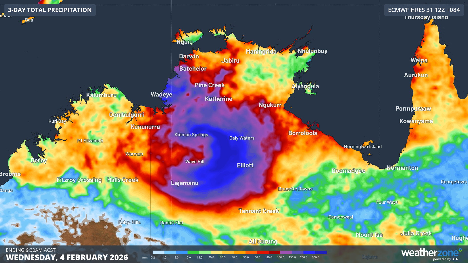
Image: Accumulating precipitation ending 9:30am ACST Wednesday, 4 February 2026. Source: Weatherzone.
Looking further ahead, this low is expected to track westward over the Kimberley during the middle of the week. Later this week, the chance of Tropical Low 21U developing into a tropical cyclone will increase as it has the potential to move offshore over waters to the north of the Pilbara.
Be sure to check our Tropical Cyclones page for the latest information as this situation evolves this week.