
Northern Territory September rain and thunderstorms
A low pressure trough has drawn in tropical moisture and spread it across northern parts of the Northern Territory, resulting in significant September rain and a few storms.
In the 24 hours to 9am Saturday morning, Charles Point picked up 18.8mm making it the highest September rain in 5 years, 4 years for Point Stuart (1.8mm) and Noonamah Airport (4.2mm), and 2 years at Darwin Airport (9.6mm). However, even higher falls were possible further southeast around the area of Maud Creek and Yeuralba Ridge.
Parts of the Daly, Tiwi, Arnhem, and Carpentaria districts have seen a few showers continue on Saturday. Light showers are expected to continue over the next few days, with thunderstorms possible each day, particularly in the northwest of the Territory. Weekly totals could see coastal areas in the far northwest pick up over 25mm.
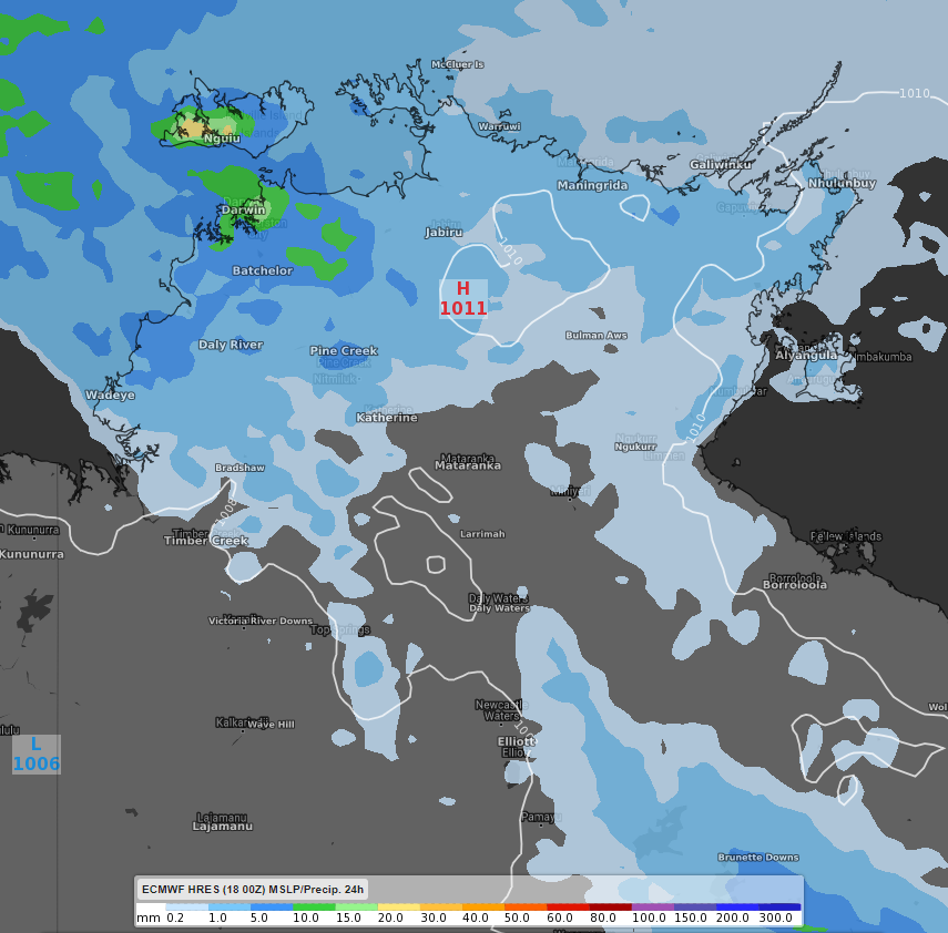
Image: 24 hour rainfall totals for the NT from Saturday 19th 7pm EST to Sunday 20th 7pm EST and surface pressure. Data displayed using the ECMWF high resolution model.
While it's not uncommon to see September rain across the north of the NT, it is fairly unusual to see such rain prior to the monsoon season which generally starts around December. Point Stuart is already at 90% of its average September rain total, Darwin Airport at 61%, Gove Airport at 96% and Cape Wessel at 85%. There is a high chance that some, or all, of these locations will see their September average rain met or exceeded over the next week.