
Northern NSW swelters in the hottest night in up to seven years
Large swathes of northwest and central western NSW failed to drop below 25 degrees overnight, as a slow moving trough, combined with high humidity and cloud cover continues to drive extreme heat over much of northern NSW, leading to the hottest night in years for some areas.
Gunnedah in the state’s Northwest Slopes and Plains district only cooled to 26.9°C overnight, which is the hottest night in just under 7 years. In addition, Murrurundi in the Upper Hunter only dropped to 24.8°C, the hottest night in almost 6 years.
A number of other areas recorded their hottest night in close to 2 years including:
- Walgett (29.1°C)
- Narrabri (28.6°C)
- Coonamble (28.2°C)
- Dubbo (25.8°C)
- Parkes (23.9°C)
- Mudgee (21.9°C)
- Armidale (19.4°C)
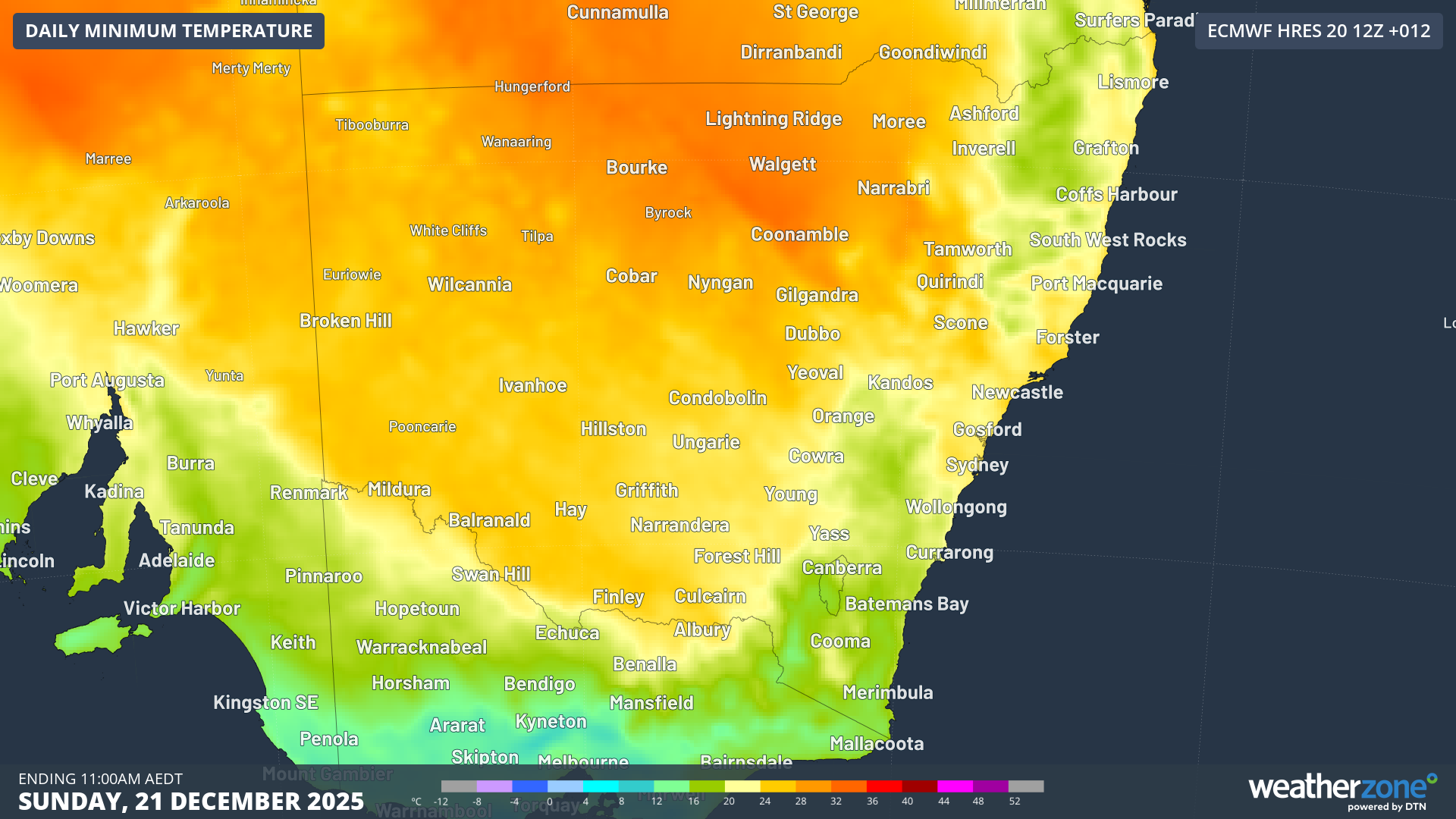 Image: Minimum temperatures for Sunday 21st forecasted by the ECMWF Saturday 12Z run
Even most of Sydney stayed well above 20°C overnight, with temperatures only dropping to 23.6°C for the Observatory Hill site (however, the official minimum will be 23.3°C recorded just before 10am yesterday), 23.4°C at Sydney Olympic Park and 22.9°C at Penrith. Olympic Park and Penrith also had their hottest night in nearly 2 years.
The reason it was stiflingly hot last night is the presence of a very hot air mass ahead of a slow moving trough, making yesterday extremely hot. Persistent northerly component winds also worked alongside increased cloud cover to prevent significant overnight cooling, allowing it to remain above 30 degrees well past midnight for many places, and above 25 degrees all night for many locations.
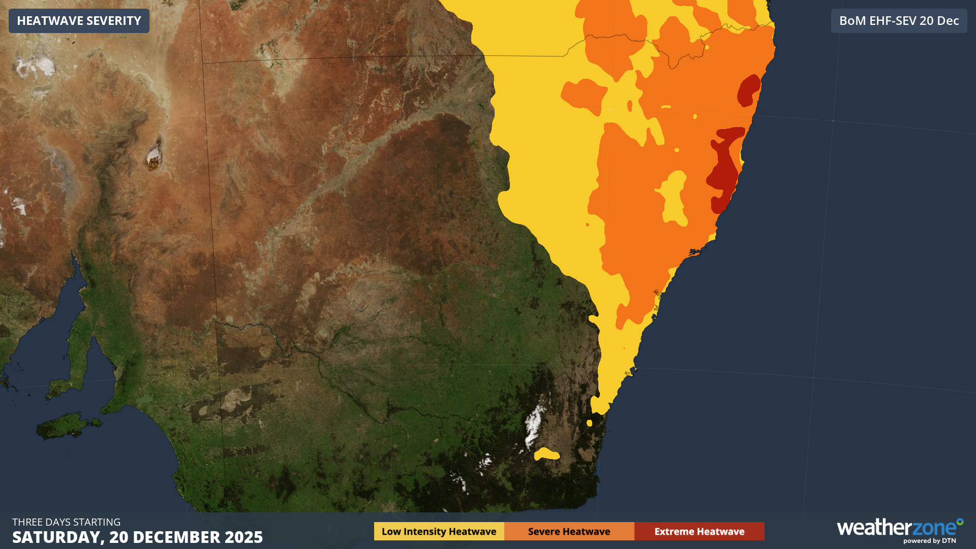
Image: Forecast heatwave intensity for NSW in the 3-day period to Monday 22nd
This is part of the ongoing severe heatwave currently affecting most of northern and eastern NSW, with severe to extreme heatwave conditions expected to continue until Monday. Temperatures are expected to reach the high 30s to low 40s on Sunday, following up on a similarly hot Saturday, with another very warm night expected to follow tonight.
Increasing showers and storms during Monday will precede the arrival of cooling southerly component winds as the trough crosses overnight Sunday and into Monday, bringing relief for the scorched and heat-weary residents of northern and central NSW.