
North American ski conditions looking very 'Australian'
Snow-loving Australians are getting an unwelcome taste of home a time of year when they've flown to North American ski resorts for a very different experience.
The image below shows the base of the hugely popular resort of Whistler, about two hours from Vancouver, and was taken by a visiting Aussie in the last week or so. Things haven't improved much down in the village since then as the resort's snow cams show.
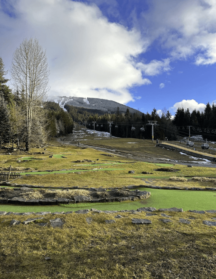
Image: It looks like one of the Aussie resorts in one of our frequent sketchy seasons: Source: @Mainstreet via ski.com.au.
Admittedly, conditions are a little better up high, but the base is still perilously thin for this time of year, with just 10 of 27 lifts open and only 57% of the resort's terrain accessible.
It's a similar story in ski resorts across western Canada, as well as popular North American ski destinations in Utah, Colorado, and the Lake Tahoe region of California.
It was a "snow" day today... lord knows we need a tonne more. This is even worse conditions than when I usually stop skiing in the spring. #whistler pic.twitter.com/fEBQKz6sKk
— Anthony ????????? (@eastsidedads) January 3, 2024
Why the snow deficit this year?
Even the world's most reliable snow spots have good seasons and bad seasons. In Whistler's case, a bad season tends to look a lot worse in the village, which has always been a bit too close to sea level for comfort at just 670 metres.
With a warming climate, locals say the incidence of rain in Whistler village has become noticeably more frequent in the last couple of decades. But there's also a very familiar climate driver at play behind this year's slow start to the season – our old mate El Niño.
As America's NOAA explains, trade winds weaken during El Niño, which pushes warm water eastwards toward the west coast of the Americas.
Those warmer waters cause the Pacific jet stream to move south of its neutral position, which means areas in the northern US and Canada are dryer and warmer than usual. This typically reduces snow in the Pacific Northwest, northern Rockies, and western Canada.
Meanwhile America's southeast and Gulf Coast can be wetter than usual, while snow can be heavier than usual during winter in southern and central parts of the US, as well as parts of eastern Canada, as the jet stream shifts further south and east.
Record-breaking weak ass snow in Hakuba this year! Some sort of warm current coming into the Sea of Japan has led to one of the warmest winters on record.
— Nikku-san (@nikbrainbuster) December 29, 2023
Photos from Happo One. These pics are from the bottom of the mtn. Snow was actually pretty good up top so we still had fun pic.twitter.com/GO27KE6Zvx
On the other side of the Pacific Ocean in Japan – the other overseas destination most favoured by Australian skiers and snowboarders – conditions are a mixed bag.
Slopes at the main ski resorts like Niseko on the northern island Hokkaido are in pretty good shape but the resorts of the Japanese Alps on Honshu are struggling a little right now.
In a story last week, Weatherzone meteorologist Stephen King wrote a great breakdown of why Japanese snow is (usually) so much better than Australia's.
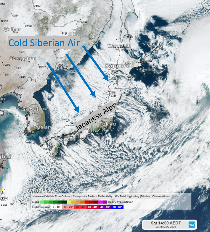
It included the image above, which shows how extremely cold and dry air from Siberia moves southwards across the Sea of Japan, picking up vast amounts of moisture, then dumping that moisture as snow as it encounters the Japanese Alps.
That pattern is not quite set in right now. But there are indications that by this time next week, normal transmission will have resumed. There are also long-term indications that the pattern could change in North America, and not before time.