
New Zealand bracing for days of wild weather
Several days of severe weather are about to lash parts of New Zealand as a powerful low pressure system and associated front barrel across the country between Thursday and Saturday.
A low pressure system that formed near southeast Qld earlier this week is expected to gain strength as it crosses the Tasman Sea on Wednesday and Thursday.
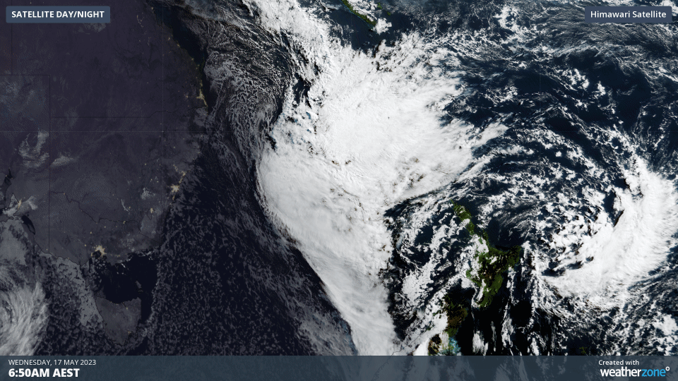
Video: Visible satellite images showing the low pressure system located off the southeast coast of Qld on Wednesday morning.
Prior to the arrival of this dangerous weather system, a slow-moving low pressure trough will cause heavy rain and snow over parts of the South Island on Wednesday into Thursday.
This South Island soaking will be followed by several days of severe weather in New Zealand’s North Island and parts of the South Island, starting from Thursday and lasting until at least Saturday, with the passage of the strong low and front.
The dangerous weather will come in two waves. The first will be a period of heavy rain and damaging winds over parts of the North Island on Thursday into Friday with the passage of a front. This will be followed by another surge of heavy rain and dangerous gales over the North Island and Upper South Island from Friday into Saturday with the passage of the subtropical low.
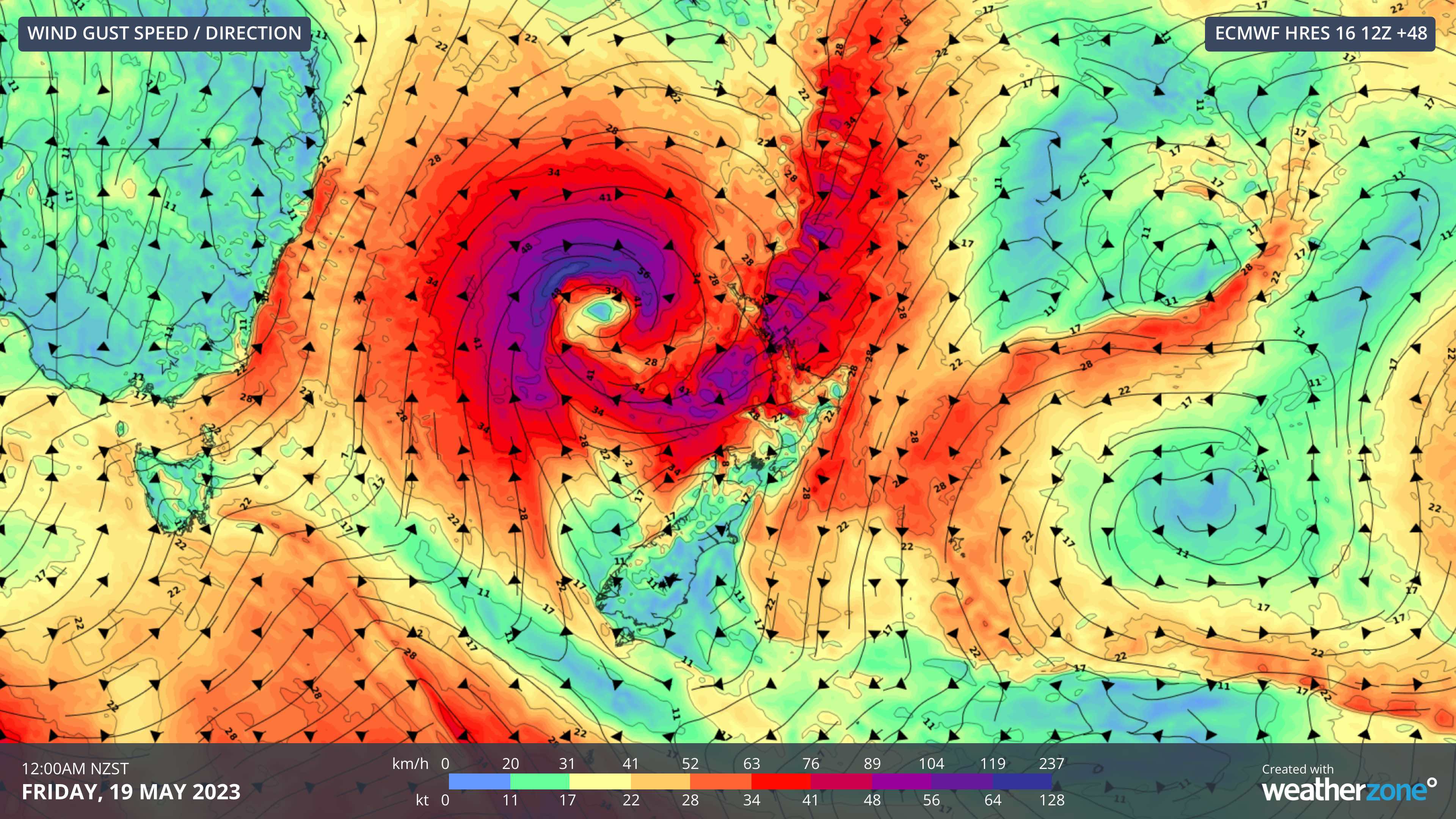
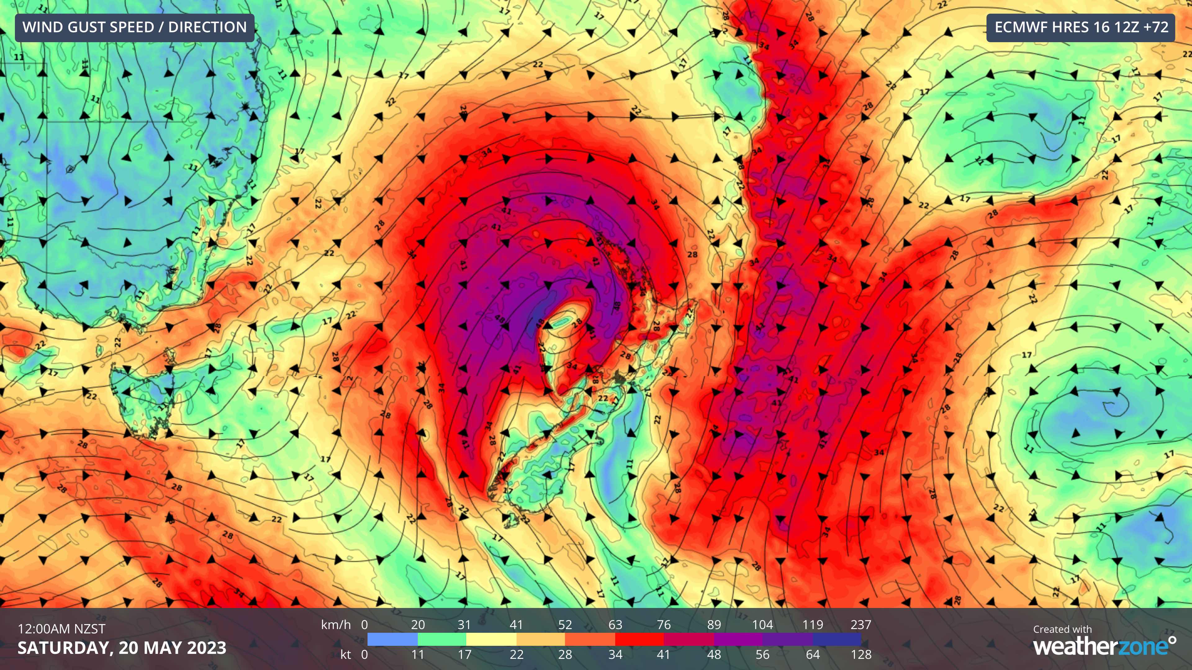
Images: Forecast wind gusts (speed and direction) at midnight NZST on Thursday night (top) and Friday night (bottom).
Severe Weather Watches are already in place for parts of New Zealand’s North Island and more watches and warnings are likely to come out in the coming days. New Zealand’s Met Service issues warnings for rainfall and wind based on the following criteria:
- Widespread rainfall greater than 50mm within 6 hours or 100mm within 24 hours
- Widespread severe gales with a minimum mean speed of 90km/h or frequent gusts exceeding 110km/h.
Visit the Met Service’s warnings page for the latest information on this weather event.