
Hawkesbury-Nepean River bursts banks amid western Sydney’s heaviest rain in over 30 years
The recent deluges across eastern NSW has been filling up many of the region’s waterways. With more than triple the monthly average rain falling in some areas since Thursday morning, the Nepean/Hawkesbury river and major tributaries are now flooding the surrounding areas, with the North Richmond bridge already submerged, and the Windsor Rd Bridge on the verge of going underwater this afternoon.
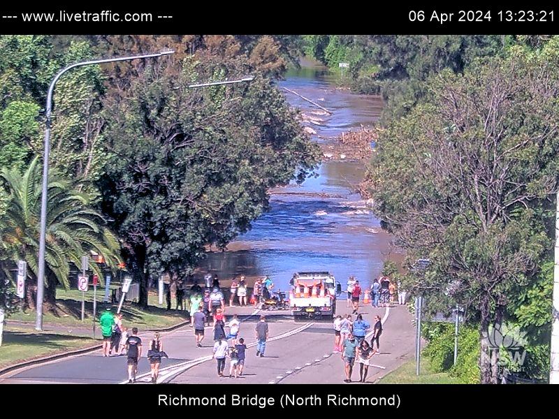
Image: Flooding occurring along the Hawkesbury River at North Richmond. Source: https://www.livetraffic.com/traffic-cameras
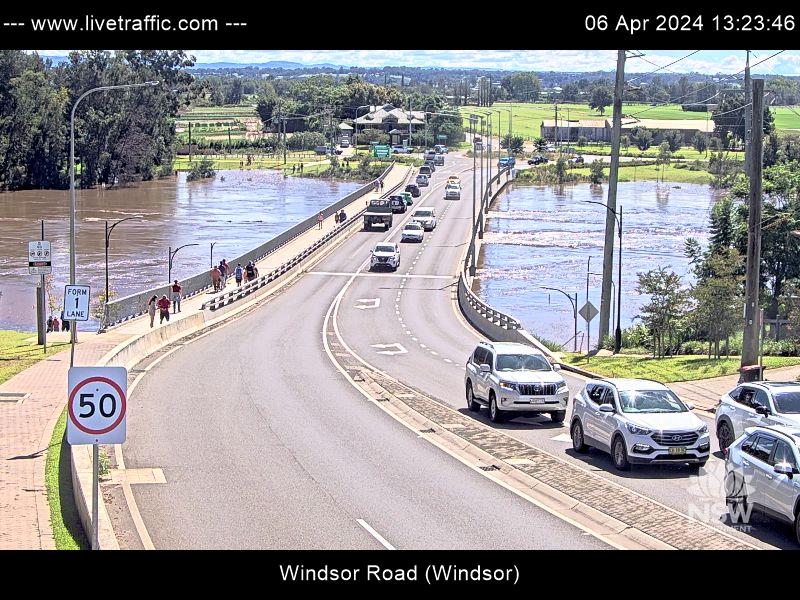
Image: The Windsor Rd bridge could be submerged this afternoon. Source: https://www.livetraffic.com/traffic-cameras
At the time of writing, just after 1pm, the Hawkesbury River has risen to 9.81m at North Richmond, and to 8.17m at Windsor PWD, both at moderate flood level. Water levels are gradually rising and the BoM warns that major flooding is likely in these areas this afternoon as water flows in from upstream along the Nepean River, and from the overflowing Warragamba Dam.
The flooding comes as a result of persistent rain, falling across a large area of eastern NSW between Thursday and Saturday morning, with the heaviest falls coming last night and into this morning. Since 9am Thursday (including the 24-hour period to 9am Saturday), some of the highest totals across Sydney were recorded at:
- Penrith – 251.8mm (including 167.0mm)
- Terrey Hills – 229.4mm (including 161.0mm)
- Canterbury – 222.4mm (including 160.6mm)
- Richmond – 197.0mm (including 133.2mm)
- Sydney Ap – 166.2mm (including 145.0mm)
- Campbelltown – 152.0mm (including 126.8mm)
For both Penrith and Richmond, the 24-hour period to 9am this morning marked the wettest day of any month for 32 years, and for Terrey Hills, the wettest in at least 19 years.
As the trough generating this flooding rain moves south, heavy rain is now falling through southern NSW and much of Vic, with 60-120mm expected across southeast NSW and eastern Victoria today and tomorrow.
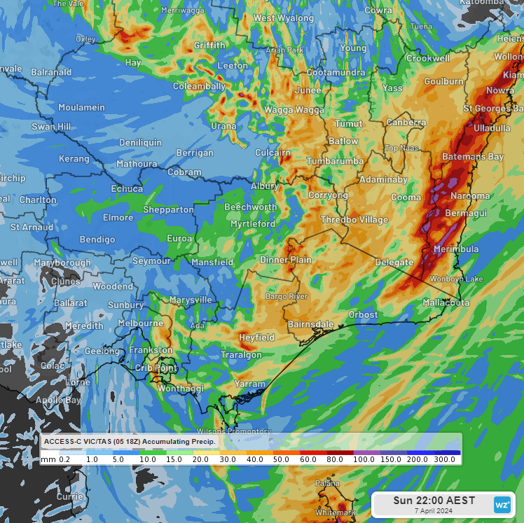
Image: Forecast accumulated rainfall to 10pm EST Sun 6th using ACCESS-C VIC/TAS
Be sure to check the latest severe weather and flood warnings for the most up-to-date information on this weather event.