
Near-record September warmth in Darwin
A surge of warm southeasterly winds will cause temperatures to soar across the western Top End during the next two days.
This burst of abnormally hot air is being pushed north by a strong high pressure system traversing southern Australia this week.
While the city's average maximum temperature in September is 32.7ºC, the mercury could climb 4-5ºC above this on Monday and Tuesday.
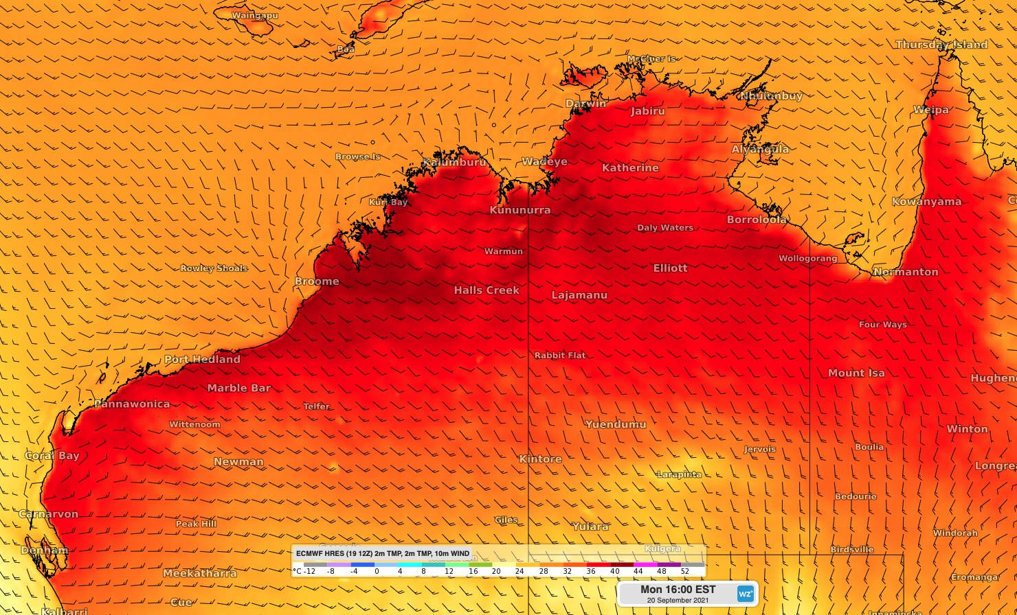
Image: Forecast temperature and wind speed/direction on Monday afternoon, according to the ECMWF-HRES model.
Darwin is forecast to reach 36ºC on Monday and 37ºC on Tuesday, which is within one degree of its September record of 37.7ºC from 1983.
If Darwin Airport does reach 37ºC on Tuesday, it will be only the seventh September day this warm in 81 years of records at the site.
The heat will combine with low relative humidity and blustery winds to cause Severe to Extreme Fire Danger Ratings across most of the Top End on Tuesday.
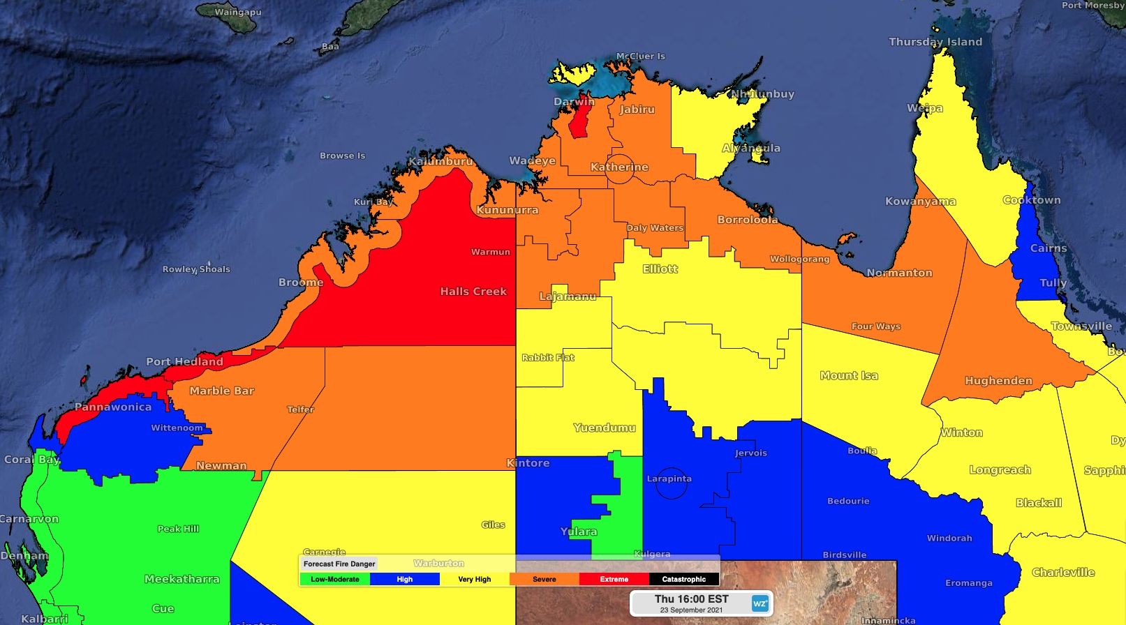
Image: Foreast fire danger ratings on Tuesday.
Intense heat and elevated fire danger ratings will also extend across parts of the Kimberley and Pilbara in WA during the next few days.
Broome is forecast to reach 40ºC on Tuesday, which hasn't happened during September for 11 years.
Maximum temperatures will return to the mid-thirties in Darwin from Wednesday as milder air moves over the region.