
Narelle on track to make landfall in third Australian state
Tropical Cyclone Narelle is expected to make landfall along the west coast of Western Australia later this week, possibly becoming the third tropical cyclone in modern records to make landfall in three Australian states.
First landfall in Queensland
Tropical Cyclone Narelle initially developed over the Coral Sea on Tuesday, March 17. It then gained strength as it tracked towards the west, becoming a category 5 tropical cyclone by Thursday, March 19. The system weakened slightly as it approached the eastern coast of the Cape York Peninsula before making landfall as a high-end category 4 system between Coen and Lockhart River on the morning of Friday, March 20.
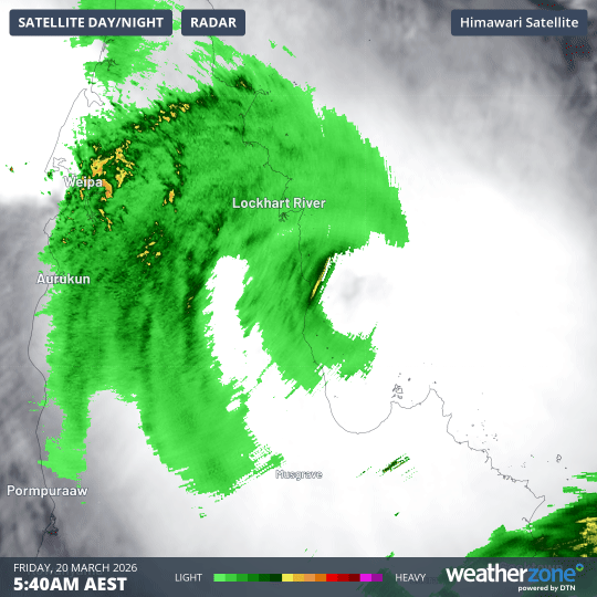
Image: Tropical Cyclone Narelle making landfall over northern Qld. Source: Weatherzone.
Following its first landfall, Narelle weakened as it passed over the Cape York Peninsula, emerging off the peninsula’s west coast as a category 2 system on Friday afternoon. It then re-gained strength as it tracked across the Gulf of Carpentaria on Friday and Saturday, March 20-21, becoming a category 3 tropical cyclone once again.
Second landfall in the Northern Territory
Narelle made a second landfall over the eastern Top End in the NT on Saturday night, crossing the coast as a category 3 severe tropical cyclone.
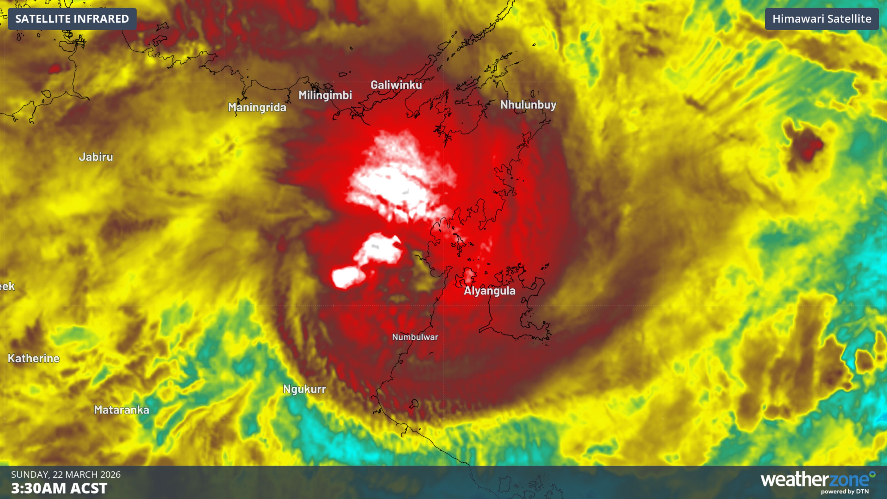
Image: Enhanced infrared satellite image showing Tropical Cyclone Narelle making landfall over the eastern Top End. Source: Weatherzone.
The system weakened quickly once over land and was reclassified as a tropical low, below tropical cyclone strength, by Sunday morning.
Ex-Tropical Cyclone Narelle then tracked across the NT’s Top End on Sunday before passing over the Joseph Bonaparte Gulf on Monday, March 23. It crossed the coast in Western Australia's Kimberley district on Monday afternoon as a tropical low.
Third landfall possible in WA this week
While Ex-Tropical Cyclone Narelle has already crossed the WA coast this week, it has not made landfall in WA as a tropical cyclone. However, this may change.
Narelle is expected to re-intensify as it moves in a west-southwesterly direction off the north coast of WA in the coming days. The latest track map from the Bureau of Meteorology predicts the system will reach category 2 strength on Wednesday and category 4 strength on Thursday or Friday. However, there is a possibility it will hit category 5 strength while located to the north of WA.
The tropical cyclone is expected to turn towards the south from Friday, causing it to approach the west coast of WA. While Narelle could weaken a bit as it moves further south, it is currently predicted to pass over the coast as a tropical cyclone somewhere between Exmouth and Yanchep, most likely around the Shark Bay area.
If this happens, Narelle will become the first tropical cyclone since Ingrid in 2005 to make landfall in three Australian states as a tropical cyclone. The only other system to do this in records since 1980 was Steve in 2000.