
Murray Darling flooding seen from space
Satellites have captured captivating images of extensive flooding across the Murray-Darling Basin this week.
Frequent rain and thunderstorm outbreaks have inundated the Murray-Darling Basin over the last few months, fuelled by a negative Indian Ocean Dipole (IOD) and La Niña.
The Basin as a whole registered its wettest October on record. This was followed by more heavy rain in the opening weeks of November, including a flurry of storms that broke daily rainfall records in the Lachlan River catchment last Sunday.
As of Friday afternoon, major flooding was occurring from the Narran River near the NSW/Qld border down to the Murray River on the NSW/Vic border, an area stretching more than 700 kilometers across the Murray-Darling Basin.
The image below shows the flooding from space, captured by the Terra satellite as it was passing over Australia on Friday.
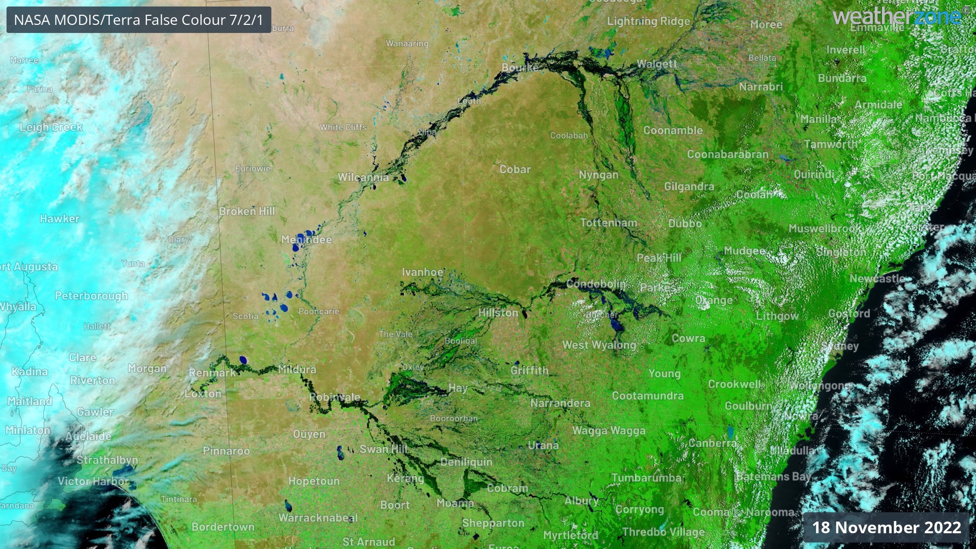
Image: Enhanced false-colour visible satellite image captured by the Terra satellite in Friday, November 18, 2022.
For comparison, below is what the land looked like at the same time in 2019, when the Murray-Darling Basin was in drought.
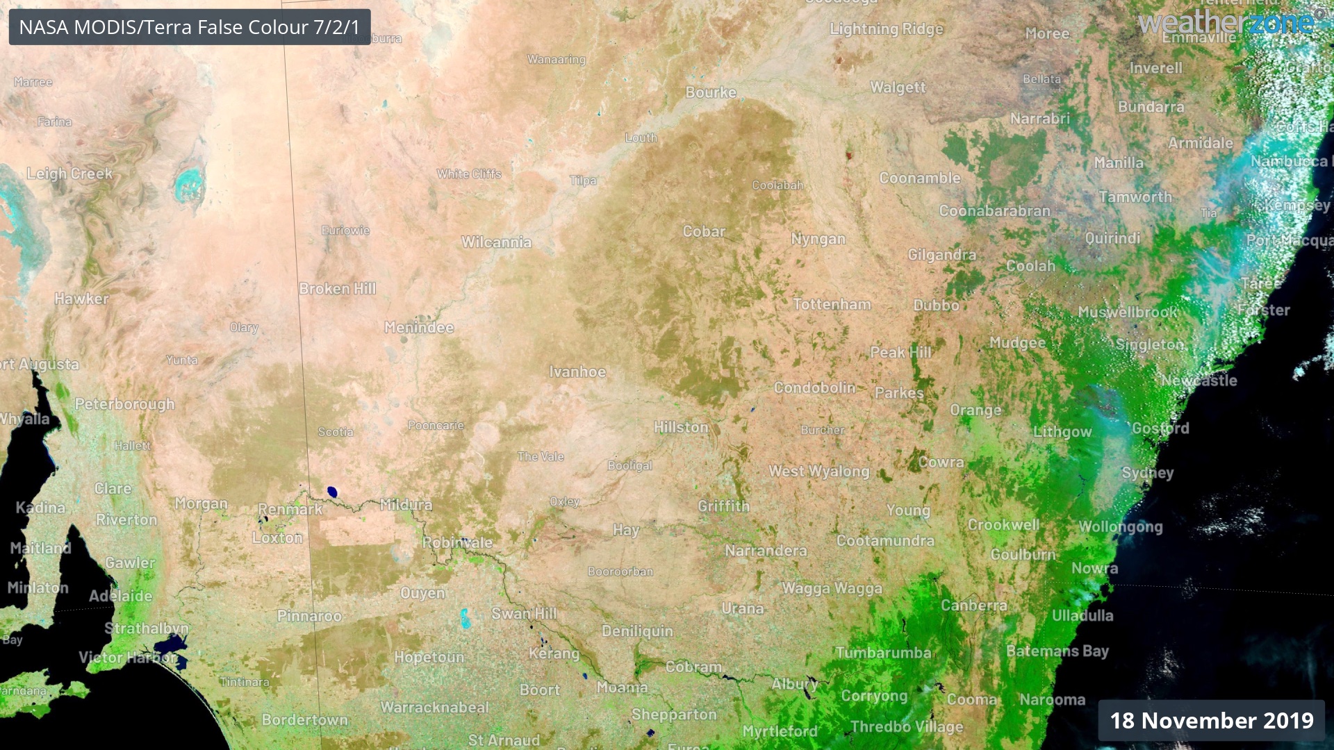
Image: Enhanced false-colour visible satellite image captured by the Terra satellite in Friday, November 18, 2022.
Flooding is likely to continue in the Murray-Darling Basin for weeks to months as water continues to make its way across the landscape. You can check the latest flood warnings on the Weatherzone website and app.