
Much-needed rain spreads across Tasmania
Rain is falling right across Tasmania this Tuesday, in a continuation of the welcome wet weather streak of recent weeks. Prior to September, Tasmania had experienced a very dry first eight months of 2025, with rainfall totals the lowest on record in some areas.
Widespread light falls dampened much of Tasmania on Monday night into Tuesday morning, and while today’s rain is not expected to be particularly heavy, the radar shows moisture streaming across the state, and not just towards the typically soggy west coast.
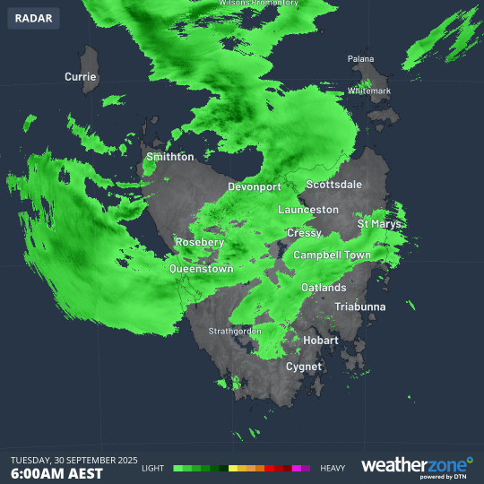
Image: Four-hour combined radar and satellite loop for Tasmania up until 10am on Tuesday, September 30, 2035.
Today’s rain is falling in an unstable moist airstream ahead of a cold front and associated low pressure system. A series of fronts will whip through our southernmost state between Tuesday and Friday, with the heaviest falls in the Western and Central Plateau forecast districts.
How badly is rain needed in Tasmania?
The chart below shows the rainfall deciles for the first eight months of the year across Tasmania (deciles break data into ten equal groups to indicate whether totals have been average, above average or below average).
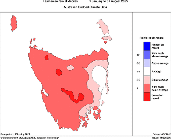
Image: Tasmanian rainfall deciles from January to August, 2025. Source: BoM.
As you can see above, most of the state saw "very much below average" rainfall or worse from January to August 2025.
Only a patch of the northeast has seen average rainfall, thanks largely to easterly rainfall events in June and July. But it’s worth noting that this is the driest part of the state, so we are not talking about huge totals.
By contrast, Tasmania's west typically receives huge annual rainfall totals. Indeed Mount Read – a 1123m peak with a weather station on Tasmania's West Coast Range – is the wettest place in Australia beyond the tropics.
Mount Read saw approximately 1150mm in the four months from May through August, yet those rainfall totals were still significantly below average in each of those months.
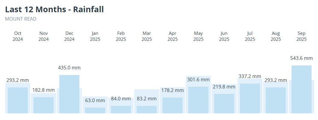
Image: Mount Read monthly rainfall totals over the last 12 months.
Mount Read’s run of eight below-average rainfall months to start the year was broken this September, with rain on every single day of the month except September 5, and a total of 543.6mm which was well over the 379mm monthly average.
As for Hobart, the state capital beat its monthly rainfall average for just the third time this year in September, but only just, with 54.2mm compared to the average of 52.9mm.
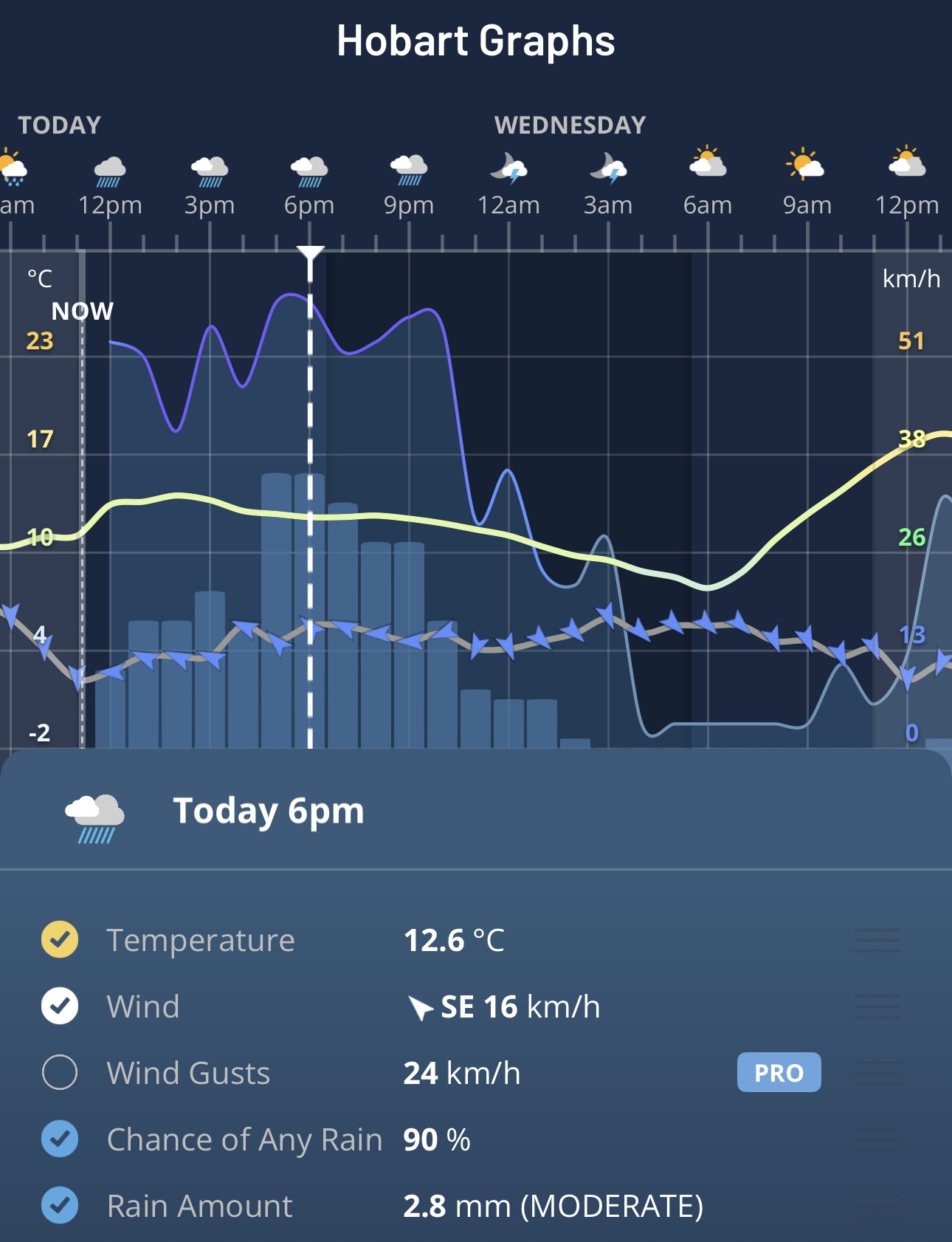
Image: Forecast rainfall for the next 24 hours in Hobart on the Weatherzone app.
Hobart’s running total for 2025 is still well down on average, with 324.6mm in the gauge so far compared to the long-term January to September average of 436.9mm. That’s why today’s rain is welcome, even though it’s relatively light.