
More than 300mm of rain in 48 hours. How unusual for Sydney and Illawarra?
Widespread rainfall amounting to 100-to-300 millimetres has just fallen across much of Sydney and Illawarra. Some areas have amassed 300-to-600mm - in just one-to-two days this is unusual but how unusual?
For starters, this much rainfall is three-to-six times the monthly average for most areas.
One of the wettest spots in the past 48 hours has been Brogers, in the Kangaroo Valley, gaining a whopping 595mm.
The 521mm recorded at Wattamolla (Kangaroo Valley) is the highest 48-hour total at the site in at least 30 years.
In other places, it has been the most intense rainfall in:
- more than 45 years in Kentlyn (193mm in 24 hours)
- 36 years in Wedderburn (216mm in 24 hours)
- 34 years in Berrima West (153mm in 24 hours)
- 31 years in Audley (234mm in 24 hours) and Lucas Heights (190mm in 24 hours)
- 30 years in Darkes Forest (298mm in 24 hours)
- more than 20 years in Albion Park (348mm in 48 hours), Kiama (273mm in 48 hours), Fitzroy Falls (236mm in 24 hours), Menangle (166mm in 24 hours), Moss Vale (165mm in 24 hours) and Bellambi Point (281mm in 48 hours)
- 19 years in Bowral (202mm in 48 hours)
- 16 years in Hampton (108mm in 24 hours)
The low-pressure system generating this rain has had help from the ocean and upper atmosphere.
The ocean just off the NSW coast is warmer than normal and is two-to-three degrees warmer than normal off the Illawarra coast, giving a moisture boost to the low-pressure system. This combined with a pool of cold air in the upper atmosphere has created extra uplift to create tall moisture-filled clouds.
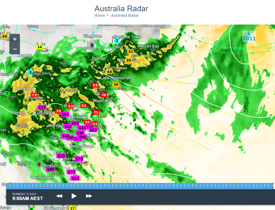
Image: sea surface temperatures, isobars indicating offshore low, rainfall observations in the 24 hours to 9am Sunday.
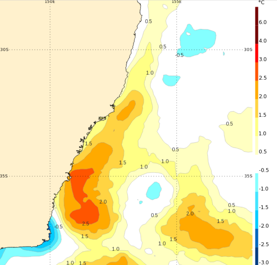
Image: sea surface temperature anomaly, measured on Saturday 2nd July 2022.
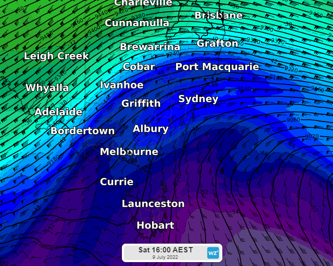
Image: wave of cold air in the upper atmosphere (at about 10km above sea level) passing over NSW.
The resultant rain has fallen on fairly saturated ground, not being able to soak in but leading to major flooding in some rivers. For the Nepean and Hawkesbury rivers, major flooding is occurring for the third time in the past four months, much more than an inconvenience for those impacted.