
More rain to soak eastern Australia next week
A broad area of eastern Australia could see rain every day next week, with potential for heavy falls and flooding along populated parts of the east coast, and a chance of snow in northern NSW and southern Queensland.
A slow-moving high pressure ridge will drive moisture-laden winds from the Tasman and Coral Seas towards eastern Australia throughout next week. These persistent onshore winds will interact with a near-stationary coastal trough and a lingering pool of cold upper-level air to produce persistent rain over parts of NSW and Qld.
The pool of cold air associated with next week’s wet weather will cause rain, hail and snow to spread over parts of southeastern Australia on Friday and over the weekend. This wintry mix of precipitation will then become more focused on NSW and Qld from Monday onwards.
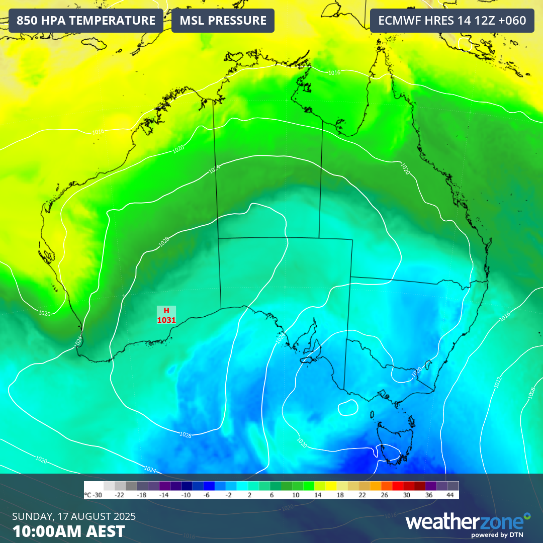
Image: 850 hPa temperature and mean sea level pressure over Australia on Sunday, showing cold air spreading across the country’s southeast and east.
It’s important to point out that there is currently quite a lot of disagreement between computer models regarding where and how much rain will fall next week. However, there is general consensus between major models that rain will occur over parts of eastern Australia every day next week.
Some models also suggest that heavy rain will occur on several days next week, possibly enough to cause flooding. The maps below show the predicted rain over the next 7 days from three different models, highlighting the model disagreement and potential for heavy rain in eastern NSW and southeast Qld.
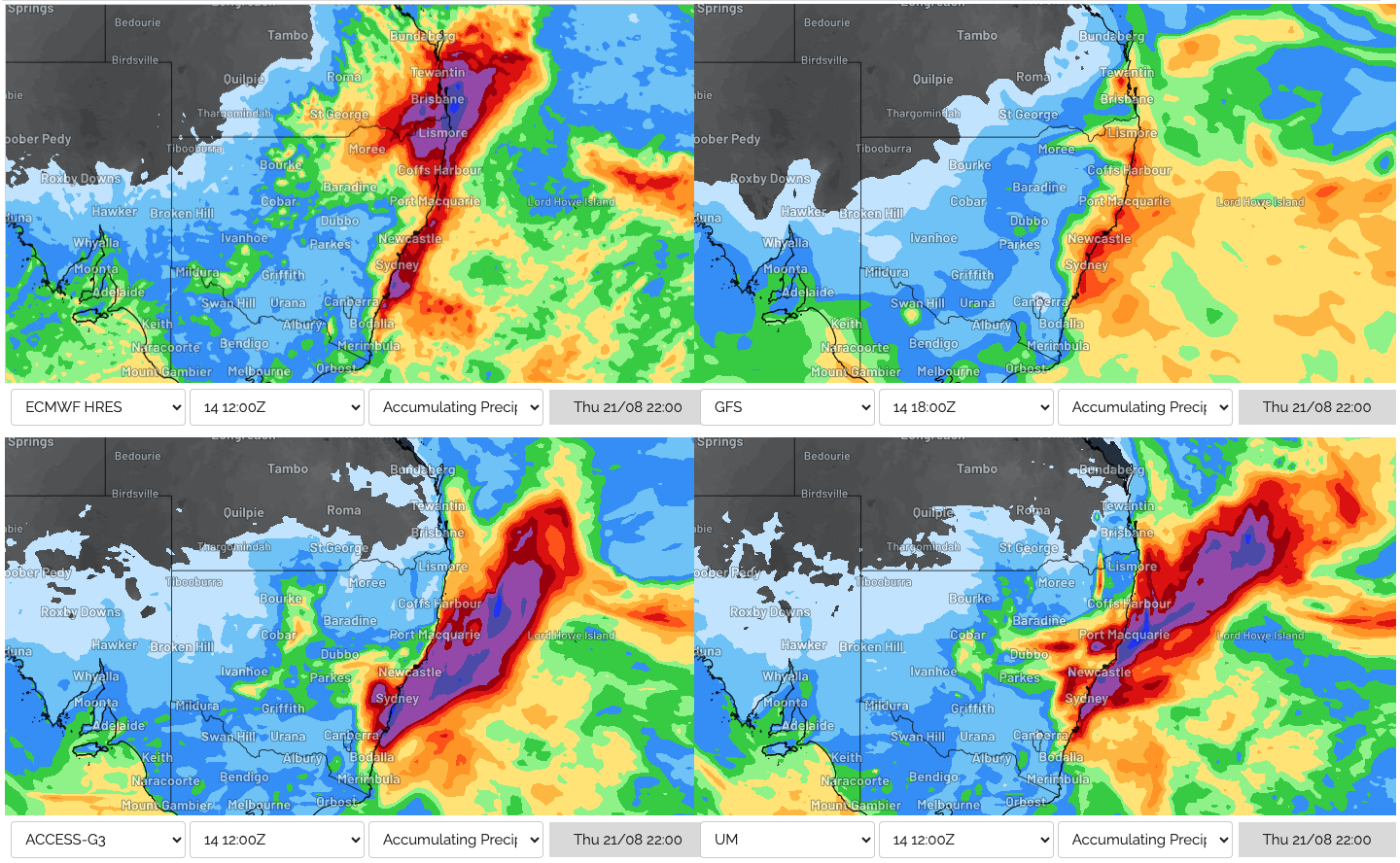
Image: Forecast accumulated rain during the 7 days ending at 10pm AEST on Thursday, August 21, 2025 from four different computer models.
The combination of cold air and moisture could see snow settling along higher parts of the Great Dividing Range early next week, possibly as far north as the Northern Tablelands in NSW or even in the Darling Downs and Granite Belt region of Qld. At this stage, snow in these northern areas is most likely on Monday night and Tuesday, although this may change in the coming days.
Despite the forecast uncertainty surrounding this system, there is potential for hazardous and severe weather in parts of eastern Australia next week. Be sure to stay up to date with the latest forecasts and warnings in your area for the most accurate information.