
More rain expected for the Kimberley
The monsoon trough is continuing to sit comfortably over northern Australia, bringing heavy rainfall to northern parts. A low is expected to develop over the Kimberley in the coming days, leading to more rain, flooding and strong winds.
Some significant 24-hour rainfall totals to 9am Friday in the Kimberley were Lansdowne with 110mm, Debesa with 60mm, Fossil Downs with 86mm and Mount Amhurst with 96mm to name a few.
Models are favoring a low developing over the Kimberley around Sunday evening or Monday morning, with possible rainfall amounts of 300mm in 24hrs. This will undoubtedly bring the risk of severe flooding to the region.
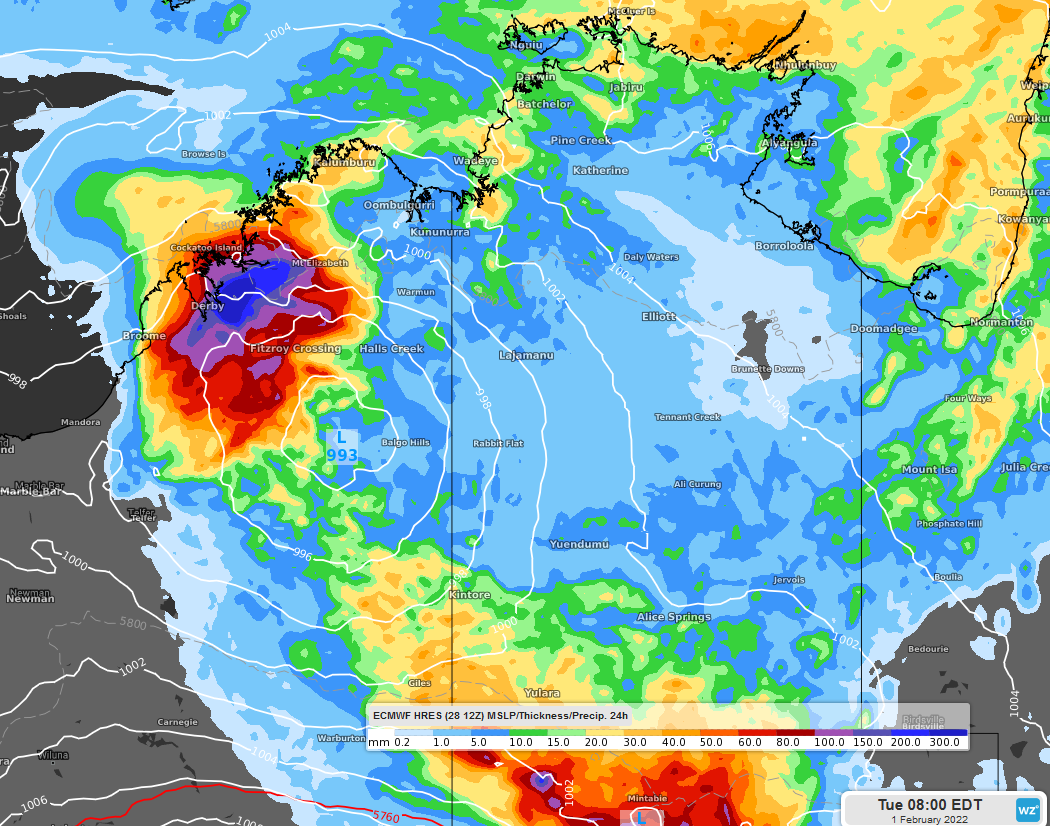
Image: 24hr Precipitation to Feb 1st Tuesday 0800 EDT, using ECMWF-HRES model.
Not only is flooding a risk, but wind gusts exceeding 90km/h are also a possibility for coastal parts as the low develops. The worst of the winds are expected on Monday and Tuesday.
Although there is some uncertainty, most models agree that the low should linger over the region for at least a couple of days after developing. Heavy rainfall and flooding could extend further into WA's interior, although its track may change in the future.