
More rain and storms loom for NSW
Rain, severe thunderstorms and strong winds are all on the cards for parts of NSW, QLD, VIC and SA in the coming days, including already flooded catchments in Central West NSW.
A low pressure trough and embedded low pressure system will produce widespread rain across southern and southeastern Australia between Friday and Monday.
On Friday, areas of rain and thunderstorms will develop along a corridor stretching from the WA Interior across to the ACT, including parts of NSW, VIC and SA. The satellite image below shows a blanket of rain-bearing clouds across southern Australia on Friday morning.
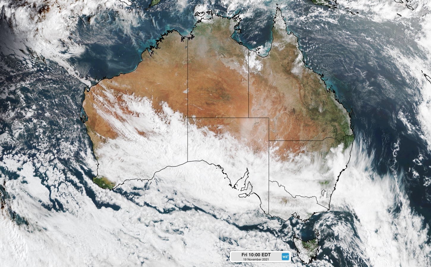
Image: Visible true colour satellite image captured at 10am AEDT on Friday, November 19.
On Saturday, the trough will move further north and east, generating rain and storms across parts of SA, VIC, NSW, the ACT and southern QLD. The heaviest falls on Saturday should occur in SA, southern NSW and possibly eastern VIC, where 24-hour falls could reach 10-20mm in some areas.
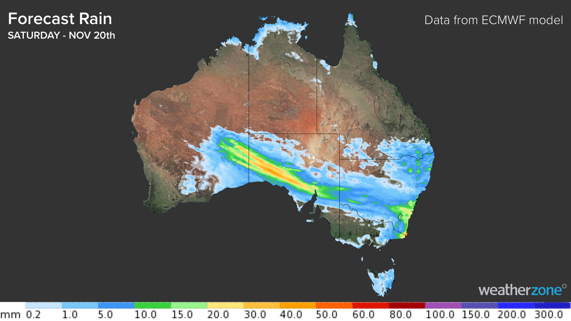
Image: Forecast accumulated rain on Saturday, November 20, according to the ECMWF-HRES model.
From Sunday, a low pressure system will develop over western NSW as the trough crosses eastern Australia. This is likely to cause areas of heavy rain, thunderstorms and potentially damaging winds.
However, forecast models are struggling to agree on where this low will develop, which makes it difficult to know where and how much rain will fall from Sunday into early next week.
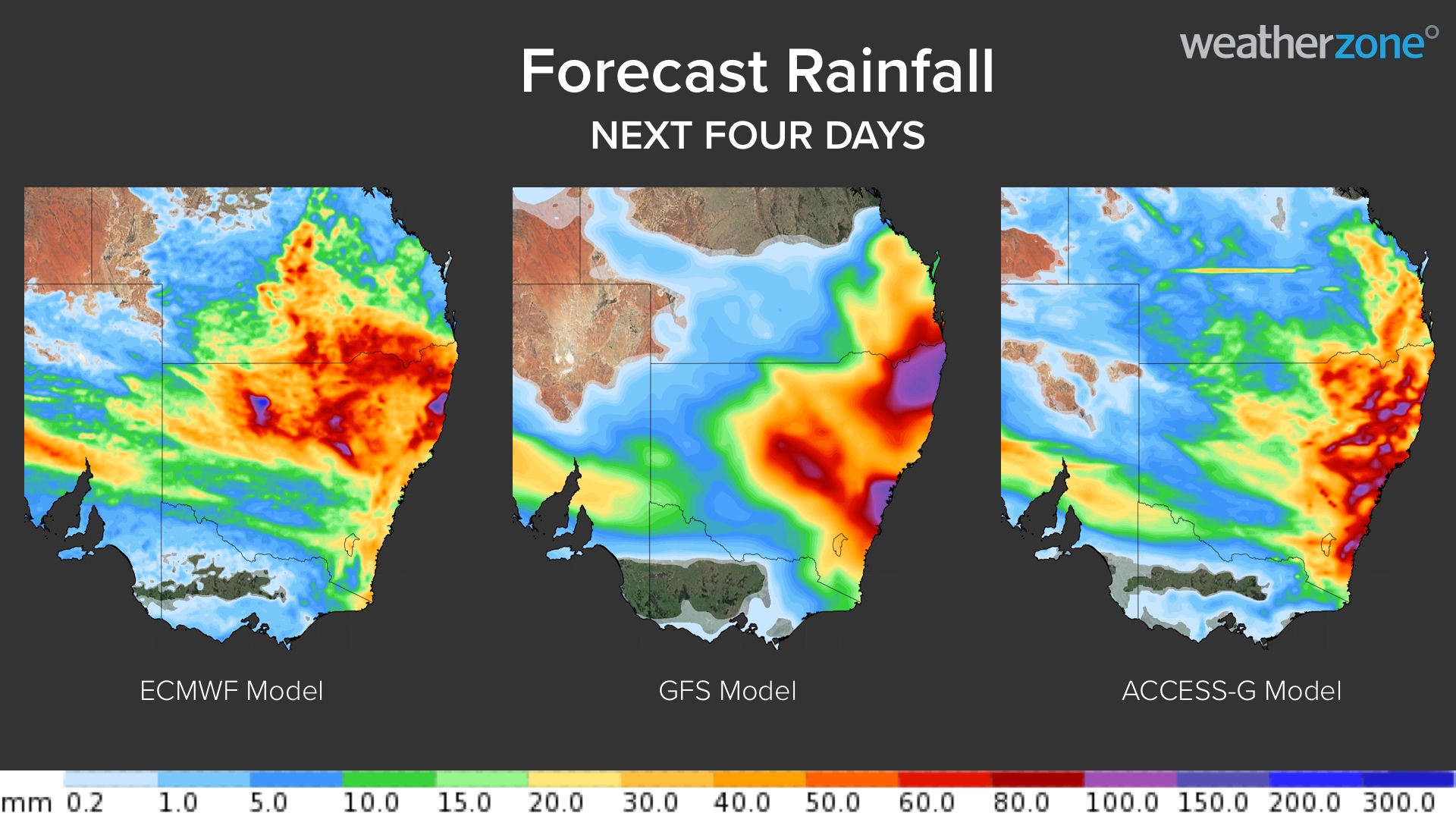
Image: Forecast accumulated rain between Friday and Monday, showing the disagreement between three different computer models.
At this stage, the low pressure system is expected to form over western or northern NSW on Sunday, causing rain and thunderstorms over a broad area of NSW, the ACT and southern QLD.
Widespread falls of 20-40mm are forecast in NSW on Sunday, while some areas could see 50-100mm, particularly with thunderstorms. The image below shows where and how much rain three different computer models are predicting for Sunday.
On Monday, rain and thunderstorms should continue over parts of NSW and QLD, with more heavy falls and severe storms a high risk. However, there is too much model uncertainty to know which areas will see the most rain.
There are early signs that another rain-bearing low pressure trough will sweep across eastern Australia during the middle of next week. More accurate details on this next system will become available early next week.
Areas of Central West NSW that are still experiencing flooding from last week's rain are likely to see more wet weather over the coming week. While uncertainty with this system remains high, there is potential for enough rain to cause renewed river level rises and further flooding.
Keep a close eye on the latest forecasts and warnings in your area over the coming week for the most up-to-date information as this weather event unfolds.