More rain and storms for WA
Days of rain and thunder are on the cards for some western and central parts of WA, with the potential for some decent falls in the region.
The map below shows showers and thunderstorms approaching the Gascoyne and Upper West districts on Monday morning.
.gif)
Image: Himawari-9 satellite image combined with Weatherzone radar and lightning data, showing three hours of cloud, rain and lightning leading up to 10:20am on Monday, May 13.
The thunderstorms and showers are forming in response to an upper-level low moving over the Indian Ocean towards the WA coastline.
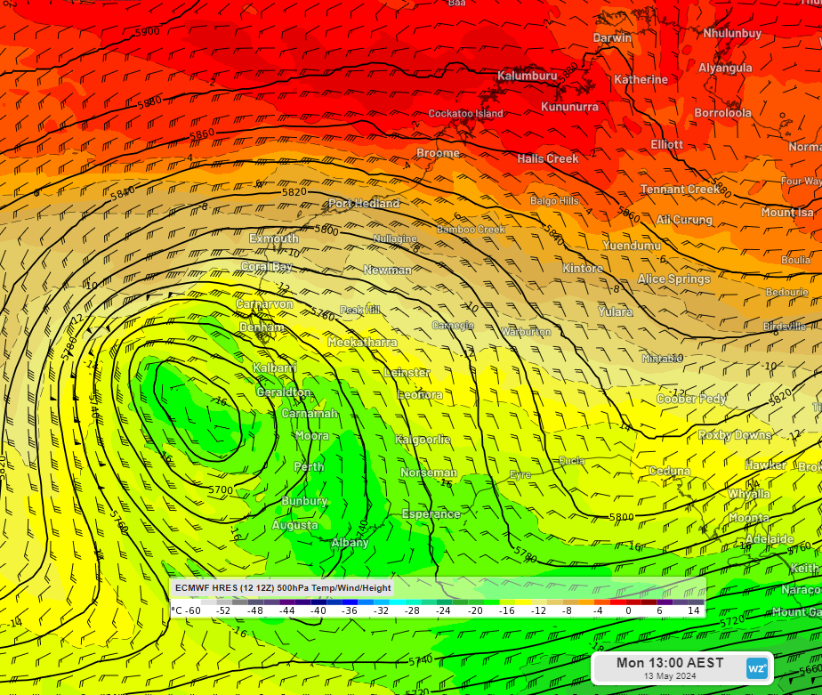
Image: 500 hPa temperature, wind and height at 11am AWST on Monday, May 13.
The largest falls in the coming days are expected in the Gascoyne and Central West districts with widespread totals of 5 to 20mm and isolated areas of 40 to 100mm in the Gascoyne district.
.png)
Image: Accumulated rainfall forecast for 3 days leading up to 8pm AWST on Wednesday, May 15.
Some rain will fall in the southwest, but unfortunately it will be much lighter than up north and certainly won't be drought breaking.
The rainfall and storms will impact western Gascoyne and Central West on Monday, before moving further inland on Tuesday as the low moves slowly east. Tuesday looks like the heaviest day, with one model hinting at the potential for 50 to 100mm to fall in a day in the Gascoyne.
The thunderstorms and rain will then move into the Southern Interior by Wednesday, before easing later in the week.